| Memorials | : | 1 |
| Location | : | Amish, Johnson County, USA |
| Coordinate | : | 41.5166702, -91.7611084 |
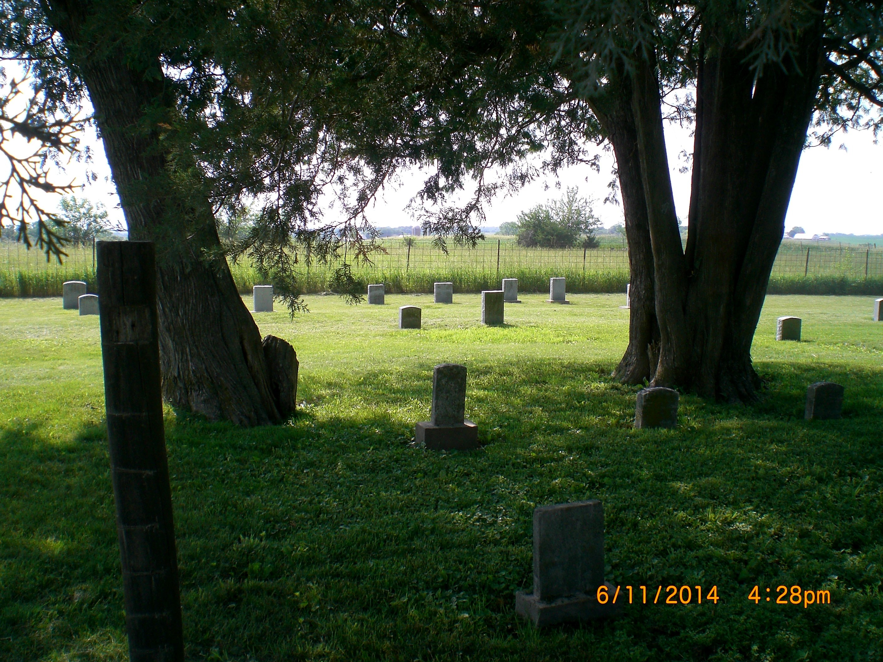
| Description | : | This is an Amish Mennonite Family Cemetery located 2 miles west and 1 1/4 miles south of the Kalona Cheese House. It is in section #34, Washington Township, Johnson County, Iowa. The first burial was Peter P. Brenneman, age 14, who died in 1864. His parents, Peter and Barbara (Hershberger) Brenneman set aside a corner of a field on the west side of the road that went past their home for his final resting place. One month later they met again at this spot for Barbara had also died. In 1984 there were but six headstones in this cemetery.... Read More |
frequently asked questions (FAQ):
-
Where is Brenneman Cemetery?
Brenneman Cemetery is located at Amish, Johnson County ,Iowa ,USA.
-
Brenneman Cemetery cemetery's updated grave count on graveviews.com?
1 memorials
-
Where are the coordinates of the Brenneman Cemetery?
Latitude: 41.5166702
Longitude: -91.7611084
Nearby Cemetories:
1. Pleasant Hill Cemetery
Johnson County, USA
Coordinate: 41.5346170, -91.7884060
2. Coffman Cemetery
English River Township, Washington County, USA
Coordinate: 41.4889045, -91.7585030
3. South Gingerich Mennonite Cemetery
Kalona, Washington County, USA
Coordinate: 41.5076294, -91.7227936
4. Lower Deer Creek Cemetery
Johnson County, USA
Coordinate: 41.5381012, -91.7985992
5. Snider Cemetery
Kalona, Washington County, USA
Coordinate: 41.4997386, -91.7196131
6. Wertz Cemetery
Amish, Johnson County, USA
Coordinate: 41.5486500, -91.7939000
7. Schottler Cemetery
Amish, Johnson County, USA
Coordinate: 41.5348950, -91.8118270
8. East Union Mennonite Cemetery
Sharon Center, Johnson County, USA
Coordinate: 41.5258179, -91.7049484
9. Haven Cemetery
Johnson County, USA
Coordinate: 41.5558080, -91.7320500
10. Sharon Hill Cemetery
Kalona, Washington County, USA
Coordinate: 41.4928017, -91.7071991
11. Moses P Miller Cemetery
Kalona, Washington County, USA
Coordinate: 41.4929610, -91.6960140
12. Sharon Bethel Cemetery
Williamstown, Johnson County, USA
Coordinate: 41.5558000, -91.7086000
13. Frytown Cemetery
Johnson County, USA
Coordinate: 41.5718000, -91.7355000
14. North Gingerich Sharon Cemetery
Johnson County, USA
Coordinate: 41.5553017, -91.7024994
15. Peter Miller Cemetery
Johnson County, USA
Coordinate: 41.5214005, -91.6813965
16. Wassonville Cemetery
Daytonville, Washington County, USA
Coordinate: 41.4846992, -91.8317032
17. Upper Deer Creek Mennonite Church Cemetery
Iowa County, USA
Coordinate: 41.5408300, -91.8398500
18. Fairview Mennonite Cemetery
Johnson County, USA
Coordinate: 41.5396000, -91.6751000
19. Angels Rest Cemetery
Washington Township, Johnson County, USA
Coordinate: 41.5896000, -91.7648000
20. Shiloh Nutmeg Cemetery
Kalona, Washington County, USA
Coordinate: 41.4581300, -91.7020800
21. Bethel Cemetery
Johnson County, USA
Coordinate: 41.5835991, -91.8082962
22. West Union Mennonite Cemetery
Parnell, Iowa County, USA
Coordinate: 41.5631866, -91.8408966
23. John Helmuth Cemetery
Sharon Center, Johnson County, USA
Coordinate: 41.5583870, -91.6764660
24. Graper Farm Cemetery
Iowa City, Johnson County, USA
Coordinate: 41.5904360, -91.7317740

