
| Memorials | : | 0 |
| Location | : | Mackeyville, Clinton County, USA |
| Coordinate | : | 41.0516000, -77.4637000 |
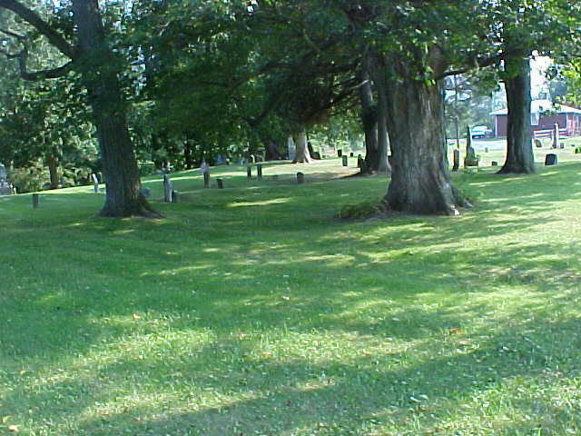
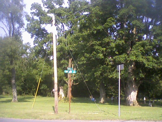
| Description | : | Courtesy of the Clinton Co Genealogical Society MUNICIPALITY: Lamar Township, Clinton Co. CEMETERY NAME: Mackeyville Cemetery SCHADT NUMBER: 022 AKA: Reesman Cemetery Number of Burials (approximate): 75 Dates of Activity: 1843 - 1915 From Interstate 80, take the Lamar Exit (Old Exit 25). If exiting from the east bound lanes, turn left; if exiting from the west bound lanes, turn right. Go East on Route 64 for 3.9 miles. Turn right onto Mackeyville Road (at the John Deere dealership). Travel 1.7 miles, and bear right where the road splits. At 1.9 miles there is an... Read More |
frequently asked questions (FAQ):
-
Where is Mackeyville Cemetery?
Mackeyville Cemetery is located at Mackeyville, Clinton County ,Pennsylvania ,USA.
-
Mackeyville Cemetery cemetery's updated grave count on graveviews.com?
0 memorials
-
Where are the coordinates of the Mackeyville Cemetery?
Latitude: 41.0516000
Longitude: -77.4637000
Nearby Cemetories:
1. Parkman Mausoleum
Mackeyville, Clinton County, USA
Coordinate: 41.0380960, -77.4611740
2. Long Cemetery
Mill Hall, Clinton County, USA
Coordinate: 41.0584667, -77.4948000
3. Cedar Hill Cemetery
Mill Hall, Clinton County, USA
Coordinate: 41.0780800, -77.4779000
4. Disciples Cemetery
Salona, Clinton County, USA
Coordinate: 41.0811005, -77.4644012
5. East End Amish Cemetery
Clinton County, USA
Coordinate: 41.0701000, -77.4281000
6. Methodist Episcopal Cemetery
Salona, Clinton County, USA
Coordinate: 41.0844000, -77.4513000
7. Saint Pauls Lutheran Cemetery
Lamar, Clinton County, USA
Coordinate: 41.0425000, -77.5085000
8. Mount Bethel United Church of Christ Cemetery
Lamar, Clinton County, USA
Coordinate: 41.0390000, -77.5136000
9. Brown Cemetery
Mill Hall, Clinton County, USA
Coordinate: 41.1053009, -77.5074997
10. Tylersville Reformed Cemetery
Tylersville, Clinton County, USA
Coordinate: 40.9897003, -77.4347000
11. Tylersville Evangelical Cemetery
Tylersville, Clinton County, USA
Coordinate: 40.9913000, -77.4272000
12. Tylersville Lutheran and Reformed Cemetery
Tylersville, Clinton County, USA
Coordinate: 40.9910000, -77.4258000
13. Snyder Cemetery
Mill Hall, Clinton County, USA
Coordinate: 41.0951000, -77.3840000
14. Flemington Cemetery
Flemington, Clinton County, USA
Coordinate: 41.1277650, -77.4681650
15. Sunnyside Cemetery
Mill Hall, Clinton County, USA
Coordinate: 41.1217003, -77.5074997
16. Presbyterian Cemetery
Lock Haven, Clinton County, USA
Coordinate: 41.1332500, -77.4569800
17. Saint Paul EUB Cemetery
Logan Mills, Clinton County, USA
Coordinate: 41.0023000, -77.3767000
18. Bossert Family Cemetery
Beech Creek, Clinton County, USA
Coordinate: 41.0709320, -77.5695600
19. Hays-Fearon Cemetery
Beech Creek, Clinton County, USA
Coordinate: 41.0703011, -77.5706024
20. Fairview Cemetery
Lock Haven, Clinton County, USA
Coordinate: 41.1353300, -77.4619700
21. Esher Cemetery
Clinton County, USA
Coordinate: 41.0191000, -77.3595000
22. Saint Johns Evangelical Lutheran Cemetery
Booneville, Clinton County, USA
Coordinate: 41.0200000, -77.3590000
23. Highland Cemetery
Lock Haven, Clinton County, USA
Coordinate: 41.1371994, -77.4625015
24. Nestlerode Cemetery
Centre County, USA
Coordinate: 41.0638333, -77.5761167