
| Memorials | : | 1 |
| Location | : | Centre County, USA |
| Coordinate | : | 41.0638333, -77.5761167 |
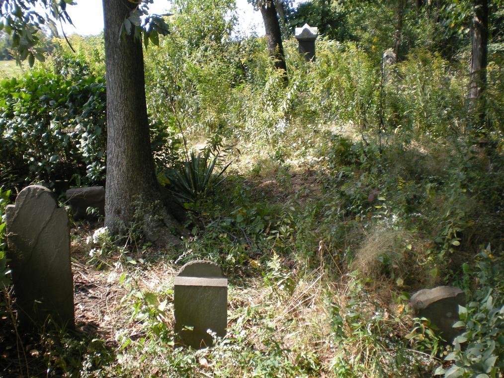
| Description | : | The Nestlerode Cemetery is the oldest existing cemetery in Liberty township. Christian Nestlerode was a fisherman from boyhood. As an adult, he made fishing his trade. He came to present Liberty township in the late 1700s and settled on the banks of Beech Creek where he continued to follow the fishing trade until he paid for his land. About 1818 he erected the first sawmill on the Centre County side of Beech Creek. He also farmed. The first burial in the family burial ground was made in 1805 when his first wife, Markret Bott... Read More |
frequently asked questions (FAQ):
-
Where is Nestlerode Cemetery?
Nestlerode Cemetery is located at Centre County ,Pennsylvania ,USA.
-
Nestlerode Cemetery cemetery's updated grave count on graveviews.com?
1 memorials
-
Where are the coordinates of the Nestlerode Cemetery?
Latitude: 41.0638333
Longitude: -77.5761167
Nearby Cemetories:
1. Hays-Fearon Cemetery
Beech Creek, Clinton County, USA
Coordinate: 41.0703011, -77.5706024
2. Bossert Family Cemetery
Beech Creek, Clinton County, USA
Coordinate: 41.0709320, -77.5695600
3. Blanchard Church of Christ Cemetery
Blanchard, Centre County, USA
Coordinate: 41.0686300, -77.5965100
4. Clark Cemetery
Beech Creek, Clinton County, USA
Coordinate: 41.0793991, -77.5860977
5. Liberty Baptist Cemetery
Blanchard, Centre County, USA
Coordinate: 41.0613000, -77.6016000
6. Bechdel Cemetery
Blanchard, Centre County, USA
Coordinate: 41.0582000, -77.6049000
7. David Family Cemetery
Beech Creek, Clinton County, USA
Coordinate: 41.0837140, -77.5926360
8. Johnson Family Cemetery
Howard, Centre County, USA
Coordinate: 41.0650450, -77.6167780
9. Wagner Cemetery
Liberty Township, Centre County, USA
Coordinate: 41.0559560, -77.6440100
10. Mount Bethel United Church of Christ Cemetery
Lamar, Clinton County, USA
Coordinate: 41.0390000, -77.5136000
11. Saint Pauls Lutheran Cemetery
Lamar, Clinton County, USA
Coordinate: 41.0425000, -77.5085000
12. Long Cemetery
Mill Hall, Clinton County, USA
Coordinate: 41.0584667, -77.4948000
13. Brown Cemetery
Mill Hall, Clinton County, USA
Coordinate: 41.1053009, -77.5074997
14. Cedar Hill Cemetery
Mill Hall, Clinton County, USA
Coordinate: 41.0780800, -77.4779000
15. Sunnyside Cemetery
Mill Hall, Clinton County, USA
Coordinate: 41.1217003, -77.5074997
16. Snydertown Cemetery
Snydertown, Centre County, USA
Coordinate: 40.9858000, -77.5832000
17. Highland Cemetery
Centre County, USA
Coordinate: 41.0367027, -77.6760056
18. Lick Run Presbyterian Church Cemetery
Jacksonville, Centre County, USA
Coordinate: 40.9938000, -77.6313000
19. Howard Cemetery
Howard, Centre County, USA
Coordinate: 41.0134870, -77.6621365
20. Romola Christian Cemetery
Romola, Centre County, USA
Coordinate: 41.0581000, -77.6855000
21. William F. Packer Family Cemetery
Howard, Centre County, USA
Coordinate: 41.0210838, -77.6716003
22. Jacksonville Cemetery
Jacksonville, Centre County, USA
Coordinate: 40.9912000, -77.6342000
23. Mackeyville Cemetery
Mackeyville, Clinton County, USA
Coordinate: 41.0516000, -77.4637000
24. Disciples Cemetery
Salona, Clinton County, USA
Coordinate: 41.0811005, -77.4644012