
| Memorials | : | 1 |
| Location | : | Tylersville, Clinton County, USA |
| Coordinate | : | 40.9910000, -77.4258000 |
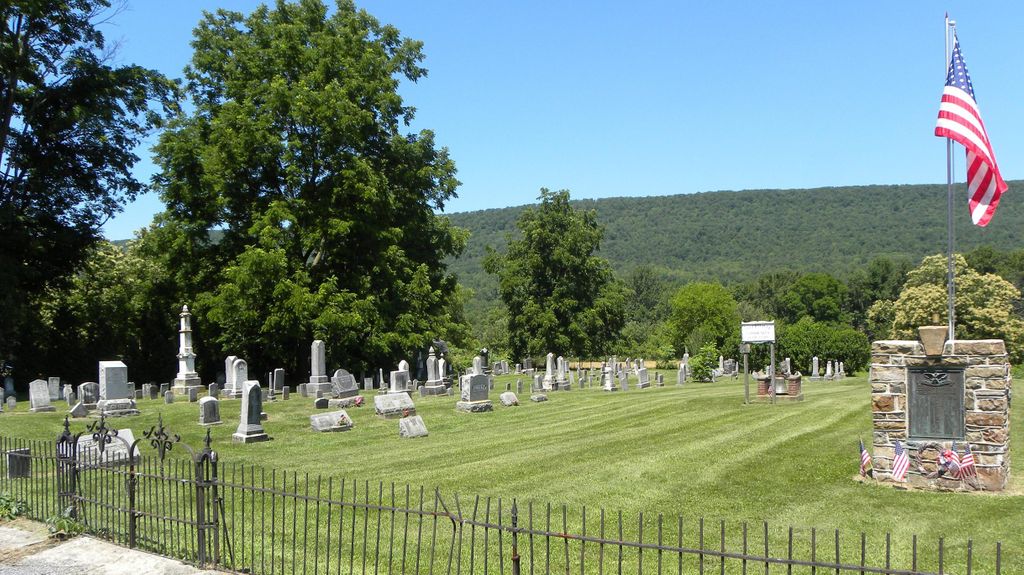
| Description | : | Tylersville Lutheran & Reformed Cemetery (Community East) This cemetery is located at the center of Tylersville at the corner of Rte 880, at the junction of Old Hill Road, the road to Rebersburg, the road to Loganton and the road to Lamar. In 1948 the cemeteries of Tylersville were united together for uniform maintenance. Directions to the Tylersville Lutheran & Reformed Cemetery from the CCGS Cemetery Book: From the Center of Loganton (at the intersection of Routes 477 & 880) travel west on Rte 880 for 7 miles. The Cemetery is on your right , behind a wrought-iron fence. Directly Across... Read More |
frequently asked questions (FAQ):
-
Where is Tylersville Lutheran and Reformed Cemetery?
Tylersville Lutheran and Reformed Cemetery is located at Narrows Road Tylersville, Clinton County ,Pennsylvania , 17747USA.
-
Tylersville Lutheran and Reformed Cemetery cemetery's updated grave count on graveviews.com?
1 memorials
-
Where are the coordinates of the Tylersville Lutheran and Reformed Cemetery?
Latitude: 40.9910000
Longitude: -77.4258000
Nearby Cemetories:
1. Tylersville Evangelical Cemetery
Tylersville, Clinton County, USA
Coordinate: 40.9913000, -77.4272000
2. Tylersville Reformed Cemetery
Tylersville, Clinton County, USA
Coordinate: 40.9897003, -77.4347000
3. Saint Paul EUB Cemetery
Logan Mills, Clinton County, USA
Coordinate: 41.0023000, -77.3767000
4. Old Wolf's Store Cemetery
Wolfs Store, Centre County, USA
Coordinate: 40.9606660, -77.3828290
5. Saint Peters Lutheran and Reformed Cemetery
Rebersburg, Centre County, USA
Coordinate: 40.9438000, -77.4427000
6. Evangelical Cemetery
Rebersburg, Centre County, USA
Coordinate: 40.9437980, -77.4429230
7. Parkman Mausoleum
Mackeyville, Clinton County, USA
Coordinate: 41.0380960, -77.4611740
8. Trinity United Methodist Cemetery
Greenburr, Clinton County, USA
Coordinate: 41.0075000, -77.3543000
9. Emanuel Reformed Cemetery
Greenburr, Clinton County, USA
Coordinate: 41.0065000, -77.3530000
10. Esher Cemetery
Clinton County, USA
Coordinate: 41.0191000, -77.3595000
11. Saint Johns Evangelical Lutheran Cemetery
Booneville, Clinton County, USA
Coordinate: 41.0200000, -77.3590000
12. Brungart Cemetery
Centre County, USA
Coordinate: 40.9707000, -77.3445000
13. Mackeyville Cemetery
Mackeyville, Clinton County, USA
Coordinate: 41.0516000, -77.4637000
14. Old Schracktown Cemetery
Loganton, Clinton County, USA
Coordinate: 41.0219002, -77.3336029
15. East End Amish Cemetery
Clinton County, USA
Coordinate: 41.0701000, -77.4281000
16. Saint Pauls Lutheran Cemetery
Lamar, Clinton County, USA
Coordinate: 41.0425000, -77.5085000
17. Mount Bethel United Church of Christ Cemetery
Lamar, Clinton County, USA
Coordinate: 41.0390000, -77.5136000
18. Elk Creek Cemetery
Rebersburg, Centre County, USA
Coordinate: 40.9219900, -77.4840030
19. McCarthy Family Cemetery
Aaronsburg, Centre County, USA
Coordinate: 40.9212000, -77.3633100
20. Long Cemetery
Mill Hall, Clinton County, USA
Coordinate: 41.0584667, -77.4948000
21. Stover Cemetery
Aaronsburg, Centre County, USA
Coordinate: 40.9055000, -77.4162000
22. Neidig Cemetery
Haines Township, Centre County, USA
Coordinate: 40.9157330, -77.3697690
23. Aaronsburg Reformed Cemetery
Aaronsburg, Centre County, USA
Coordinate: 40.9026000, -77.4530000
24. Aaronsburg Salem Lutheran Cemetery
Aaronsburg, Centre County, USA
Coordinate: 40.9020000, -77.4497000