
| Memorials | : | 0 |
| Location | : | Richmond Furnace, Franklin County, USA |
| Coordinate | : | 39.9650506, -77.9132391 |
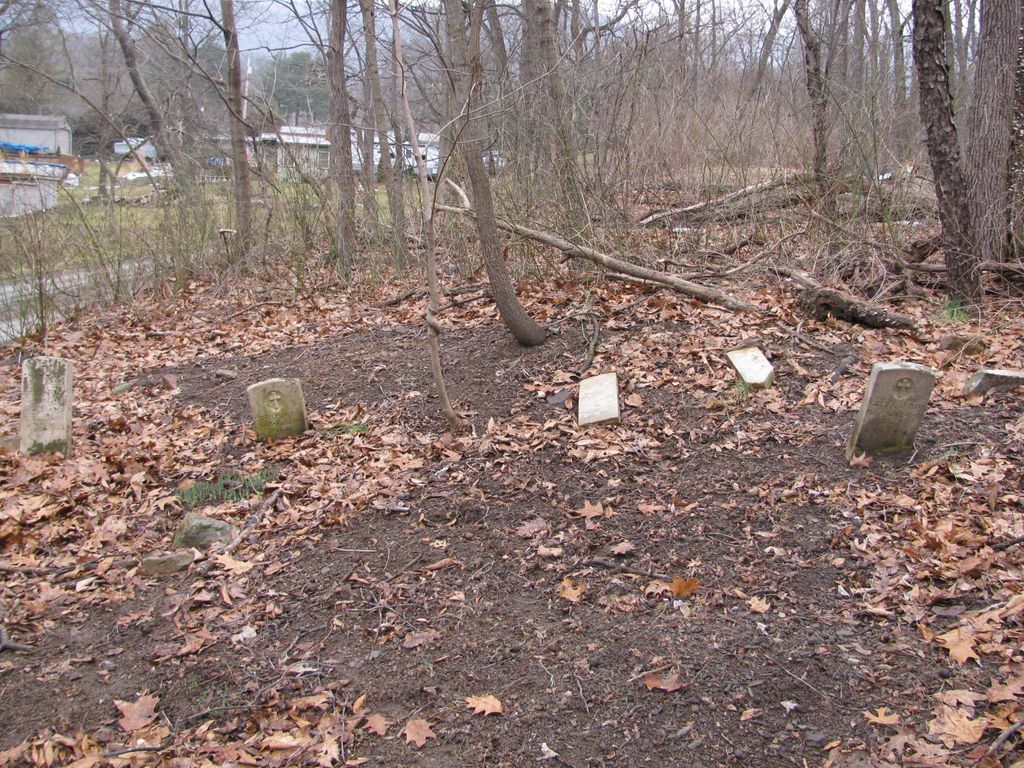
| Description | : | As Per the Harry Foreman collection Forbes Road (1954) MALONE GRAVEYARD The old grave yard on the present "Mart" Bricker farm one-half mile west of Richmond Furnace was on the Burd Road of 1755. The Forbes or Burd Road definitely passed along the lower edge of this old burial ground. The writer believes that there was a home on this farm as early as the building of the road. Seemingly reliable tradition lends credence to this statement. The earliest irrefutable date, however, is 1790 when George Chambers sold 84 acres to Edward Malone from the Mount Pleasant tract of 1757. This... Read More |
frequently asked questions (FAQ):
-
Where is Malone Graveyard?
Malone Graveyard is located at Forbes Road Richmond Furnace, Franklin County ,Pennsylvania ,USA.
-
Malone Graveyard cemetery's updated grave count on graveviews.com?
0 memorials
-
Where are the coordinates of the Malone Graveyard?
Latitude: 39.9650506
Longitude: -77.9132391
Nearby Cemetories:
1. Cox Family Cemetery
Richmond Furnace, Franklin County, USA
Coordinate: 39.9697033, -77.9059752
2. Pheil Family
Richmond Furnace, Franklin County, USA
Coordinate: 39.9762558, -77.9024141
3. Mealman Cemetery
Upper Strasburg, Franklin County, USA
Coordinate: 39.9531000, -77.8824330
4. Hessian Cemetery
Upper Strasburg, Franklin County, USA
Coordinate: 39.9731830, -77.8636000
5. Gingrey/Marshall Family Cemetery
McConnellsburg, Fulton County, USA
Coordinate: 39.9585850, -77.9757460
6. Old Reformed and Lutheran Church Cemetery
Fort Loudon, Franklin County, USA
Coordinate: 39.9167000, -77.9047000
7. Zion United Brethren Cemetery
Saint Thomas, Franklin County, USA
Coordinate: 39.9909893, -77.8516591
8. Zion United Brethren Cemetery
Upper Strasburg, Franklin County, USA
Coordinate: 39.9909670, -77.8514330
9. McConnellsdale Brethren Cemetery
McConnellsburg, Fulton County, USA
Coordinate: 39.9542700, -77.9831800
10. Carrick United Methodist Church Cemetery
Metal, Franklin County, USA
Coordinate: 40.0151850, -77.8783810
11. Knobsville United Methodist Church Cemetery
Knobsville, Fulton County, USA
Coordinate: 40.0077000, -77.9645000
12. Stenger Hill Cemetery
Fort Loudon, Franklin County, USA
Coordinate: 39.9085655, -77.8929367
13. Knobsville Reformed Cemetery
Fulton County, USA
Coordinate: 40.0106000, -77.9626000
14. Wright Farm Family Cemetery
Metal, Franklin County, USA
Coordinate: 40.0213364, -77.8832249
15. Englert Farm Cemetery
Knobsville, Fulton County, USA
Coordinate: 40.0246000, -77.9400000
16. Metal Methodist Cemetery
Metal, Franklin County, USA
Coordinate: 40.0240000, -77.8725000
17. Magsam Family Cemetery
McConnellsburg, Fulton County, USA
Coordinate: 39.9192000, -77.9770000
18. McConnellsburg Lutheran Cemetery
McConnellsburg, Fulton County, USA
Coordinate: 39.9340000, -77.9957000
19. McConnellsburg Methodist Cemetery
McConnellsburg, Fulton County, USA
Coordinate: 39.9328000, -77.9962000
20. McConnellsburg Reformed Cemetery
McConnellsburg, Fulton County, USA
Coordinate: 39.9348770, -77.9976990
21. Bethlehem United Brethren Cemetery
McConnellsburg, Fulton County, USA
Coordinate: 39.9699000, -78.0078000
22. Martz Cemetery
Fort Loudon, Franklin County, USA
Coordinate: 39.9029700, -77.8626400
23. McConnellsburg Presbyterian Cemetery
McConnellsburg, Fulton County, USA
Coordinate: 39.9316000, -78.0001000
24. Ryder Family Cemetery
Franklin County, USA
Coordinate: 39.8881140, -77.9113769