
| Memorials | : | 0 |
| Location | : | Metal, Franklin County, USA |
| Coordinate | : | 40.0151850, -77.8783810 |
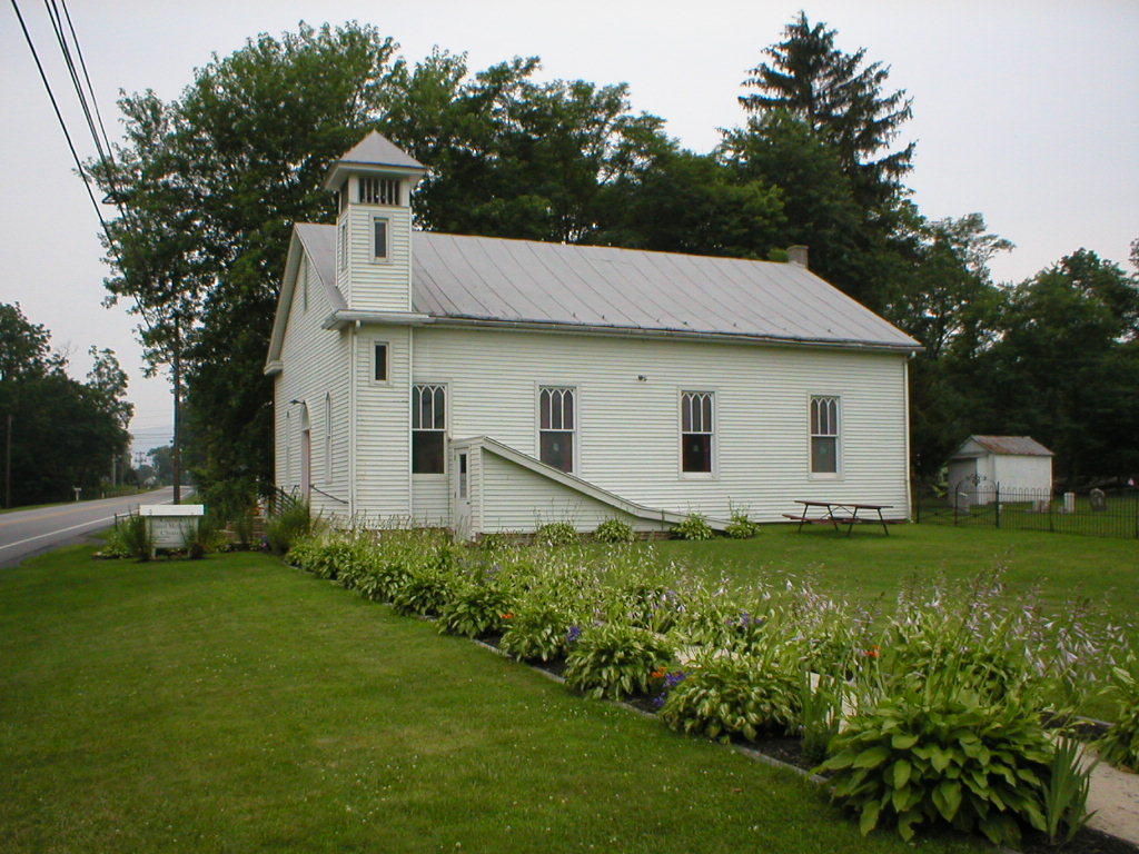
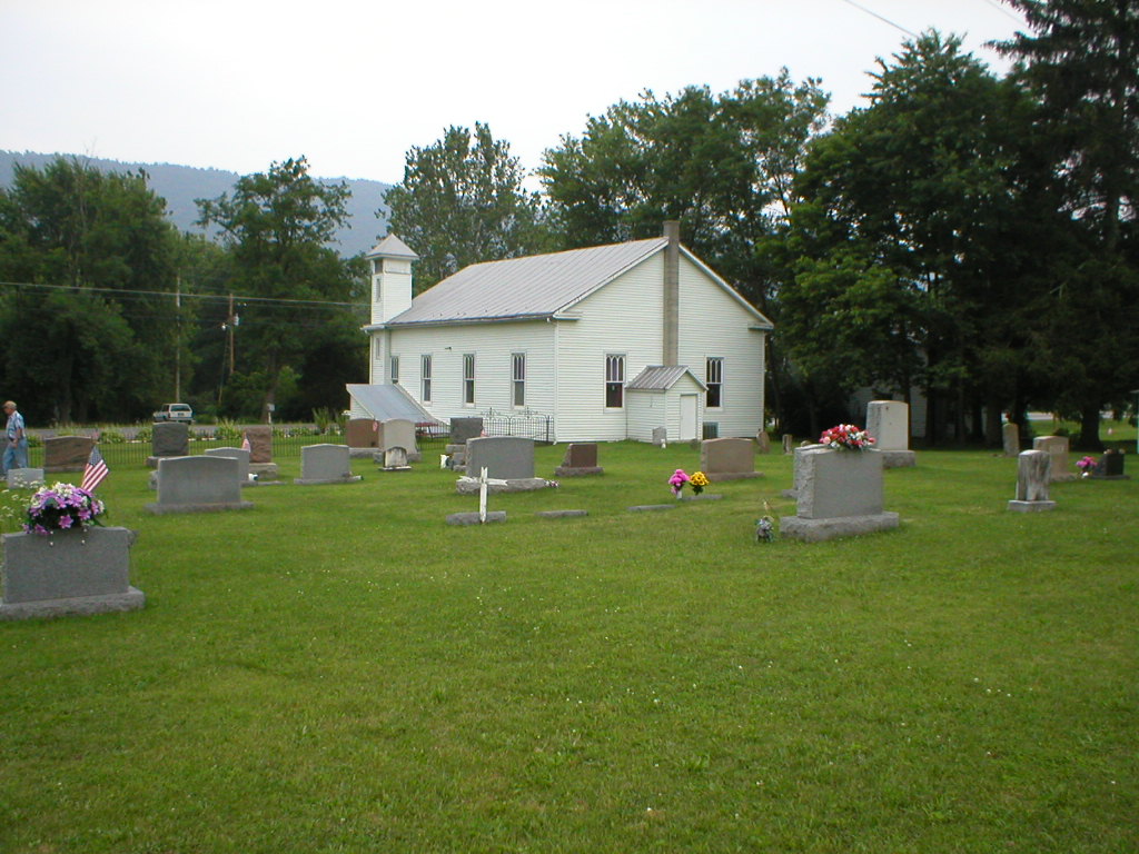
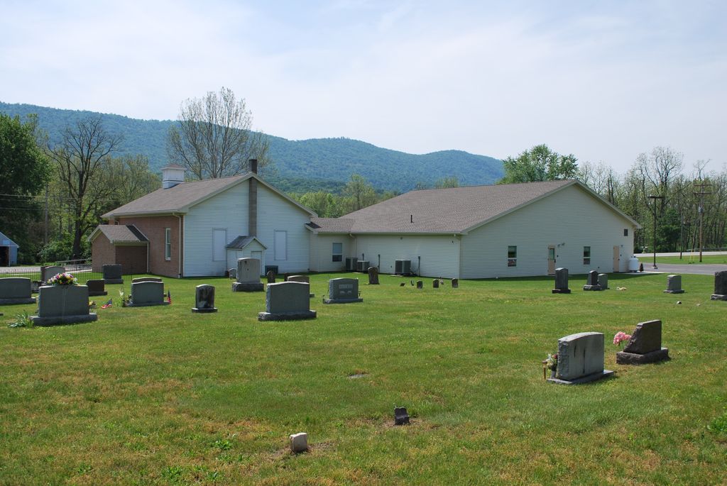
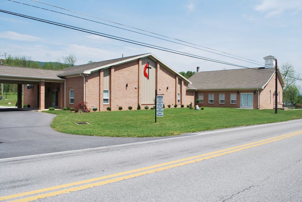
| Description | : | This cemetery is located on the west side of Pennsylvania Route Number 75 (Path Valley Road), in the village of Metal, in Metal Township, Franklin County, PA. This cemetery was originally the Metal Evangelical United Brethren Church Cemetery and was later changed to the Carrick United Methodist Cemetery. A second and much larger brick church building was recently added and connected to the old church. Also, brick on three sides was added to the old white frame church when the new brick building was added. The cemetery is located to the rear and right of the church building. |
frequently asked questions (FAQ):
-
Where is Carrick United Methodist Church Cemetery?
Carrick United Methodist Church Cemetery is located at 7003 Path Valley Road Metal, Franklin County ,Pennsylvania , 17221USA.
-
Carrick United Methodist Church Cemetery cemetery's updated grave count on graveviews.com?
0 memorials
-
Where are the coordinates of the Carrick United Methodist Church Cemetery?
Latitude: 40.0151850
Longitude: -77.8783810
Nearby Cemetories:
1. Wright Farm Family Cemetery
Metal, Franklin County, USA
Coordinate: 40.0213364, -77.8832249
2. Metal Methodist Cemetery
Metal, Franklin County, USA
Coordinate: 40.0240000, -77.8725000
3. Zion United Brethren Cemetery
Saint Thomas, Franklin County, USA
Coordinate: 39.9909893, -77.8516591
4. Zion United Brethren Cemetery
Upper Strasburg, Franklin County, USA
Coordinate: 39.9909670, -77.8514330
5. Forrester Family Cemetery
Freestone, Franklin County, USA
Coordinate: 40.0172290, -77.8317830
6. Pheil Family
Richmond Furnace, Franklin County, USA
Coordinate: 39.9762558, -77.9024141
7. Hessian Cemetery
Upper Strasburg, Franklin County, USA
Coordinate: 39.9731830, -77.8636000
8. Lower Path Valley Cemetery
Fannettsburg, Franklin County, USA
Coordinate: 40.0531006, -77.8450012
9. Englert Farm Cemetery
Knobsville, Fulton County, USA
Coordinate: 40.0246000, -77.9400000
10. Cox Family Cemetery
Richmond Furnace, Franklin County, USA
Coordinate: 39.9697033, -77.9059752
11. Malone Graveyard
Richmond Furnace, Franklin County, USA
Coordinate: 39.9650506, -77.9132391
12. Keefers Cemetery
Upper Strasburg, Franklin County, USA
Coordinate: 40.0406550, -77.8079090
13. Horse Valley Cemetery
Franklin County, USA
Coordinate: 40.0386009, -77.8058014
14. Burnt Cabins Cemetery
Burnt Cabins, Fulton County, USA
Coordinate: 40.0754000, -77.8963000
15. Mealman Cemetery
Upper Strasburg, Franklin County, USA
Coordinate: 39.9531000, -77.8824330
16. Knobsville Reformed Cemetery
Fulton County, USA
Coordinate: 40.0106000, -77.9626000
17. Knobsville United Methodist Church Cemetery
Knobsville, Fulton County, USA
Coordinate: 40.0077000, -77.9645000
18. Fannettsburg Reformed Church Cemetery
Fannettsburg, Franklin County, USA
Coordinate: 40.0735000, -77.8277000
19. Mount Olivet Cemetery
Chambersburg, Franklin County, USA
Coordinate: 39.9771000, -77.7921000
20. Edenville Methodist Church Cemetery
Edenville, Franklin County, USA
Coordinate: 39.9577000, -77.8031000
21. Cree Cemetery
Dublin Township, Huntingdon County, USA
Coordinate: 40.0982014, -77.8660481
22. Fort Littleton Cemetery
Fort Littleton, Fulton County, USA
Coordinate: 40.0705986, -77.9674988
23. Evert Farm Family Cemetery
Metal, Franklin County, USA
Coordinate: 40.0794670, -77.7987490
24. Gingrey/Marshall Family Cemetery
McConnellsburg, Fulton County, USA
Coordinate: 39.9585850, -77.9757460