
| Memorials | : | 0 |
| Location | : | Marsden, Metropolitan Borough of Kirklees, England |
| Website | : | heritage.quaker.org.uk/files/Marsden%20LM.pdf |
| Coordinate | : | 53.8241910, -2.2197410 |
| Description | : | The earlier burials here are recorded as "at ye hill" in Marsden. Page three of website mentioned above gives details to the history of this meeting. Please also see: http://marsden.pendlehillquakers.org.uk/ National Grid Reference: SD 85651 36462 |
frequently asked questions (FAQ):
-
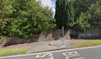
Where is Marsden Friends Burial Ground?
Marsden Friends Burial Ground is located at 21 Walverden Road, Nelson Marsden, Metropolitan Borough of Kirklees ,West Yorkshire , BB9 0PJEngland.
-
Marsden Friends Burial Ground cemetery's updated grave count on graveviews.com?
0 memorials
-
Where are the coordinates of the Marsden Friends Burial Ground?
Latitude: 53.8241910
Longitude: -2.2197410
Nearby Cemetories:
1. St. Paul's Churchyard
Nelson, Pendle Borough, England
Coordinate: 53.8289250, -2.2157520
2. St. James' Churchyard
Briercliffe, Burnley Borough, England
Coordinate: 53.8107700, -2.2031800
3. Haggate Baptist Church Burial Ground
Burnley Borough, England
Coordinate: 53.8145048, -2.1960725
4. St. John the Evangelist Churchyard
Nelson, Pendle Borough, England
Coordinate: 53.8367000, -2.1977200
5. Hill Lane Baptist Church Churchyard
Briercliffe, Burnley Borough, England
Coordinate: 53.8161467, -2.1875368
6. Nelson Cemetery
Nelson, Pendle Borough, England
Coordinate: 53.8420330, -2.1972230
7. Wheatley Lane Inghamite Church Churchyard
Wheatley Lane, Pendle Borough, England
Coordinate: 53.8412800, -2.2457100
8. All Souls Cemetery
Barrowford, Pendle Borough, England
Coordinate: 53.8462900, -2.2355600
9. Wheatley Lane Methodist Churchyard
Fence, Pendle Borough, England
Coordinate: 53.8341457, -2.2596202
10. St. Thomas Churchyard
Barrowford, Pendle Borough, England
Coordinate: 53.8513900, -2.2196600
11. Barrowford Cemetery
Nelson, Pendle Borough, England
Coordinate: 53.8521100, -2.2130300
12. St. Anne Churchyard
Fence, Pendle Borough, England
Coordinate: 53.8304372, -2.2679552
13. Ebenezer Baptist Chapel Chapelyard
Burnley, Burnley Borough, England
Coordinate: 53.7975120, -2.2397260
14. John Ecroyd's Orchard
Lancaster, City of Lancaster, England
Coordinate: 53.8201990, -2.1697920
15. St. Peter's Churchyard
Burnley, Burnley Borough, England
Coordinate: 53.7924450, -2.2394890
16. St. James' Churchyard
Burnley, Burnley Borough, England
Coordinate: 53.7905590, -2.2458280
17. St. Mary's Churchyard
Newchurch in Pendle, Pendle Borough, England
Coordinate: 53.8504181, -2.2706807
18. St. John the Evangelist Churchyard
Worsthorne, Burnley Borough, England
Coordinate: 53.7877640, -2.1887420
19. Holy Trinity Churchyard
Burnley, Burnley Borough, England
Coordinate: 53.7898290, -2.2574200
20. St John Churchyard
Higham, Pendle Borough, England
Coordinate: 53.8251420, -2.2898120
21. St. Bartholomew Churchyard
Colne, Pendle Borough, England
Coordinate: 53.8570600, -2.1700470
22. West Street Inghamite Chapel Chapelyard
Colne, Pendle Borough, England
Coordinate: 53.8555930, -2.1672140
23. Colne Cemetery
Colne, Pendle Borough, England
Coordinate: 53.8577420, -2.1585350
24. All Saints Churchyard
Habergham Eaves, Burnley Borough, England
Coordinate: 53.7971060, -2.2913770