
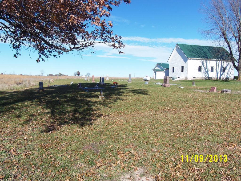
| Memorials | : | 2 |
| Location | : | Roads, Carroll County, USA |
| Coordinate | : | 39.4486008, -93.7021027 |
frequently asked questions (FAQ):
-
Where is Union Baptist Church Cemetery?
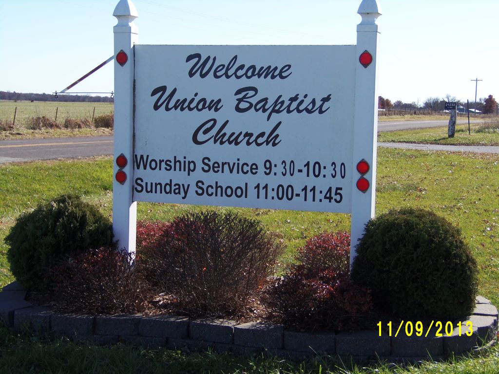
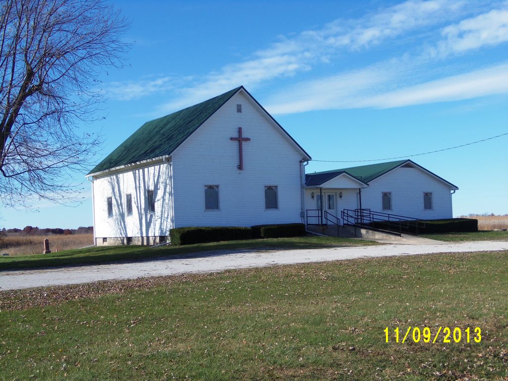
Union Baptist Church Cemetery is located at Fairfield Township Roads, Carroll County ,Missouri ,USA.
-
Union Baptist Church Cemetery cemetery's updated grave count on graveviews.com?
2 memorials
-
Where are the coordinates of the Union Baptist Church Cemetery?
Latitude: 39.4486008
Longitude: -93.7021027
Nearby Cemetories:
1. Tevalt-Northern Sympathizers Cemetery
Carroll County, USA
Coordinate: 39.4593010, -93.7379990
2. Mount Olivet Cemetery
Stet, Carroll County, USA
Coordinate: 39.4366000, -93.7403000
3. Antioch Cemetery
Norborne, Carroll County, USA
Coordinate: 39.4083519, -93.7010498
4. Hawkins Cemetery
Carroll County, USA
Coordinate: 39.5014000, -93.6569977
5. Bethany Church Cemetery
Stet, Ray County, USA
Coordinate: 39.4230995, -93.7838974
6. Smith Cemetery
Carroll County, USA
Coordinate: 39.4813995, -93.6205978
7. Low Gap Cemetery
Norborne, Carroll County, USA
Coordinate: 39.5244000, -93.7024000
8. Harris Cemetery
Mandeville, Carroll County, USA
Coordinate: 39.5083680, -93.6314570
9. Kasriek Cemetery
Carroll County, USA
Coordinate: 39.4556999, -93.5977020
10. Street Cemetery
Bogard, Carroll County, USA
Coordinate: 39.4606018, -93.5969009
11. McBee Chapel Cemetery
Carroll County, USA
Coordinate: 39.5239983, -93.7559967
12. Unnamed Cemetery #26
Carroll County, USA
Coordinate: 39.4808006, -93.5985031
13. McCroskie Creek Baptist Church Cemetery
Carroll County, USA
Coordinate: 39.3840179, -93.6199951
14. Silas Keith Cemetery
Regal, Ray County, USA
Coordinate: 39.4387800, -93.8262100
15. Unnamed Cemetery #47
Carroll County, USA
Coordinate: 39.3558998, -93.6673965
16. Graff Cemetery
Grape Grove Township, Ray County, USA
Coordinate: 39.4909286, -93.8144836
17. Tinney Grove Cemetery
Tinney Grove, Ray County, USA
Coordinate: 39.5066280, -93.8050000
18. Providence Cemetery
Norborne, Carroll County, USA
Coordinate: 39.3511009, -93.7230988
19. Elder Cemetery
Grape Grove Township, Ray County, USA
Coordinate: 39.5015259, -93.8108826
20. Ebenezer Cemetery
Bogard, Carroll County, USA
Coordinate: 39.4692001, -93.5691986
21. Glaze Cemetery
Carroll County, USA
Coordinate: 39.4908000, -93.5720000
22. Old New Hope Cemetery
Millville, Ray County, USA
Coordinate: 39.4327200, -93.8435900
23. New Hope United Methodist Church Cemetery
Millville, Ray County, USA
Coordinate: 39.4236259, -93.8416061
24. German Methodist Cemetery
Norborne, Carroll County, USA
Coordinate: 39.3428001, -93.6500015