
| Memorials | : | 32 |
| Location | : | Cheadle, Metropolitan Borough of Stockport, England |
| Coordinate | : | 53.3992000, -2.2150800 |
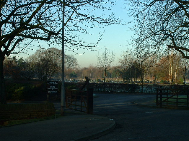
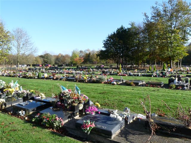
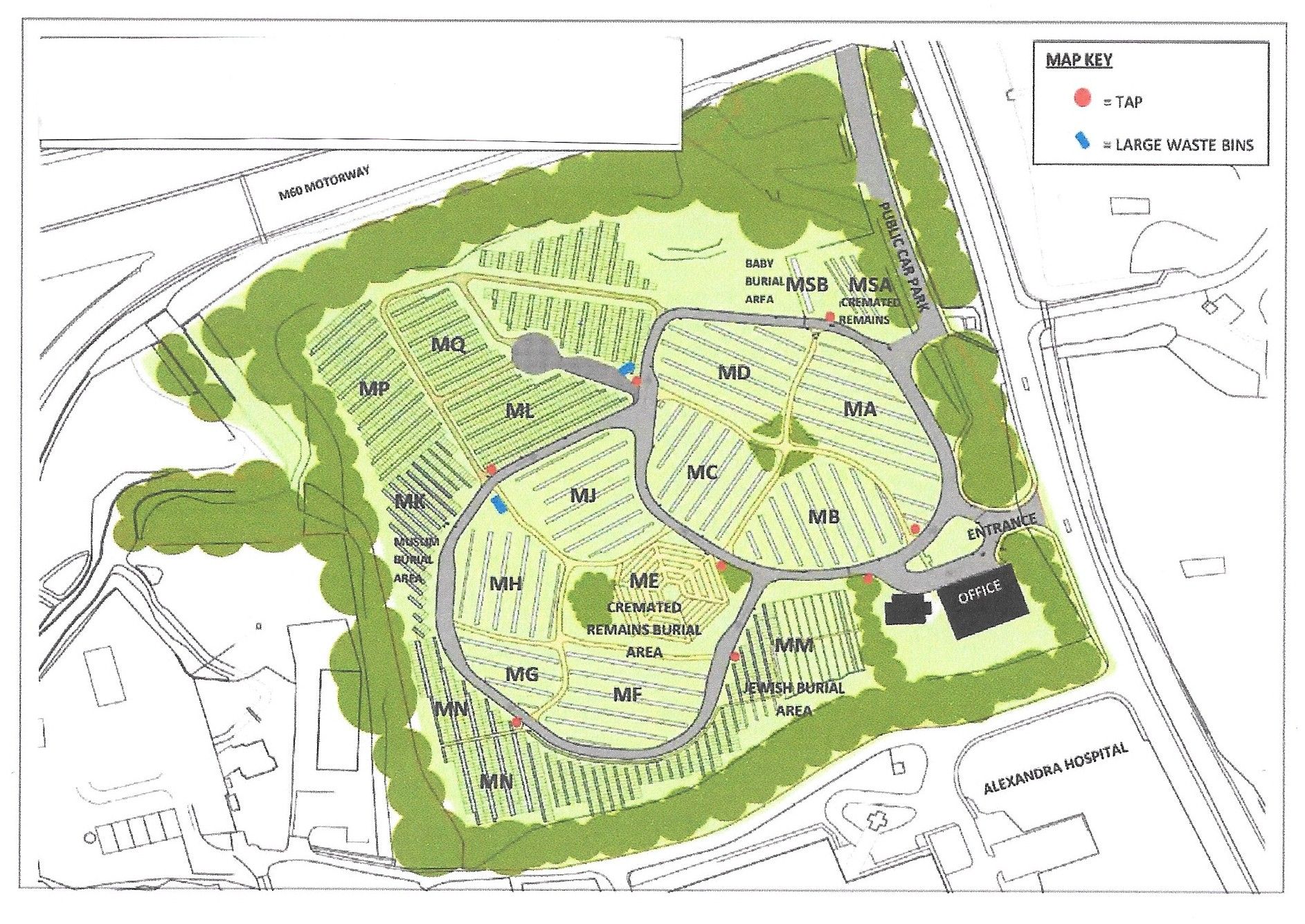
| Description | : | Mill Lane Cemetery is located off Manchester Road (B5095) between Parrs Wood and Cheadle Village. The post code is SK8 2PX. The cemetery was opened in 1993. Its modern layout and appearance are emphasised by long sweeping lawns interspersed with small copses of decorative trees. It can accommodate burials for a range of faith groups including Christian, Jewish and Muslim, and those of no particular faith. The cemetery also has sections specifically for the internment of cremated remains. |
frequently asked questions (FAQ):
-
Where is Mill Lane Cemetery?
Mill Lane Cemetery is located at Manchester Road Cheadle, Metropolitan Borough of Stockport ,Greater Manchester , SK8 2PXEngland.
-
Mill Lane Cemetery cemetery's updated grave count on graveviews.com?
32 memorials
-
Where are the coordinates of the Mill Lane Cemetery?
Latitude: 53.3992000
Longitude: -2.2150800
Nearby Cemetories:
1. St Mary's Churchyard
Cheadle, Metropolitan Borough of Stockport, England
Coordinate: 53.3944820, -2.2176205
2. Cheadle Cemetery
Cheadle, Metropolitan Borough of Stockport, England
Coordinate: 53.3927610, -2.2054690
3. Parsonage Gardens
Didsbury, Metropolitan Borough of Manchester, England
Coordinate: 53.4094440, -2.2302780
4. St. John the Baptist Churchyard
Heaton Mersey, Metropolitan Borough of Stockport, England
Coordinate: 53.4124526, -2.2064749
5. St James Churchyard
Didsbury, Metropolitan Borough of Manchester, England
Coordinate: 53.4088737, -2.2330498
6. Heaton Mersey Congregational Churchyard
Stockport, Metropolitan Borough of Stockport, England
Coordinate: 53.4128680, -2.2038150
7. Wesleyan Chapel
Edgeley, Metropolitan Borough of Stockport, England
Coordinate: 53.4019700, -2.1673860
8. Heald Green United Reformed Church
Heald Green, Metropolitan Borough of Stockport, England
Coordinate: 53.3674480, -2.2165710
9. Christ Church
Heaton Norris, Metropolitan Borough of Stockport, England
Coordinate: 53.4144000, -2.1678000
10. St. Paul's Churchyard
Portwood, Metropolitan Borough of Stockport, England
Coordinate: 53.4215604, -2.1717953
11. St. Paul's Churchyard
Withington, Metropolitan Borough of Manchester, England
Coordinate: 53.4324900, -2.2280790
12. St. Peter's Churchyard
Stockport, Metropolitan Borough of Stockport, England
Coordinate: 53.4105000, -2.1587000
13. St Thomas Churchyard
Stockport, Metropolitan Borough of Stockport, England
Coordinate: 53.4036000, -2.1550000
14. All Saints Churchyard
Cheadle Hulme, Metropolitan Borough of Stockport, England
Coordinate: 53.3669444, -2.1863889
15. Stockport Quaker Burial Ground (Defunct)
Stockport, Metropolitan Borough of Stockport, England
Coordinate: 53.4096205, -2.1555406
16. Saint Thomas the Apostle Heaton Chapel
Heaton Norris, Metropolitan Borough of Stockport, England
Coordinate: 53.4297783, -2.1797558
17. St. Mary's Churchyard
Stockport, Metropolitan Borough of Stockport, England
Coordinate: 53.4112340, -2.1555140
18. Stockport Cemetery and Crematorium
Stockport, Metropolitan Borough of Stockport, England
Coordinate: 53.3979110, -2.1511430
19. Southern Cemetery
Chorlton-Cum-Hardy, Metropolitan Borough of Manchester, England
Coordinate: 53.4278060, -2.2611000
20. The Parish Church of Saint Peter
Stockport, Metropolitan Borough of Stockport, England
Coordinate: 53.4084880, -2.1492930
21. Manchester Crematorium
Manchester, Metropolitan Borough of Manchester, England
Coordinate: 53.4306520, -2.2669990
22. Willow Grove Cemetery
Stockport, Metropolitan Borough of Stockport, England
Coordinate: 53.4252900, -2.1508100
23. St Elisabeth Church
Reddish, Metropolitan Borough of Stockport, England
Coordinate: 53.4379400, -2.1633950
24. St James Churchyard
Rusholme, Metropolitan Borough of Manchester, England
Coordinate: 53.4490050, -2.2151450