
| Memorials | : | 0 |
| Location | : | Stockport, Metropolitan Borough of Stockport, England |
| Coordinate | : | 53.4128680, -2.2038150 |
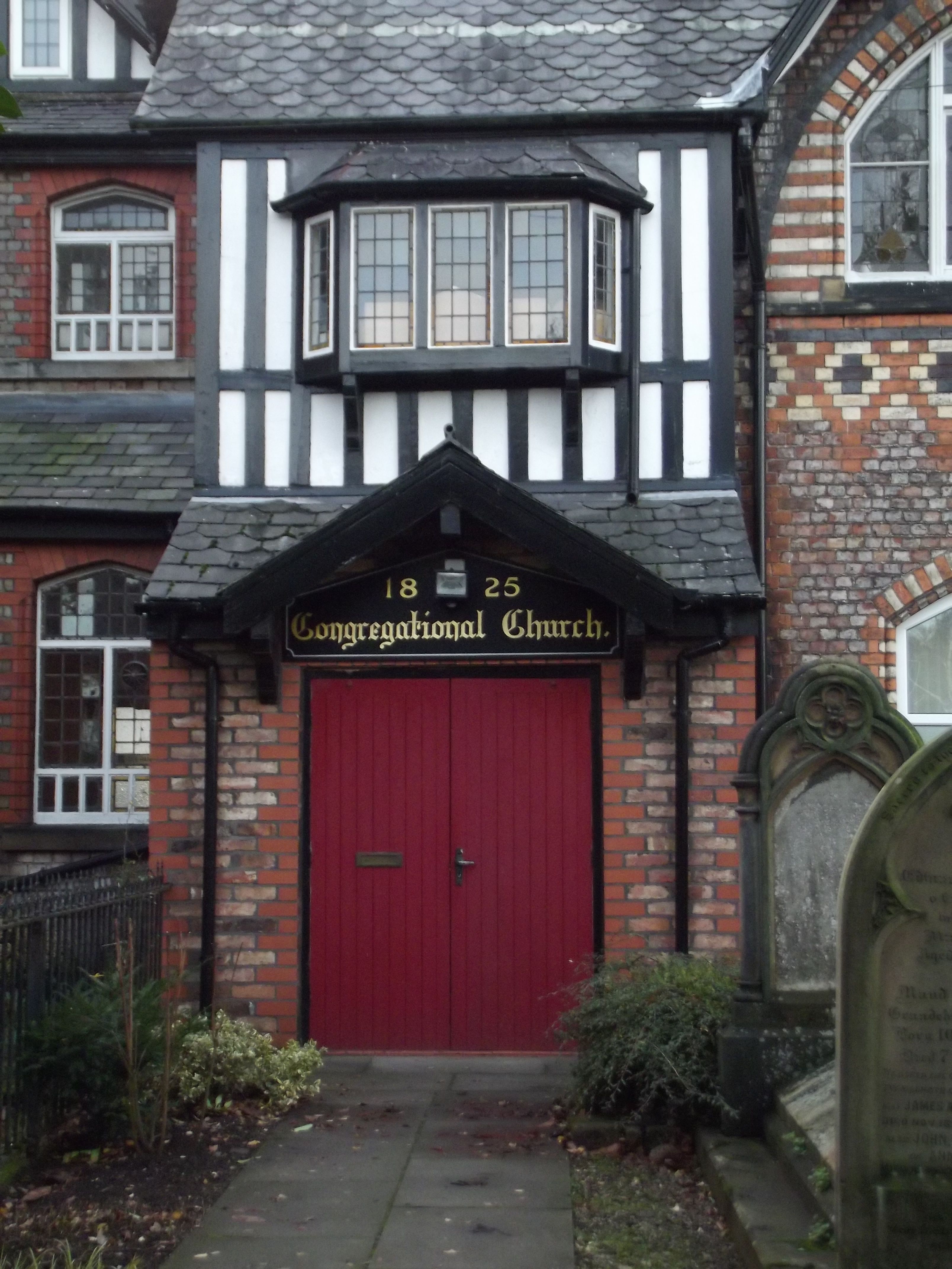
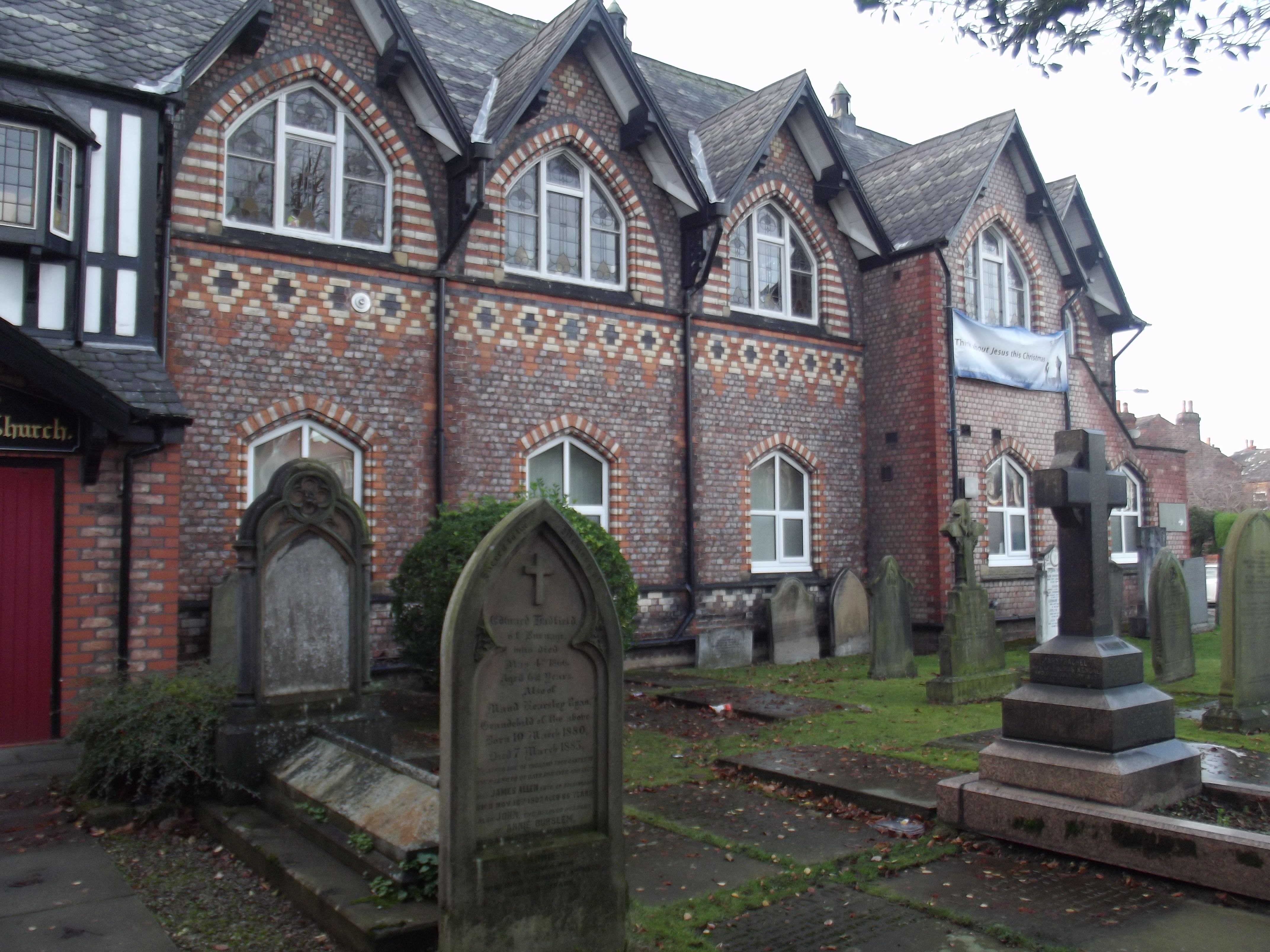
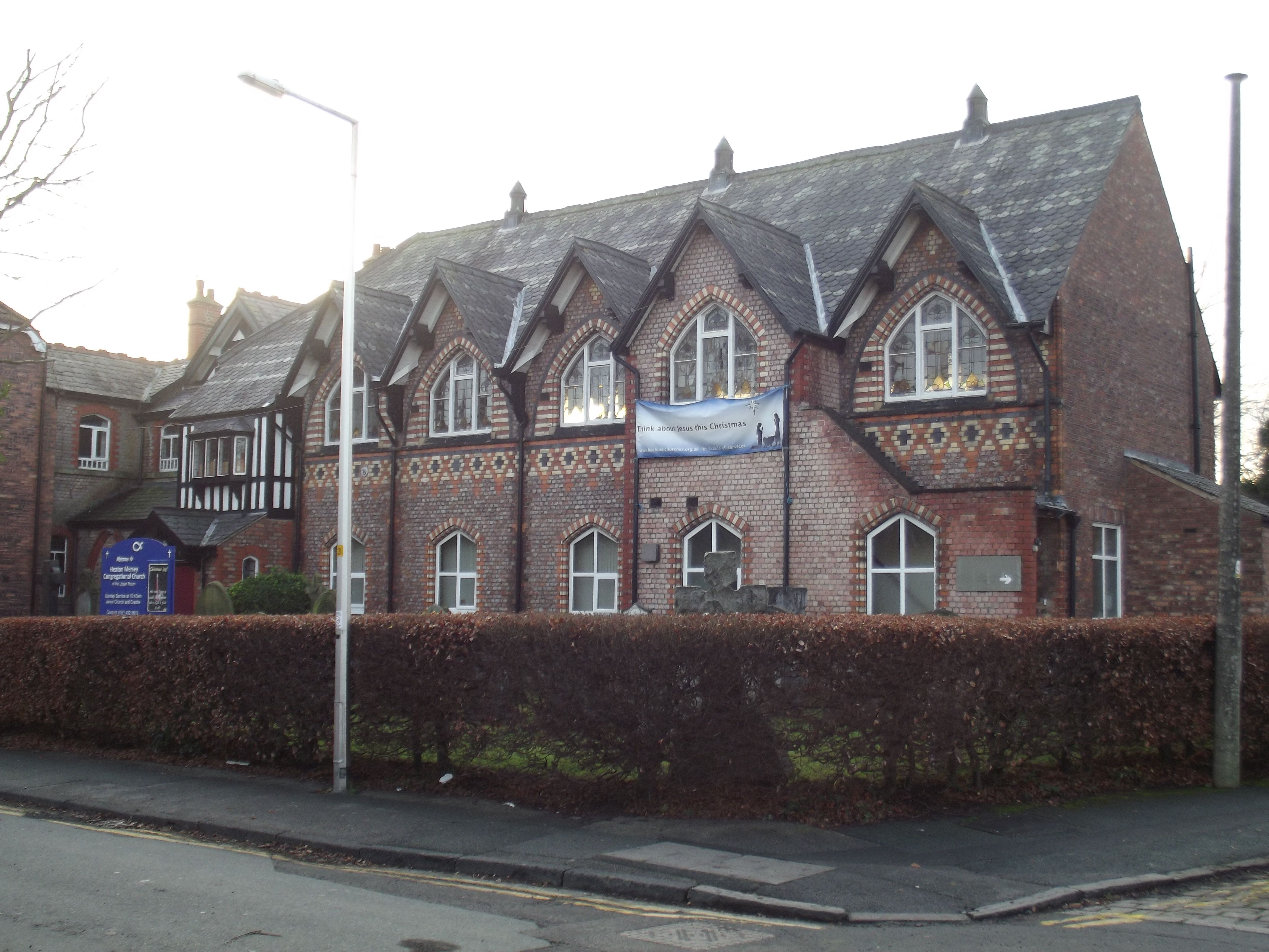
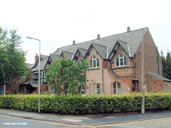
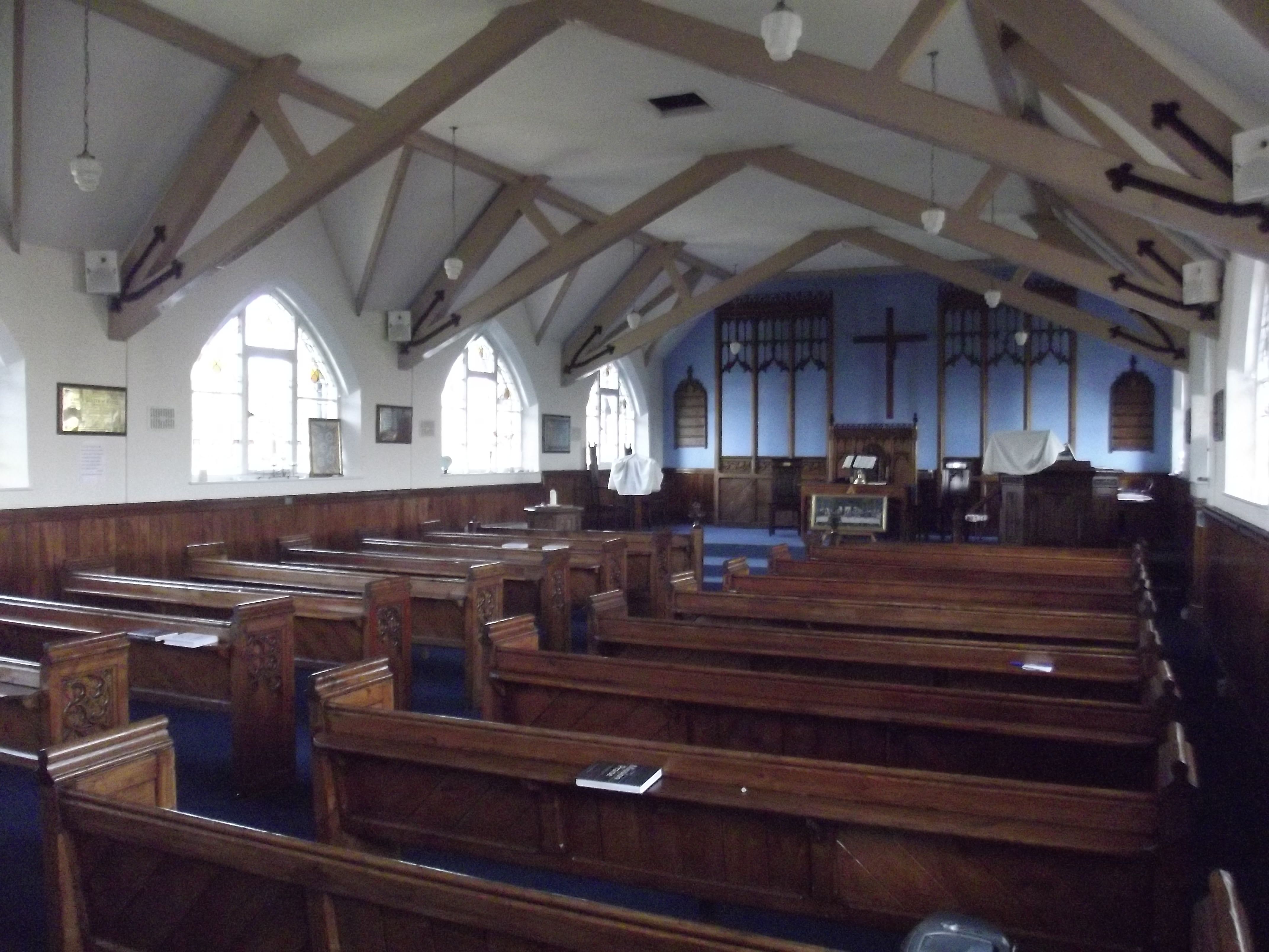
| Description | : | The Church was founded in 1825 when meetings for worship were held in one of the local village cottages. The original church building was opened in 1840 to accommodate a growing congregation, and the associated buildings were constructed over the next quarter of a century to cater for the demand for a Sunday school. The church building was demolished in 1988 and the upper hall of the adjacent building was converted into a place of worship in 1990, being furnished with items taken from the church building before its demolition. In some documents and on the name board outside the... Read More |
frequently asked questions (FAQ):
-
Where is Heaton Mersey Congregational Churchyard?
Heaton Mersey Congregational Churchyard is located at Mersey Road Stockport, Metropolitan Borough of Stockport ,Greater Manchester , SK4 3DEEngland.
-
Heaton Mersey Congregational Churchyard cemetery's updated grave count on graveviews.com?
0 memorials
-
Where are the coordinates of the Heaton Mersey Congregational Churchyard?
Latitude: 53.4128680
Longitude: -2.2038150
Nearby Cemetories:
1. St. John the Baptist Churchyard
Heaton Mersey, Metropolitan Borough of Stockport, England
Coordinate: 53.4124526, -2.2064749
2. Mill Lane Cemetery
Cheadle, Metropolitan Borough of Stockport, England
Coordinate: 53.3992000, -2.2150800
3. Parsonage Gardens
Didsbury, Metropolitan Borough of Manchester, England
Coordinate: 53.4094440, -2.2302780
4. St James Churchyard
Didsbury, Metropolitan Borough of Manchester, England
Coordinate: 53.4088737, -2.2330498
5. Cheadle Cemetery
Cheadle, Metropolitan Borough of Stockport, England
Coordinate: 53.3927610, -2.2054690
6. St Mary's Churchyard
Cheadle, Metropolitan Borough of Stockport, England
Coordinate: 53.3944820, -2.2176205
7. St. Paul's Churchyard
Portwood, Metropolitan Borough of Stockport, England
Coordinate: 53.4215604, -2.1717953
8. Christ Church
Heaton Norris, Metropolitan Borough of Stockport, England
Coordinate: 53.4144000, -2.1678000
9. Saint Thomas the Apostle Heaton Chapel
Heaton Norris, Metropolitan Borough of Stockport, England
Coordinate: 53.4297783, -2.1797558
10. Wesleyan Chapel
Edgeley, Metropolitan Borough of Stockport, England
Coordinate: 53.4019700, -2.1673860
11. St. Paul's Churchyard
Withington, Metropolitan Borough of Manchester, England
Coordinate: 53.4324900, -2.2280790
12. St. Peter's Churchyard
Stockport, Metropolitan Borough of Stockport, England
Coordinate: 53.4105000, -2.1587000
13. St. Mary's Churchyard
Stockport, Metropolitan Borough of Stockport, England
Coordinate: 53.4112340, -2.1555140
14. Stockport Quaker Burial Ground (Defunct)
Stockport, Metropolitan Borough of Stockport, England
Coordinate: 53.4096205, -2.1555406
15. St Thomas Churchyard
Stockport, Metropolitan Borough of Stockport, England
Coordinate: 53.4036000, -2.1550000
16. The Parish Church of Saint Peter
Stockport, Metropolitan Borough of Stockport, England
Coordinate: 53.4084880, -2.1492930
17. Willow Grove Cemetery
Stockport, Metropolitan Borough of Stockport, England
Coordinate: 53.4252900, -2.1508100
18. St Elisabeth Church
Reddish, Metropolitan Borough of Stockport, England
Coordinate: 53.4379400, -2.1633950
19. Stockport Cemetery and Crematorium
Stockport, Metropolitan Borough of Stockport, England
Coordinate: 53.3979110, -2.1511430
20. St James Churchyard
Rusholme, Metropolitan Borough of Manchester, England
Coordinate: 53.4490050, -2.2151450
21. Southern Cemetery
Chorlton-Cum-Hardy, Metropolitan Borough of Manchester, England
Coordinate: 53.4278060, -2.2611000
22. Manchester Crematorium
Manchester, Metropolitan Borough of Manchester, England
Coordinate: 53.4306520, -2.2669990
23. Former Saint Johns Churchyard
Longsight, Metropolitan Borough of Manchester, England
Coordinate: 53.4570760, -2.2025800
24. Heald Green United Reformed Church
Heald Green, Metropolitan Borough of Stockport, England
Coordinate: 53.3674480, -2.2165710