
| Memorials | : | 189 |
| Location | : | Didsbury, Metropolitan Borough of Manchester, England |
| Coordinate | : | 53.4088737, -2.2330498 |
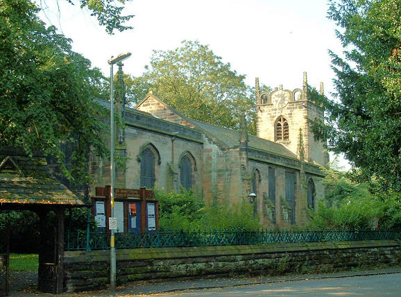
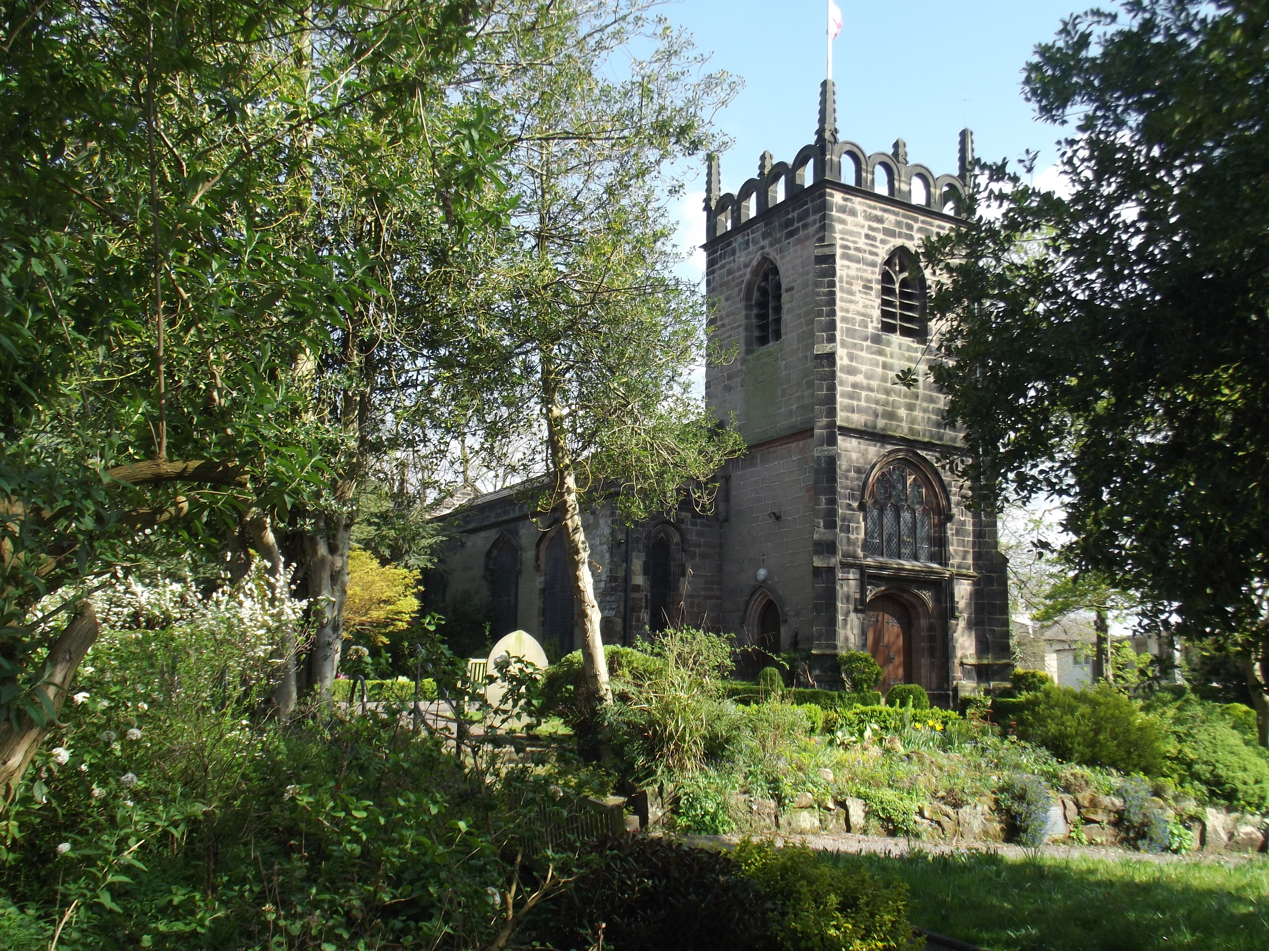
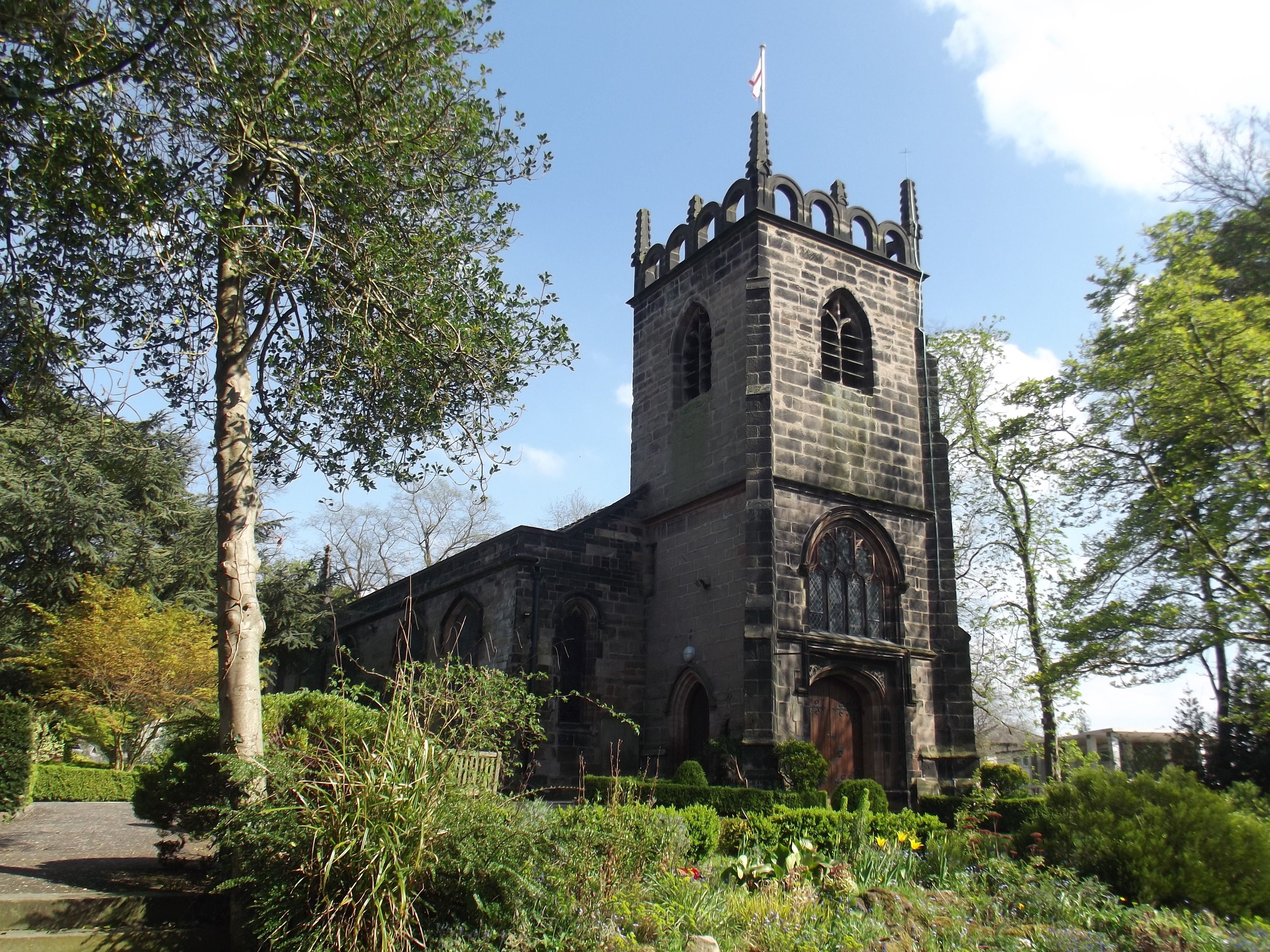
| Description | : | The church of St. James is located in Stenner Lane, Didsbury, Manchester M20 2RQ. Stenner Lane is off Wilmslow Road (A5145) with its entrance between two pubs, The Didsbury and Ye Olde Cock Inn. The church is the oldest in Didsbury and is a Grade 2 Listed Building. Its origins can be traced back to 1235 when Didsbury was a tiny rural hamlet. The west tower is the oldest part of the present building; it was rebuilt in 1620 after a fire. The chapel became the parish church of Didsbury in 1850. The 18th-century galleries have been removed... Read More |
frequently asked questions (FAQ):
-
Where is St James Churchyard?
St James Churchyard is located at Didsbury, Metropolitan Borough of Manchester ,Greater Manchester ,England.
-
St James Churchyard cemetery's updated grave count on graveviews.com?
189 memorials
-
Where are the coordinates of the St James Churchyard?
Latitude: 53.4088737
Longitude: -2.2330498
Nearby Cemetories:
1. Parsonage Gardens
Didsbury, Metropolitan Borough of Manchester, England
Coordinate: 53.4094440, -2.2302780
2. Mill Lane Cemetery
Cheadle, Metropolitan Borough of Stockport, England
Coordinate: 53.3992000, -2.2150800
3. St. John the Baptist Churchyard
Heaton Mersey, Metropolitan Borough of Stockport, England
Coordinate: 53.4124526, -2.2064749
4. St Mary's Churchyard
Cheadle, Metropolitan Borough of Stockport, England
Coordinate: 53.3944820, -2.2176205
5. Heaton Mersey Congregational Churchyard
Stockport, Metropolitan Borough of Stockport, England
Coordinate: 53.4128680, -2.2038150
6. Cheadle Cemetery
Cheadle, Metropolitan Borough of Stockport, England
Coordinate: 53.3927610, -2.2054690
7. St. Paul's Churchyard
Withington, Metropolitan Borough of Manchester, England
Coordinate: 53.4324900, -2.2280790
8. Southern Cemetery
Chorlton-Cum-Hardy, Metropolitan Borough of Manchester, England
Coordinate: 53.4278060, -2.2611000
9. Manchester Crematorium
Manchester, Metropolitan Borough of Manchester, England
Coordinate: 53.4306520, -2.2669990
10. Saint Thomas the Apostle Heaton Chapel
Heaton Norris, Metropolitan Borough of Stockport, England
Coordinate: 53.4297783, -2.1797558
11. St. Paul's Churchyard
Portwood, Metropolitan Borough of Stockport, England
Coordinate: 53.4215604, -2.1717953
12. Christ Church
Heaton Norris, Metropolitan Borough of Stockport, England
Coordinate: 53.4144000, -2.1678000
13. Wesleyan Chapel
Edgeley, Metropolitan Borough of Stockport, England
Coordinate: 53.4019700, -2.1673860
14. St James Churchyard
Rusholme, Metropolitan Borough of Manchester, England
Coordinate: 53.4490050, -2.2151450
15. Chorlton Green Cemetery
Chorlton-Cum-Hardy, Metropolitan Borough of Manchester, England
Coordinate: 53.4377780, -2.2830910
16. Heald Green United Reformed Church
Heald Green, Metropolitan Borough of Stockport, England
Coordinate: 53.3674480, -2.2165710
17. St. Peter's Churchyard
Stockport, Metropolitan Borough of Stockport, England
Coordinate: 53.4105000, -2.1587000
18. Stockport Quaker Burial Ground (Defunct)
Stockport, Metropolitan Borough of Stockport, England
Coordinate: 53.4096205, -2.1555406
19. St. Mary's Churchyard
Stockport, Metropolitan Borough of Stockport, England
Coordinate: 53.4112340, -2.1555140
20. St Thomas Churchyard
Stockport, Metropolitan Borough of Stockport, England
Coordinate: 53.4036000, -2.1550000
21. The Parish Church of Saint Peter
Stockport, Metropolitan Borough of Stockport, England
Coordinate: 53.4084880, -2.1492930
22. Stockport Cemetery and Crematorium
Stockport, Metropolitan Borough of Stockport, England
Coordinate: 53.3979110, -2.1511430
23. All Saints Churchyard
Cheadle Hulme, Metropolitan Borough of Stockport, England
Coordinate: 53.3669444, -2.1863889
24. Christ Church Churchyard
Chorlton-on-Medlock, Metropolitan Borough of Manchester, England
Coordinate: 53.4592000, -2.2362000