
| Memorials | : | 0 |
| Location | : | Romney, Hampshire County, USA |
| Coordinate | : | 39.2902600, -78.7842700 |
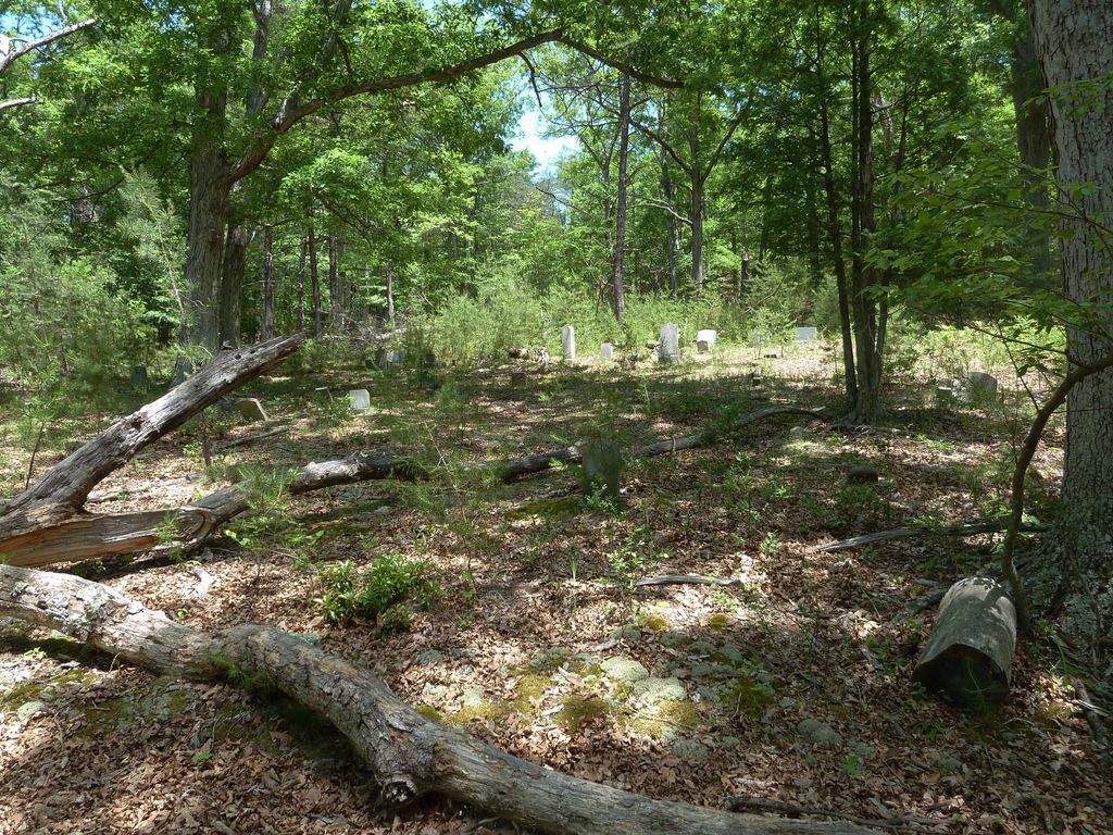
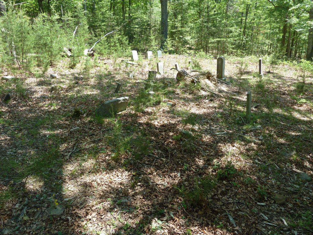
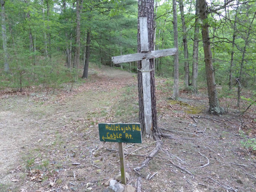
| Description | : | The Mill Run Cemetery appeared to be abandoned when visited in May, 2013. There was no signage or fencing. Just a collection of about three dozen grave markers in a small clearing in the woods. The most recent headstone date observed was 1980. Driving Directions: From Romney travel one half mile west on US Rt. 50 to the South Branch River Road. Drive 3.2 miles south to Club House Road. Drive one mile on Club House Road through the Peterkin Conference Center to a stream crossing where the road is blocked by a cable. Continue up hill on foot about 200... Read More |
frequently asked questions (FAQ):
-
Where is Mill Run Cemetery?
Mill Run Cemetery is located at Romney, Hampshire County ,West Virginia ,USA.
-
Mill Run Cemetery cemetery's updated grave count on graveviews.com?
0 memorials
-
Where are the coordinates of the Mill Run Cemetery?
Latitude: 39.2902600
Longitude: -78.7842700
Nearby Cemetories:
1. Pancake Cemetery
Romney, Hampshire County, USA
Coordinate: 39.2656170, -78.8133930
2. Parker Cemetery
Junction, Hampshire County, USA
Coordinate: 39.3168360, -78.8258110
3. Old Bethel Church Cemetery
Kirby, Hampshire County, USA
Coordinate: 39.2852930, -78.7242200
4. Cheshire Family Cemetery
Romney, Hampshire County, USA
Coordinate: 39.3110500, -78.7299500
5. Parker Family Cemetery
Mechanicsburg, Hampshire County, USA
Coordinate: 39.3273390, -78.8230560
6. Mount Pisgah Benevolent Cemetery
Romney, Hampshire County, USA
Coordinate: 39.3418800, -78.7661500
7. Old Presbyterian Cemetery
Romney, Hampshire County, USA
Coordinate: 39.3408800, -78.7573200
8. Sloan - Ludwick Cemetery
Junction, Hampshire County, USA
Coordinate: 39.3143500, -78.8479500
9. Indian Mound Cemetery
Romney, Hampshire County, USA
Coordinate: 39.3432999, -78.7660980
10. Mountaindale Cemetery
Romney, Hampshire County, USA
Coordinate: 39.2491989, -78.7099991
11. Ebenezer Cemetery
Romney, Hampshire County, USA
Coordinate: 39.3299400, -78.7064700
12. John High Cemetery
Junction, Hampshire County, USA
Coordinate: 39.2938140, -78.8832230
13. Arnold Cemetery
Junction, Hampshire County, USA
Coordinate: 39.3235900, -78.8751500
14. Poorhouse Cemetery
Romney, Hampshire County, USA
Coordinate: 39.2271000, -78.8524400
15. Elijah High Cemetery
Purgitsville, Hampshire County, USA
Coordinate: 39.2882996, -78.8921967
16. Beaver Run Cemetery
Burlington, Mineral County, USA
Coordinate: 39.3467712, -78.8677979
17. Shoemaker Cemetery
Burlington, Mineral County, USA
Coordinate: 39.3288260, -78.8835580
18. Herriott Family Cemetery
Romney, Hampshire County, USA
Coordinate: 39.3765550, -78.7826250
19. Mount Olive United Methodist Church Cemetery
Purgitsville, Hampshire County, USA
Coordinate: 39.2871260, -78.8970630
20. High Cemetery
Sector, Hampshire County, USA
Coordinate: 39.2517730, -78.8857090
21. Saint Lukes Cemetery
Romney, Hampshire County, USA
Coordinate: 39.2192300, -78.8529200
22. Hotts Chapel Cemetery
Kirby, Hampshire County, USA
Coordinate: 39.2097015, -78.7341995
23. Hotts Cemetery
Hampshire County, USA
Coordinate: 39.2085870, -78.7344600
24. Park Cemetery
Augusta, Hampshire County, USA
Coordinate: 39.2639999, -78.6653976