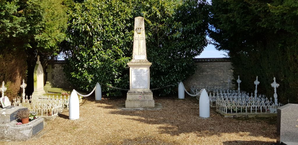
| Memorials | : | 0 |
| Location | : | Moisy, Departement du Loir-et-Cher, France |
| Coordinate | : | 47.9124300, 1.3214900 |
| Description | : | Moisy is a village and commune 22.5 miles (36 kilometres) north of Blois. The cemetery is east of the village, north of the road to Orme-Guignard and about three hundred yards from the church. There is 1 Commonwealth burial of the 1939-1945 war here, north of the memorial, west of the entrance. |
frequently asked questions (FAQ):
-
Where is Moisy Communal Cemetery?
Moisy Communal Cemetery is located at Moisy, Departement du Loir-et-Cher ,Centre ,France.
-
Moisy Communal Cemetery cemetery's updated grave count on graveviews.com?
0 memorials
-
Where are the coordinates of the Moisy Communal Cemetery?
Latitude: 47.9124300
Longitude: 1.3214900
Nearby Cemetories:
1. Chateaudun Eastern Communal Cemetery
Chateaudun, Departement d'Eure-et-Loir, France
Coordinate: 48.0694771, 1.3286591
2. Seris Communal Cemetery
Seris, Departement du Loir-et-Cher, France
Coordinate: 47.7565900, 1.5043200
3. Vendome Town Cemetery
Vendome, Departement du Loir-et-Cher, France
Coordinate: 47.8052110, 1.0682970
4. Collégiale Saint-Georges
Vendome, Departement du Loir-et-Cher, France
Coordinate: 47.7936110, 1.0663890
5. Abbaye de la Trinité
Vendome, Departement du Loir-et-Cher, France
Coordinate: 47.7911110, 1.0688890
6. Church of Saint-Georges (Defunct)
Vendome, Departement du Loir-et-Cher, France
Coordinate: 47.7891290, 1.0655560
7. Villiers-sur-Loir Communal Cemetery
Villiers-sur-Loir, Departement du Loir-et-Cher, France
Coordinate: 47.8035800, 0.9910300
8. Cimetière de Beaugency
Beaugency, Departement du Loiret, France
Coordinate: 47.7828700, 1.6350900
9. Thore Cemetery
Thore-la-Rochette, Departement du Loir-et-Cher, France
Coordinate: 47.7903454, 0.9685482
10. Église de Montharville
Montharville, Departement d'Eure-et-Loir, France
Coordinate: 48.1844000, 1.3319000
11. St. Laurent-des-Eaux Communal Cemetery
Saint-Laurent-Nouan, Departement du Loir-et-Cher, France
Coordinate: 47.7189600, 1.6164400
12. Basilique Notre-Dame de Cléry-Saint-André
Clery-Saint-Andre, Departement du Loiret, France
Coordinate: 47.8201140, 1.7552300
13. Saint Rimay Cemetery
Saint-Rimay, Departement du Loir-et-Cher, France
Coordinate: 47.7671450, 0.9147830
14. Cimetière La-Forêt
Blois, Departement du Loir-et-Cher, France
Coordinate: 47.5918600, 1.2864761
15. Cimetière Blois-Ville
Blois, Departement du Loir-et-Cher, France
Coordinate: 47.5894230, 1.3215856
16. Chapelle royale de Chambord
Chambord, Departement du Loir-et-Cher, France
Coordinate: 47.6159725, 1.5160940
17. Eglise Saint-Nicolas
Blois, Departement du Loir-et-Cher, France
Coordinate: 47.5841420, 1.3313960
18. Abbaye Saint-Laumer de Blois
Blois, Departement du Loir-et-Cher, France
Coordinate: 47.5837200, 1.3318980
19. Cimetiere Blois-Vienne
Blois, Departement du Loir-et-Cher, France
Coordinate: 47.5782200, 1.3394600
20. La Ferte-St. Cyr Communal Cemetery
La Ferte-Saint-Cyr, Departement du Loir-et-Cher, France
Coordinate: 47.6522700, 1.6716800
21. La Chapelle-St. Mesmin Communal Cemetery
La Chapelle-Saint-Mesmin, Departement du Loiret, France
Coordinate: 47.8890900, 1.8445300
22. Cimetière des Grouëts
Blois, Departement du Loir-et-Cher, France
Coordinate: 47.5550338, 1.2866732
23. Jouy-le-Potier Communal Cemetery
Jouy-le-Potier, Departement du Loiret, France
Coordinate: 47.7480200, 1.8110600
24. Cimetière de Cellettes
Cellettes, Departement du Loir-et-Cher, France
Coordinate: 47.5317266, 1.3808086

