
| Memorials | : | 13 |
| Location | : | Cedar Township, Pettis County, USA |
| Coordinate | : | 38.7748700, -93.2198700 |
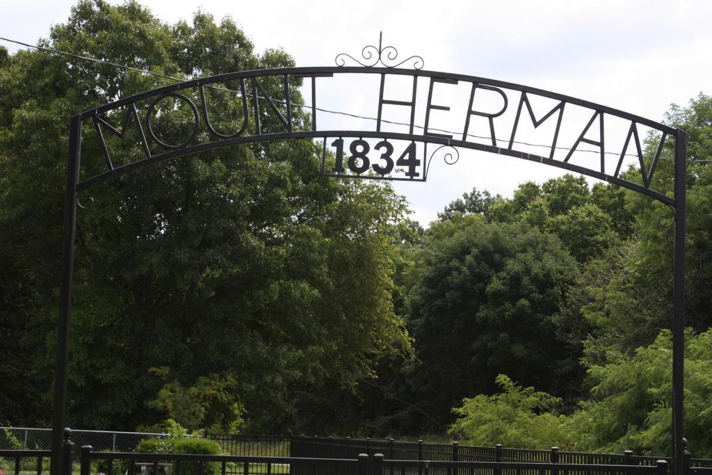
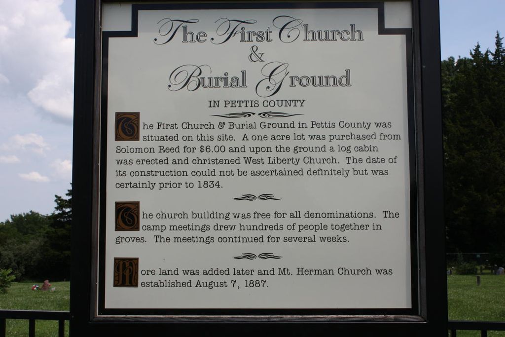
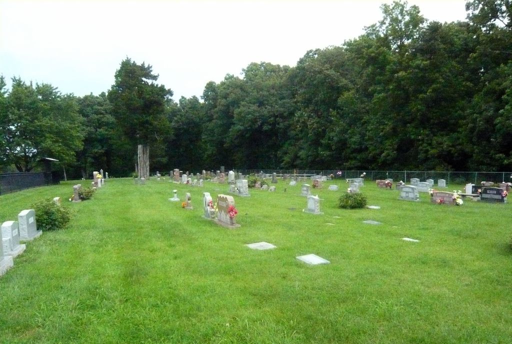
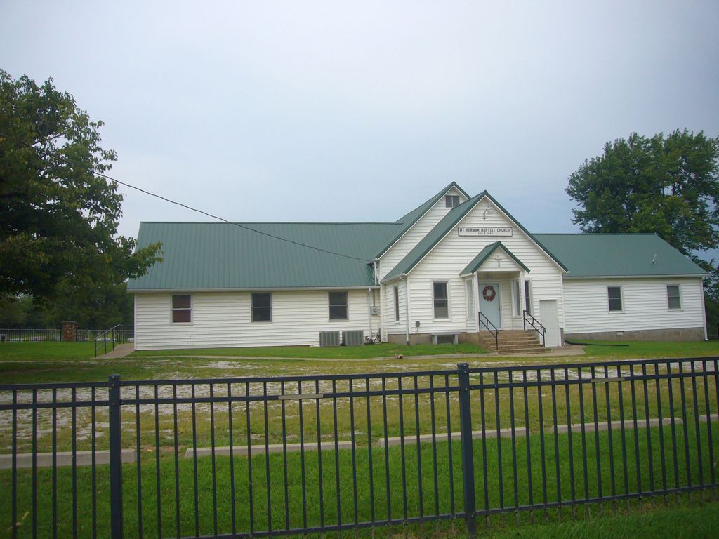
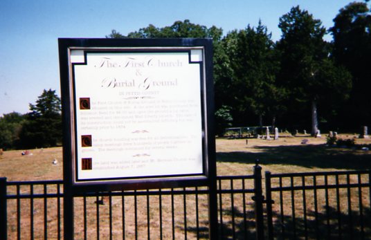
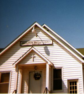
| Description | : | The oldest burials in this cemetery are from the early 1830s, when West Liberty Church and Cemetery were established at this location. They were the first church and organized cemetery in Pettis County. The original founders were Baptists, but both the small log-cabin church building and cemetery were used by all denominations. Religious camp meetings were sometimes held here, lasting for a number of days and having a large attendance. Several other names were also used for the cemetery over the years, including Georgetown, Muddy Fork, and Mount Olive. In 1887, Mount Herman Baptist Church and Cemetery were established at the... Read More |
frequently asked questions (FAQ):
-
Where is Mount Herman Cemetery?
Mount Herman Cemetery is located at Cedar Township, Pettis County ,Missouri ,USA.
-
Mount Herman Cemetery cemetery's updated grave count on graveviews.com?
12 memorials
-
Where are the coordinates of the Mount Herman Cemetery?
Latitude: 38.7748700
Longitude: -93.2198700
Nearby Cemetories:
1. Georgetown Cemetery
Georgetown, Pettis County, USA
Coordinate: 38.7616770, -93.2398460
2. Forbes-Heard Cemetery
Hughesville, Pettis County, USA
Coordinate: 38.7937100, -93.2470200
3. Forbes-Bouldin Cemetery
Hughesville, Pettis County, USA
Coordinate: 38.7956200, -93.2589500
4. David Thomson Cemetery
Georgetown, Pettis County, USA
Coordinate: 38.7799500, -93.2723500
5. Hopewell Cemetery
Newland, Pettis County, USA
Coordinate: 38.8130989, -93.1660995
6. Crown Hill Cemetery
Sedalia, Pettis County, USA
Coordinate: 38.7178001, -93.2149963
7. Calvary Cemetery
Sedalia, Pettis County, USA
Coordinate: 38.7170100, -93.2131300
8. Glenwood Cemetery
Sedalia, Pettis County, USA
Coordinate: 38.7163000, -93.2171500
9. Olive Hill Amish Mennonite Cemetery
Beaman, Pettis County, USA
Coordinate: 38.7705600, -93.1413200
10. Olive Branch Cemetery
Beaman, Pettis County, USA
Coordinate: 38.7792015, -93.1355972
11. Calvary Episcopal Church Columbarium
Sedalia, Pettis County, USA
Coordinate: 38.7044800, -93.2282100
12. Salem Cemetery
Smithton, Pettis County, USA
Coordinate: 38.7352982, -93.1333008
13. High Hill Cemetery
Pettis County, USA
Coordinate: 38.8544006, -93.2446976
14. High Point Cemetery
Hughesville, Pettis County, USA
Coordinate: 38.8549995, -93.2506027
15. Scott Cemetery
Pettis County, USA
Coordinate: 38.8293991, -93.1367035
16. Ellis Cemetery
Newland, Pettis County, USA
Coordinate: 38.8366400, -93.1410500
17. Hebrew Cemetery
Sedalia, Pettis County, USA
Coordinate: 38.6875000, -93.2371979
18. Wheeler Family Cemetery
Beaman, Pettis County, USA
Coordinate: 38.7533600, -93.1045000
19. Dresden Cemetery
Dresden, Pettis County, USA
Coordinate: 38.7468987, -93.3349991
20. North Dresden Cemetery
Dresden, Pettis County, USA
Coordinate: 38.7469600, -93.3352400
21. Highland Sacred Gardens
Sedalia, Pettis County, USA
Coordinate: 38.6831017, -93.1883011
22. Memorial Park Cemetery
Sedalia, Pettis County, USA
Coordinate: 38.6824989, -93.2542038
23. Shobe Cemetery
Sedalia, Pettis County, USA
Coordinate: 38.6996994, -93.2968979
24. Allcorn-Dumsday Cemetery
Sedalia, Pettis County, USA
Coordinate: 38.6772100, -93.2011800