
| Memorials | : | 0 |
| Location | : | Sedalia, Pettis County, USA |
| Coordinate | : | 38.6996994, -93.2968979 |
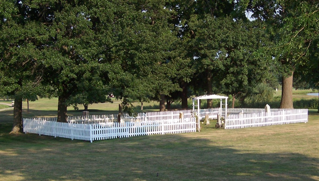
| Description | : | Located in the Sedalia Country Club golf course rough between the 10th, 11th, and 18th fairways. Surrounded by a white wood fence. Attended by course maintenance crews. Cemetery has been closed to burials for over half a century. Quisenberry cemetery. Off the south side of Y road, a mile west of current Sedalia limits. Presently on the 18th hole of the Sedalia Country Club. Aka Shobe Cemetery. |
frequently asked questions (FAQ):
-
Where is Shobe Cemetery?
Shobe Cemetery is located at Sedalia, Pettis County ,Missouri ,USA.
-
Shobe Cemetery cemetery's updated grave count on graveviews.com?
0 memorials
-
Where are the coordinates of the Shobe Cemetery?
Latitude: 38.6996994
Longitude: -93.2968979
Nearby Cemetories:
1. Memorial Park Cemetery
Sedalia, Pettis County, USA
Coordinate: 38.6824989, -93.2542038
2. Hebrew Cemetery
Sedalia, Pettis County, USA
Coordinate: 38.6875000, -93.2371979
3. Calvary Episcopal Church Columbarium
Sedalia, Pettis County, USA
Coordinate: 38.7044800, -93.2282100
4. Camp Branch Baptist Church Cemetery
Sedalia, Pettis County, USA
Coordinate: 38.6731900, -93.3589900
5. Dresden Cemetery
Dresden, Pettis County, USA
Coordinate: 38.7468987, -93.3349991
6. North Dresden Cemetery
Dresden, Pettis County, USA
Coordinate: 38.7469600, -93.3352400
7. McKee Chapel Cemetery
Sedalia, Pettis County, USA
Coordinate: 38.6396100, -93.3144800
8. Glenwood Cemetery
Sedalia, Pettis County, USA
Coordinate: 38.7163000, -93.2171500
9. Crown Hill Cemetery
Sedalia, Pettis County, USA
Coordinate: 38.7178001, -93.2149963
10. Calvary Cemetery
Sedalia, Pettis County, USA
Coordinate: 38.7170100, -93.2131300
11. Georgetown Cemetery
Georgetown, Pettis County, USA
Coordinate: 38.7616770, -93.2398460
12. Allcorn-Dumsday Cemetery
Sedalia, Pettis County, USA
Coordinate: 38.6772100, -93.2011800
13. David Thomson Cemetery
Georgetown, Pettis County, USA
Coordinate: 38.7799500, -93.2723500
14. Botts Cemetery
Pettis County, USA
Coordinate: 38.7118988, -93.4019012
15. New Bethel Cemetery
Sedalia, Pettis County, USA
Coordinate: 38.6191500, -93.2669600
16. Bethlehem Baptist Church Cemetery
Pettis County, USA
Coordinate: 38.6250000, -93.2457962
17. Highland Sacred Gardens
Sedalia, Pettis County, USA
Coordinate: 38.6831017, -93.1883011
18. Mount Herman Cemetery
Cedar Township, Pettis County, USA
Coordinate: 38.7748700, -93.2198700
19. Bourn Cemetery
Spring Fork, Pettis County, USA
Coordinate: 38.6119410, -93.2463310
20. Craighead Cemetery
La Monte, Pettis County, USA
Coordinate: 38.7350006, -93.4124985
21. Forbes-Bouldin Cemetery
Hughesville, Pettis County, USA
Coordinate: 38.7956200, -93.2589500
22. Forbes-Heard Cemetery
Hughesville, Pettis County, USA
Coordinate: 38.7937100, -93.2470200
23. Abell Cemetery
Sedalia, Pettis County, USA
Coordinate: 38.6542015, -93.1774979
24. Nelson Cemetery
Washington Township, Pettis County, USA
Coordinate: 38.6106500, -93.3723300