
| Memorials | : | 149 |
| Location | : | Mount Holly, Warren County, USA |
| Coordinate | : | 39.5630989, -84.0342026 |
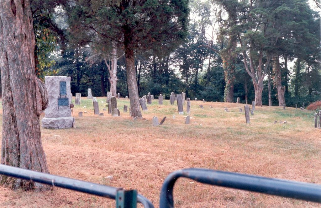
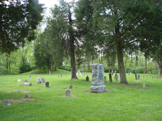
| Description | : | This inactive cemetery is about 600 feet west of Cincinnati-Columbus Road. It is reached by travelling 0.16 mile from US 42 north along Cincinnati-Columbus Road and turning left on the first road on the left. The first known burial occurred in 1818. The cemetery is located in Wayne Township, Warren County, Ohio, and is # 12331 in “Ohio Cemeteries 1803-2003”, compiled by the Ohio Genealogical Society. The U.S. Geological Survey (USGS) Geographic Names Information System (GNIS) feature ID for the cemetery is 1043567 (Mount Holly Cemetery). |
frequently asked questions (FAQ):
-
Where is Mount Holly Cemetery?
Mount Holly Cemetery is located at 9357 N. Cincinnati-Columbus Road Mount Holly, Warren County ,Ohio , 45068USA.
-
Mount Holly Cemetery cemetery's updated grave count on graveviews.com?
149 memorials
-
Where are the coordinates of the Mount Holly Cemetery?
Latitude: 39.5630989
Longitude: -84.0342026
Nearby Cemetories:
1. Compton Farm Cemetery
Waynesville, Warren County, USA
Coordinate: 39.5716110, -84.0043610
2. Roxanna Cemetery (Defunct)
Spring Valley, Greene County, USA
Coordinate: 39.5867004, -84.0089035
3. Middle Run Cemetery
Bellbrook, Greene County, USA
Coordinate: 39.5816800, -84.0745480
4. Caesar Creek Cemetery
Waynesville, Warren County, USA
Coordinate: 39.5477420, -83.9835450
5. Miami Cemetery
Corwin, Warren County, USA
Coordinate: 39.5217018, -84.0721970
6. Friends Burial Ground
Waynesville, Warren County, USA
Coordinate: 39.5292830, -84.0882500
7. McKnight Cemetery
Spring Valley Township, Greene County, USA
Coordinate: 39.5906860, -83.9725670
8. Spring Valley Cemetery
Spring Valley, Greene County, USA
Coordinate: 39.6127010, -84.0005030
9. New Burlington Cemetery
New Burlington, Clinton County, USA
Coordinate: 39.5675201, -83.9591064
10. Harveysburg United Brethren Cemetery
Harveysburg, Warren County, USA
Coordinate: 39.5048270, -84.0127730
11. Elam Cemetery
Spring Valley, Greene County, USA
Coordinate: 39.6060867, -83.9771729
12. Zion Baptist Cemetery
Harveysburg, Warren County, USA
Coordinate: 39.5024700, -84.0209450
13. Friends Cemetery
Harveysburg, Warren County, USA
Coordinate: 39.5030310, -84.0132390
14. Cain Cemetery
Spring Valley, Greene County, USA
Coordinate: 39.6187250, -83.9947030
15. Lukens Cemetery
Harveysburg, Warren County, USA
Coordinate: 39.4991989, -84.0267029
16. Harveysburg Hicksite Cemetery
Harveysburg, Warren County, USA
Coordinate: 39.5004610, -84.0046420
17. Fairview Primitive Baptist Church Cemetery
Bellbrook, Greene County, USA
Coordinate: 39.6258888, -84.0815048
18. Lytle Cemetery
Lytle, Warren County, USA
Coordinate: 39.5605830, -84.1301230
19. Mercer Cemetery
Spring Valley Township, Greene County, USA
Coordinate: 39.6097830, -83.9543750
20. Jonahs Run Cemetery
Chester Township, Clinton County, USA
Coordinate: 39.4964490, -83.9804860
21. Massie Township Pioneer Cemetery
Harveysburg, Warren County, USA
Coordinate: 39.4821000, -84.0370100
22. Bellbrook Cemetery
Bellbrook, Greene County, USA
Coordinate: 39.6441480, -84.0697750
23. Pioneer Cemetery
Bellbrook, Greene County, USA
Coordinate: 39.6464005, -84.0691986
24. Mount Pisgah Cemetery (Defunct)
Chester Township, Clinton County, USA
Coordinate: 39.5428640, -83.9177940