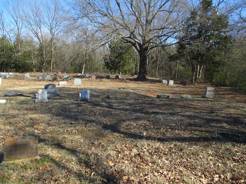
| Memorials | : | 1 |
| Location | : | Hugo, Choctaw County, USA |
| Coordinate | : | 33.9680840, -95.5187580 |
| Description | : | Mount Olive Cemetery is an historically African-American cemetery located south of Hugo. Take US 271 where it turns south out of Hugo and go for about 2 miles. Turn east on Country Club Road (a.k.a. E2100 Road) and go about a quarter of a mile on the road through the golf course. There is no cemetery fence or sign, but you will see the lane that goes off to the right into the cemetery. |
frequently asked questions (FAQ):
-
Where is Mount Olive Cemetery?
Mount Olive Cemetery is located at Hugo, Choctaw County ,Oklahoma ,USA.
-
Mount Olive Cemetery cemetery's updated grave count on graveviews.com?
1 memorials
-
Where are the coordinates of the Mount Olive Cemetery?
Latitude: 33.9680840
Longitude: -95.5187580
Nearby Cemetories:
1. Crosley Cemetery
Hugo, Choctaw County, USA
Coordinate: 33.9877670, -95.5127330
2. Springs Chapel Cemetery
Hugo, Choctaw County, USA
Coordinate: 33.9907990, -95.5111008
3. Spring Family Cemetery
Hugo, Choctaw County, USA
Coordinate: 33.9940000, -95.5040000
4. Poor Farm Cemetery
Choctaw County, USA
Coordinate: 33.9869970, -95.5508000
5. Grant Cemetery
Grant, Choctaw County, USA
Coordinate: 33.9392014, -95.4972000
6. Mount Olivet Cemetery
Hugo, Choctaw County, USA
Coordinate: 33.9981003, -95.4955978
7. Goodland Cemetery
Choctaw County, USA
Coordinate: 33.9832993, -95.5580978
8. Sweet Hill Cemetery
Choctaw County, USA
Coordinate: 33.9536280, -95.5734990
9. Bohannon-Davis Plot
Hugo, Choctaw County, USA
Coordinate: 34.0190500, -95.5245200
10. Jones Cemetery
Choctaw County, USA
Coordinate: 33.9767200, -95.4497000
11. Pleasant Hill Cemetery
Grant, Choctaw County, USA
Coordinate: 33.9250020, -95.4685850
12. Gay Cemetery
Choctaw County, USA
Coordinate: 33.9537020, -95.5908570
13. Cold Springs Cemetery
Choctaw County, USA
Coordinate: 33.9741670, -95.6036110
14. Roebuck Cemetery
Hugo, Choctaw County, USA
Coordinate: 34.0016100, -95.6042800
15. Durant Cemetery
Choctaw County, USA
Coordinate: 33.9146996, -95.4494019
16. Shoat Springs Cemetery
Hugo, Choctaw County, USA
Coordinate: 33.9738998, -95.4169006
17. Sand Bluff Cemetery
Sand Bluff, Choctaw County, USA
Coordinate: 34.0616000, -95.5039000
18. Long Creek Cemetery
Messer, Choctaw County, USA
Coordinate: 34.0548800, -95.4682100
19. Coon Family Cemetery
Soper, Choctaw County, USA
Coordinate: 34.0033900, -95.6466900
20. Ahekatubby Cemetery
Choctaw County, USA
Coordinate: 33.9900300, -95.3864100
21. Shoals Cemetery
Hugo, Choctaw County, USA
Coordinate: 33.9115450, -95.3996800
22. Long Creek Cemetery
Hugo, Choctaw County, USA
Coordinate: 34.0824700, -95.5389800
23. Woodlawn Cemetery
Choctaw County, USA
Coordinate: 34.0849991, -95.4811020
24. Everidge Cemetery
Hugo, Choctaw County, USA
Coordinate: 33.9432983, -95.3657990

