| Memorials | : | 3 |
| Location | : | Hugo, Choctaw County, USA |
| Coordinate | : | 33.9907990, -95.5111008 |
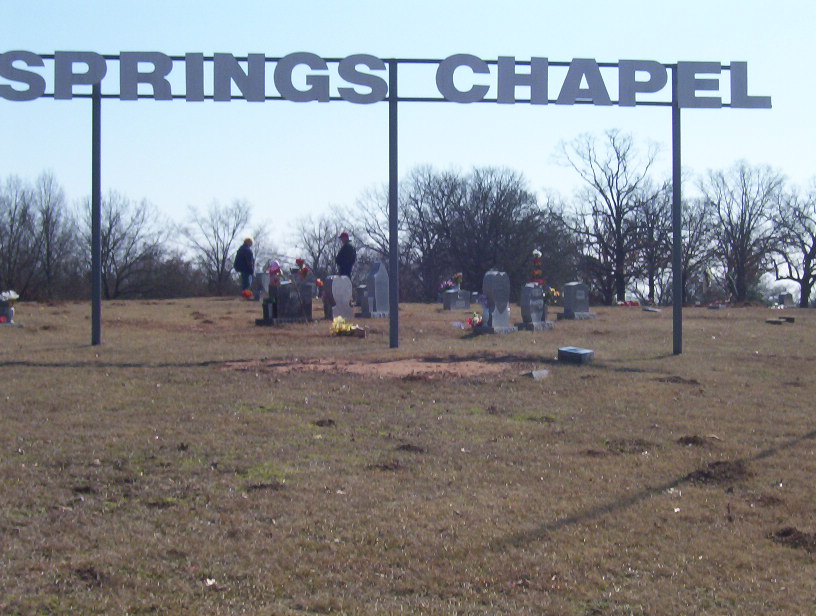
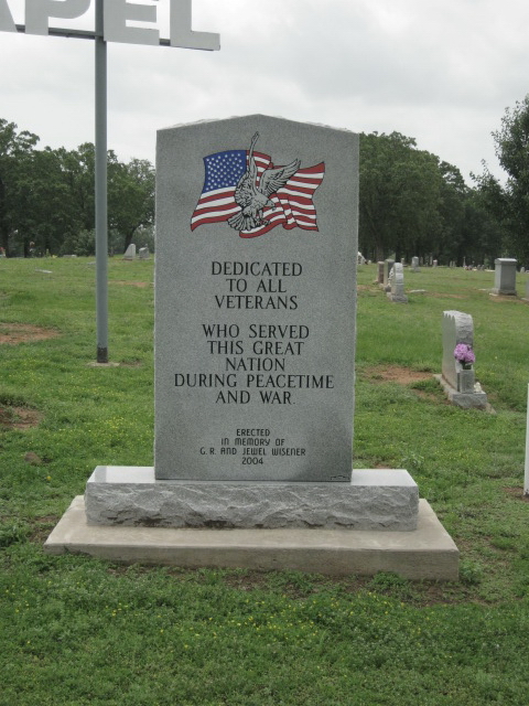
| Description | : | Springs Chapel Cemetery is located south of Hugo on Broadway Street. There is no access from U.S. 70 to the cemetery. Follow Broadway Street south from downtown Hugo. When you pass under US 70 the cemetery will be on your left. Entrance is at the south end of the cemetery where the road curves right to cross the railroad tracks. The road is paved and the cemetery is well maintained. Oldest recorded burial is 1874. The cemetery is divided into 7 sections and the numbering system shown is the one used by the cemetery association. The sections were recently subdivided... Read More |
frequently asked questions (FAQ):
-
Where is Springs Chapel Cemetery?
Springs Chapel Cemetery is located at Hugo, Choctaw County ,Oklahoma ,USA.
-
Springs Chapel Cemetery cemetery's updated grave count on graveviews.com?
2 memorials
-
Where are the coordinates of the Springs Chapel Cemetery?
Latitude: 33.9907990
Longitude: -95.5111008
Nearby Cemetories:
1. Crosley Cemetery
Hugo, Choctaw County, USA
Coordinate: 33.9877670, -95.5127330
2. Spring Family Cemetery
Hugo, Choctaw County, USA
Coordinate: 33.9940000, -95.5040000
3. Mount Olivet Cemetery
Hugo, Choctaw County, USA
Coordinate: 33.9981003, -95.4955978
4. Mount Olive Cemetery
Hugo, Choctaw County, USA
Coordinate: 33.9680840, -95.5187580
5. Bohannon-Davis Plot
Hugo, Choctaw County, USA
Coordinate: 34.0190500, -95.5245200
6. Poor Farm Cemetery
Choctaw County, USA
Coordinate: 33.9869970, -95.5508000
7. Goodland Cemetery
Choctaw County, USA
Coordinate: 33.9832993, -95.5580978
8. Jones Cemetery
Choctaw County, USA
Coordinate: 33.9767200, -95.4497000
9. Grant Cemetery
Grant, Choctaw County, USA
Coordinate: 33.9392014, -95.4972000
10. Sweet Hill Cemetery
Choctaw County, USA
Coordinate: 33.9536280, -95.5734990
11. Sand Bluff Cemetery
Sand Bluff, Choctaw County, USA
Coordinate: 34.0616000, -95.5039000
12. Long Creek Cemetery
Messer, Choctaw County, USA
Coordinate: 34.0548800, -95.4682100
13. Pleasant Hill Cemetery
Grant, Choctaw County, USA
Coordinate: 33.9250020, -95.4685850
14. Gay Cemetery
Choctaw County, USA
Coordinate: 33.9537020, -95.5908570
15. Roebuck Cemetery
Hugo, Choctaw County, USA
Coordinate: 34.0016100, -95.6042800
16. Cold Springs Cemetery
Choctaw County, USA
Coordinate: 33.9741670, -95.6036110
17. Shoat Springs Cemetery
Hugo, Choctaw County, USA
Coordinate: 33.9738998, -95.4169006
18. Durant Cemetery
Choctaw County, USA
Coordinate: 33.9146996, -95.4494019
19. Long Creek Cemetery
Hugo, Choctaw County, USA
Coordinate: 34.0824700, -95.5389800
20. Woodlawn Cemetery
Choctaw County, USA
Coordinate: 34.0849991, -95.4811020
21. Ahekatubby Cemetery
Choctaw County, USA
Coordinate: 33.9900300, -95.3864100
22. Fennel Cemetery
Messer, Choctaw County, USA
Coordinate: 34.0913500, -95.4695000
23. Pisachubbee Cemetery
Speer, Choctaw County, USA
Coordinate: 34.0960361, -95.5569440
24. Coon Family Cemetery
Soper, Choctaw County, USA
Coordinate: 34.0033900, -95.6466900


