
| Memorials | : | 26 |
| Location | : | Casar, Cleveland County, USA |
| Phone | : | 704-538-0162 |
| Coordinate | : | 35.4843300, -81.6655900 |
frequently asked questions (FAQ):
-
Where is Mount Zion Baptist Church Cemetery?
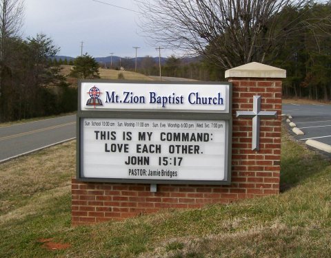
Mount Zion Baptist Church Cemetery is located at 400 Mt. Zion Church Rd Casar, Cleveland County ,North Carolina , 28020USA.
-
Mount Zion Baptist Church Cemetery cemetery's updated grave count on graveviews.com?
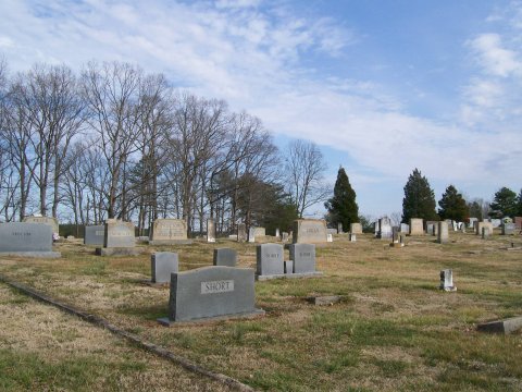
21 memorials
-
Where are the coordinates of the Mount Zion Baptist Church Cemetery?
Latitude: 35.4843300
Longitude: -81.6655900
Nearby Cemetories:
1. Calvary's Cross Baptist Cemetery
Lawndale, Cleveland County, USA
Coordinate: 35.4743690, -81.6791790
2. New Home United Methodist Church Cemetery
Casar, Cleveland County, USA
Coordinate: 35.5064300, -81.6653100
3. Lees Chapel United Methodist Church Cemetery
Polkville, Cleveland County, USA
Coordinate: 35.4860764, -81.6936951
4. Mount Harmony Memorial Cemetery
Polkville, Cleveland County, USA
Coordinate: 35.4598700, -81.6858000
5. Ferrells Chapel Cemetery
Shelby, Cleveland County, USA
Coordinate: 35.4520000, -81.6660000
6. Clover Hill United Methodist Church Cemetery
Lawndale, Cleveland County, USA
Coordinate: 35.4817500, -81.6246000
7. Old Cloverhill Cemetery
Casar, Cleveland County, USA
Coordinate: 35.4826190, -81.6239550
8. Lattimore Family Cemetery
Polkville, Cleveland County, USA
Coordinate: 35.4472810, -81.6658400
9. Hoyle Family Cemetery
Casar, Cleveland County, USA
Coordinate: 35.5139540, -81.6380520
10. Lattimore Baptist Cemetery
Lattimore, Cleveland County, USA
Coordinate: 35.4435997, -81.6667023
11. Brooks Chapel United Methodist Church Cemetery
Shelby, Cleveland County, USA
Coordinate: 35.4461580, -81.6905520
12. Diviney Cemetery
Duncans Creek, Rutherford County, USA
Coordinate: 35.5143920, -81.7042200
13. Corinth Baptist Church Cemetery
Casar, Cleveland County, USA
Coordinate: 35.5284615, -81.6434326
14. Casar Tabernacle Baptist Cemetery
Casar, Cleveland County, USA
Coordinate: 35.5172960, -81.6230690
15. Casar United Methodist Church Cemetery
Casar, Cleveland County, USA
Coordinate: 35.5152600, -81.6183200
16. Casar Baptist Cemetery
Casar, Cleveland County, USA
Coordinate: 35.5067450, -81.6099510
17. Duncans Creek Presbyterian Church Cemetery
Hollis, Rutherford County, USA
Coordinate: 35.4742680, -81.7276620
18. Price Family Cemetery
Hollis, Rutherford County, USA
Coordinate: 35.4548240, -81.7194440
19. Eaker Cemetery
Cleveland County, USA
Coordinate: 35.4516983, -81.6144028
20. Lucas Family Cemetery
Polkville, Cleveland County, USA
Coordinate: 35.4415210, -81.6235040
21. Zoar Baptist Church Cemetery
Casar, Cleveland County, USA
Coordinate: 35.5169296, -81.6045532
22. Elliott Cemetery
Polkville, Cleveland County, USA
Coordinate: 35.4247017, -81.6781006
23. Big Springs Baptist Cemetery
Hollis, Rutherford County, USA
Coordinate: 35.4366430, -81.7119510
24. Oak Grove United Methodist Church Cemetery
Polkville, Cleveland County, USA
Coordinate: 35.4337440, -81.6225710