
| Memorials | : | 1 |
| Location | : | Randolph County, USA |
| Coordinate | : | 35.5310430, -79.5624010 |
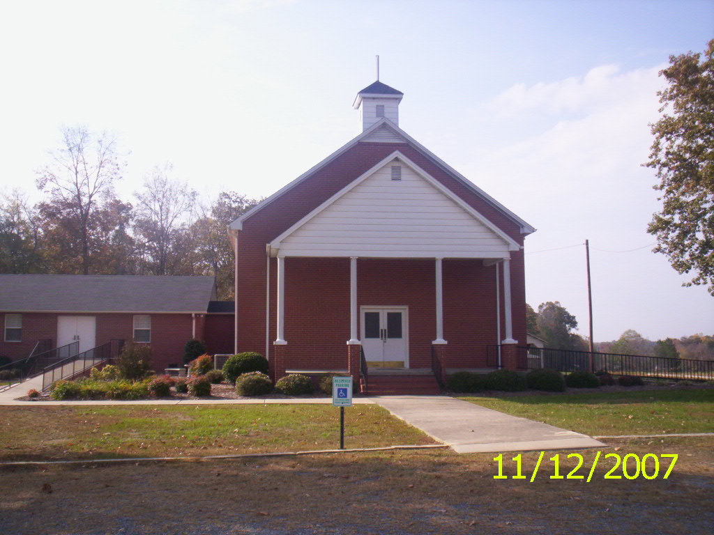
| Description | : | MT. ZION UNITED METHODIST CHURCH Location - on the west side of Howard Mill Rd (SR-2877), at Curtis Powers Rd (SR-2976). Coordinates: 35d 31m 51.6s N; 79d 33m 45.1s W Click here for Google maps Surveyed by Ralph Brady, Sexton, and Inez Jones, Church Historian in September 1987 and May 1993. Inez Dickerson Jones, in her manuscript dated 25 June 1993, reported 208 grave markers, 100 vacant sites and 65 unlettered concrete blocks. In May 1997, Audrey O. Heiser reviewed many stones and added information. |
frequently asked questions (FAQ):
-
Where is Mount Zion United Methodist Church Cemetery?
Mount Zion United Methodist Church Cemetery is located at 8616 Curtis Powers Rd Randolph County ,North Carolina ,USA.
-
Mount Zion United Methodist Church Cemetery cemetery's updated grave count on graveviews.com?
1 memorials
-
Where are the coordinates of the Mount Zion United Methodist Church Cemetery?
Latitude: 35.5310430
Longitude: -79.5624010

Nearby Cemetories:
1. Beulah Baptist Church Cemetery
Randolph County, USA
Coordinate: 35.5183320, -79.5662690
2. Deaton Family Cemetery
Chatham County, USA
Coordinate: 35.5353440, -79.5469330
3. Waddell Memorial Chapel Cemetery
Randolph County, USA
Coordinate: 35.5256450, -79.5795590
4. Purvis Cemetery
Bennett, Chatham County, USA
Coordinate: 35.5184244, -79.5488155
5. Bennett Baptist Church Cemetery
Bennett, Chatham County, USA
Coordinate: 35.5602350, -79.5418390
6. Fall Creek Baptist Cemetery
Bennett, Chatham County, USA
Coordinate: 35.5272540, -79.5158190
7. Riverside Baptist Church Cemetery
Seagrove, Randolph County, USA
Coordinate: 35.5337430, -79.6099330
8. John D. Scott Graveyard
Harpers Crossroads, Chatham County, USA
Coordinate: 35.5519400, -79.5188900
9. Highfalls Wesleyan Church Cemetery
Robbins, Moore County, USA
Coordinate: 35.4976400, -79.5278600
10. Chesley Jones Family Cemetery
Bear Creek, Chatham County, USA
Coordinate: 35.5322300, -79.5043200
11. Maness Family Cemetery
Coleridge, Randolph County, USA
Coordinate: 35.5315700, -79.6235700
12. Pleasant Hill United Methodist Church Cemetery
Seagrove, Randolph County, USA
Coordinate: 35.5641190, -79.6124860
13. Smyrna United Methodist Church Cemetery
Robbins, Moore County, USA
Coordinate: 35.4940200, -79.6097400
14. High Falls Friends Church Cemetery
High Falls, Moore County, USA
Coordinate: 35.4872330, -79.5211110
15. James Scott Family Cemetery
Chatham County, USA
Coordinate: 35.5494444, -79.4977778
16. Pleasant Grove Christian Church Cemetery
Coleridge, Randolph County, USA
Coordinate: 35.5857160, -79.5783140
17. Pine Mountain Friends Church Cemetery
High Falls, Moore County, USA
Coordinate: 35.5122833, -79.4959946
18. High Falls United Methodist Church Cemetery
High Falls, Moore County, USA
Coordinate: 35.4803650, -79.5172570
19. Elmodam Phillips Cemetery
Bear Creek, Chatham County, USA
Coordinate: 35.5211100, -79.4855600
20. New Zion Hill Cemetery
Moore County, USA
Coordinate: 35.4743996, -79.6031036
21. Pleasant Hill Methodist Church
Robbins, Moore County, USA
Coordinate: 35.4655685, -79.5528336
22. Prosperity Friends Meeting Cemetery
High Falls, Moore County, USA
Coordinate: 35.4941040, -79.4942180
23. Needham's Grove Baptist Church Cemetery
Robbins, Moore County, USA
Coordinate: 35.5069240, -79.6398630
24. Welch Family Cemetery
Bear Creek Township, Chatham County, USA
Coordinate: 35.5502140, -79.4768570