
| Memorials | : | 0 |
| Location | : | Horsell, Woking Borough, England |
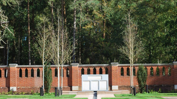
| Description | : | The Muslim Burial Ground, Horsell Common , in Woking, Surrey, United Kingdom, was the original resting place of two dozen Muslim soldiers who died during World War I and World War II. It measures about 30 metres (98 ft) by 30 metres and is located at grid reference TQ016599 in the southeast corner of Horsell Common about 100 metres off Monument Road. It is a Grade II listed building. Large numbers of men from the Indian subcontinent fought on the Western Front during World War I. Some of those who were injured were moved to hospitals on the English south coast... Read More |
frequently asked questions (FAQ):
-
Where is Muslim Burial Ground?
Muslim Burial Ground is located at Horsell, Woking Borough, England.
-
Muslim Burial Ground cemetery's updated grave count on graveviews.com?
0 memorials

Nearby Cemetories:
1. Old Woking Burial Ground
Old Woking, Woking Borough, England
Coordinate: 51.3013535, -0.6297340
2. St Peter's Church
Old Woking, Woking Borough, England
Coordinate: 51.3011700, -0.6384920
3. St Mary Churchyard
Byfleet, Woking Borough, England
Coordinate: 51.3012619, -0.6419710
4. St John the Baptist Church
West Byfleet, Woking Borough, England
Coordinate: 51.2741930, -0.5608230
5. St. Nicholas Church
Pyrford, Woking Borough, England
Coordinate: 51.3227460, -0.5703770
6. Brookwood 1914-1918 Memorial
Brookwood, Woking Borough, England
7. Brookwood 1939-1945 Memorial
Brookwood, Woking Borough, England
Coordinate: 51.3122590, -0.6022630
8. Brookwood American Military Cemetery
Brookwood, Woking Borough, England
Coordinate: 51.3104700, -0.5929170
9. Brookwood Cemetery
Brookwood, Woking Borough, England
Coordinate: 51.3013535, -0.6297340
10. Brookwood French Military Cemetery
Brookwood, Woking Borough, England
Coordinate: 51.3011700, -0.6384920
11. Brookwood Military Cemetery
Brookwood, Woking Borough, England
Coordinate: 51.3012619, -0.6419710
12. St Edward the Confessor Churchyard
Sutton Green, Woking Borough, England
Coordinate: 51.2741930, -0.5608230
13. St Mary the Virgin Churchyard
Horsell, Woking Borough, England
Coordinate: 51.3227460, -0.5703770
14. St John the Baptist Churchyard
Woking, Woking Borough, England
15. Woking Crematorium
Woking, Woking Borough, England
Coordinate: 51.3122590, -0.6022630
16. St John the Baptist Churchyard
St Johns, Woking Borough, England
Coordinate: 51.3104700, -0.5929170