
| Memorials | : | 4 |
| Location | : | Brookwood, Woking Borough, England |
| Coordinate | : | 51.3002815, -0.6409460 |
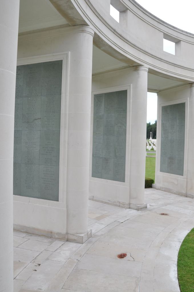
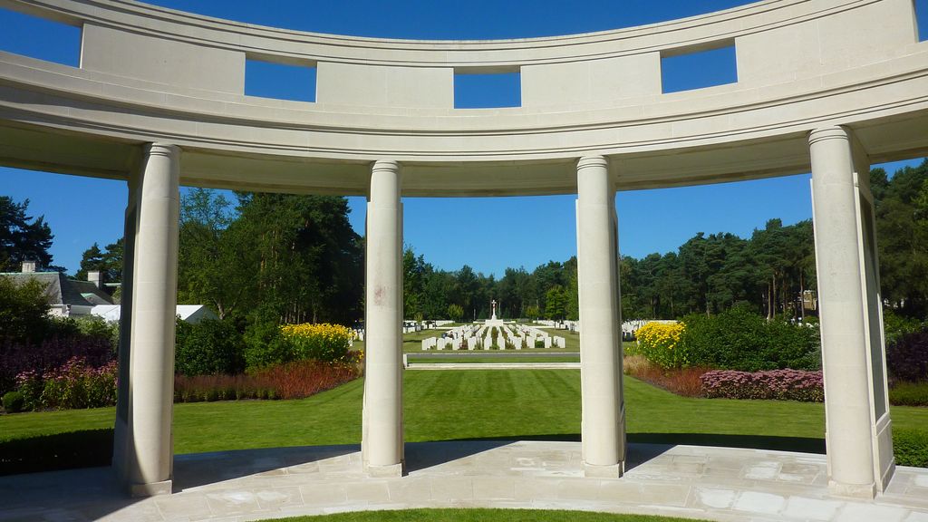
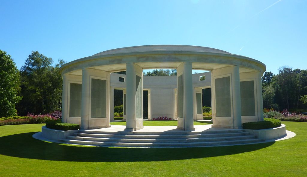
| Description | : | Brookwood Military Cemetery is part of Brookwood Cemetery, also known as the London Necropolis, which was established in 1852. The Military Cemetery, the largest Commonwealth war cemetery in the United Kingdom, was established in 1917 to accommodate Commonwealth and United States dead of World War I, then expanded during World War II to include French, Polish, Czech, Belgian, Italian, and other nationalities who fought in Commonwealth units during the war. The Brookwood (1939-1945) Memorial commemorates nearly 3,500 men and women of the land forces of the Commonwealth who died during the Second World War and have no known... Read More |
frequently asked questions (FAQ):
-
Where is Brookwood 1939-1945 Memorial?
Brookwood 1939-1945 Memorial is located at Brookwood, Woking Borough ,Surrey ,England.
-
Brookwood 1939-1945 Memorial cemetery's updated grave count on graveviews.com?
4 memorials
-
Where are the coordinates of the Brookwood 1939-1945 Memorial?
Latitude: 51.3002815
Longitude: -0.6409460
Nearby Cemetories:
1. Brookwood 1914-1918 Memorial
Brookwood, Woking Borough, England
Coordinate: 51.3007800, -0.6403300
2. Brookwood Military Cemetery
Brookwood, Woking Borough, England
Coordinate: 51.3012619, -0.6419710
3. Brookwood American Military Cemetery
Brookwood, Woking Borough, England
Coordinate: 51.3014080, -0.6397010
4. Brookwood French Military Cemetery
Brookwood, Woking Borough, England
Coordinate: 51.3011700, -0.6384920
5. Brookwood Cemetery
Brookwood, Woking Borough, England
Coordinate: 51.3013535, -0.6297340
6. St Michael and All Angels Churchyard
Pirbright, Guildford Borough, England
Coordinate: 51.2945800, -0.6500000
7. Woking Crematorium
Woking, Woking Borough, England
Coordinate: 51.3122590, -0.6022630
8. St. John the Baptist Churchyard
Bisley, Surrey Heath Borough, England
Coordinate: 51.3273600, -0.6266370
9. St John the Baptist Churchyard
St Johns, Woking Borough, England
Coordinate: 51.3104700, -0.5929170
10. St Mary the Virgin Churchyard
Worplesdon, Guildford Borough, England
Coordinate: 51.2730100, -0.6067360
11. Deepcut Military Cemetery
Deepcut, Surrey Heath Borough, England
Coordinate: 51.3062170, -0.7049060
12. Holy Trinity Churchyard
West End, Surrey Heath Borough, England
Coordinate: 51.3434880, -0.6420670
13. St Mary the Virgin Churchyard
Horsell, Woking Borough, England
Coordinate: 51.3227460, -0.5703770
14. St. Mark's Churchyard
Pirbright, Guildford Borough, England
Coordinate: 51.2549050, -0.6812810
15. St Edward the Confessor Churchyard
Sutton Green, Woking Borough, England
Coordinate: 51.2741930, -0.5608230
16. Stoke New Cemetery
Guildford, Guildford Borough, England
Coordinate: 51.2543900, -0.5824700
17. Stoke Old Cemetery
Guildford, Guildford Borough, England
Coordinate: 51.2522600, -0.5828500
18. St Peter's Churchyard
Frimley, Surrey Heath Borough, England
Coordinate: 51.3149770, -0.7393330
19. Valley End St Saviour Churchyard
Chobham, Surrey Heath Borough, England
Coordinate: 51.3647100, -0.6317100
20. St Peter's Church
Old Woking, Woking Borough, England
Coordinate: 51.3017410, -0.5372560
21. Ash War Memorial
Ash, Guildford Borough, England
Coordinate: 51.2546746, -0.7157783
22. St Mary the Virgin Churchyard
Send, Guildford Borough, England
Coordinate: 51.2791230, -0.5408600
23. Old Woking Burial Ground
Old Woking, Woking Borough, England
Coordinate: 51.3026230, -0.5351320
24. Church of Saint Francis of Assisi
Camberley, Surrey Heath Borough, England
Coordinate: 51.3311000, -0.7350400