
| Memorials | : | 0 |
| Location | : | Nederweert, Nederweert Municipality, Netherlands |
| Coordinate | : | 51.2895400, 5.7500300 |
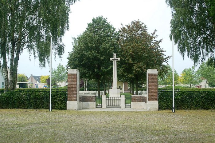
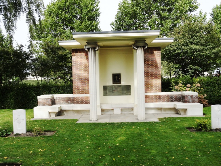
| Description | : | The village of Nederweert lies in the south of the Netherlands, approx 30kms to the south east of Eindhoven. From the A2 motorway Eindhoven to Maastricht take exit 39 (Afrit 39) N275 NEDERWEERT and follow the signs for NEDERWEERT. Continue for approx 1.5kms and turn left onto the N266 direction HELMOND. Continue for approx 1km and turn left (CWGC sign) onto MONSEIGNEUR KREYELMANSSTRAAT. The cemetery can be found after 200m on the right. Nederweert was liberated by British troops on 21st September, 1944. The front line until 14th November was close by, following the Zuidwillemsvaart and Wessem-Nederweert canals;... Read More |
frequently asked questions (FAQ):
-
Where is Nederweert War Cemetery?
Nederweert War Cemetery is located at Monseigneur Kreyelmanstraat Nederweert, Nederweert Municipality ,Limburg , 6031Netherlands.
-
Nederweert War Cemetery cemetery's updated grave count on graveviews.com?
0 memorials
-
Where are the coordinates of the Nederweert War Cemetery?
Latitude: 51.2895400
Longitude: 5.7500300
Nearby Cemetories:
1. Nederweert Saint Lambert Roman Catholic cemetery
Nederweert, Nederweert Municipality, Netherlands
Coordinate: 51.2833328, 5.7500000
2. Nederweert Saint Lambert Roman Catholic cemetery
Nederweert, Nederweert Municipality, Netherlands
Coordinate: 51.2833328, 5.7500000
3. Sint Martinus Kerkhof
Weert, Weert Municipality, Netherlands
Coordinate: 51.2544500, 5.7019900
4. Swartbroek Churchyard
Swartbroek, Weert Municipality, Netherlands
Coordinate: 51.2298200, 5.7713800
5. Tungelroij Roman Catholic Churchyard
Tungelroy, Weert Municipality, Netherlands
Coordinate: 51.2126400, 5.7309200
6. Heibloem Cemetery
Heibloem, Leudal Municipality, Netherlands
Coordinate: 51.3004231, 5.9025150
7. Stramproy Rooms-Katholieke Begraafplaats
Stramproy, Weert Municipality, Netherlands
Coordinate: 51.1915100, 5.7259200
8. Sterksel Monastery Cemetery
Sterksel, Heeze-Leende Municipality, Netherlands
Coordinate: 51.3570900, 5.6228800
9. Hunsel Roman Catholic Churchyard
Hunsel, Leudal Municipality, Netherlands
Coordinate: 51.1883600, 5.8113600
10. Budel Dorplein Roman Catholic Cemetery
Budel, Cranendonck Municipality, Netherlands
Coordinate: 51.2391600, 5.5882700
11. Molenbeersel Churchyard
Kinrooi, Arrondissement Maaseik, Belgium
Coordinate: 51.1698500, 5.7374600
12. Hamont Churchyard
Hamont-Achel, Arrondissement Maaseik, Belgium
Coordinate: 51.2518800, 5.5466300
13. Hamont Centrum Cemetery
Hamont-Achel, Arrondissement Maaseik, Belgium
Coordinate: 51.2542000, 5.5441600
14. Oud Kerkhof Hamont
Hamont, Arrondissement Maaseik, Belgium
Coordinate: 51.2534880, 5.5440170
15. Heeze Catholic Cemetery
Heeze, Heeze-Leende Municipality, Netherlands
Coordinate: 51.3777900, 5.5755100
16. Abdijkerk
Thorn, Maasgouw Municipality, Netherlands
Coordinate: 51.1606200, 5.8416700
17. Kinrooi Cemetery
Kinrooi, Arrondissement Maaseik, Belgium
Coordinate: 51.1469900, 5.7361800
18. Lozen Cemetery
Bocholt, Arrondissement Maaseik, Belgium
Coordinate: 51.2034200, 5.5623700
19. Kessenich Churchyard
Kinrooi, Arrondissement Maaseik, Belgium
Coordinate: 51.1509000, 5.8249600
20. Panningen cemetery
Panningen, Peel en Maas Municipality, Netherlands
Coordinate: 51.3291100, 5.9756400
21. Wessem Begraafplaats
Wessem, Maasgouw Municipality, Netherlands
Coordinate: 51.1588700, 5.8777600
22. Medarduskerkhof
Wessem, Maasgouw Municipality, Netherlands
Coordinate: 51.1579900, 5.8789900
23. Buggenum Roman Catholic Cemetery
Buggenum, Leudal Municipality, Netherlands
Coordinate: 51.2317500, 5.9816200
24. Helden Begraafplaats
Helden, Peel en Maas Municipality, Netherlands
Coordinate: 51.3177900, 6.0008200