
| Memorials | : | 2 |
| Location | : | Arabia, Lawrence County, USA |
| Coordinate | : | 38.6377983, -82.5061035 |
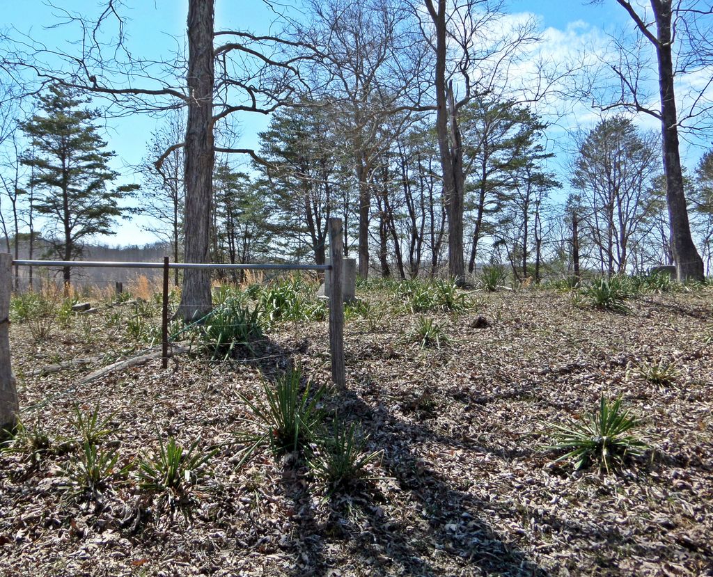
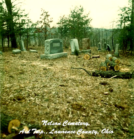
| Description | : | The cemetery is located about 500 feet west of Elkins Creek Road (County Road 5) about 750 feet north of its intersection with Symmes Creek Road (County Road 8). The cemetery is 0.5 acres in size. The cemetery is located in Aid Township, Lawrence County, Ohio, and is # 6380 (Nelson Cemetery / Simmons Cemetery) in “Ohio Cemeteries 1803-2003”, compiled by the Ohio Genealogical Society. The U.S. Geological Survey (USGS) Geographic Names Information System (GNIS) feature ID for the cemetery is 1698958 (Nelson Cemetery). |
frequently asked questions (FAQ):
-
Where is Nelson Cemetery?
Nelson Cemetery is located at Elkins Creek Road (County Road 5) Arabia, Lawrence County ,Ohio , 45659USA.
-
Nelson Cemetery cemetery's updated grave count on graveviews.com?
0 memorials
-
Where are the coordinates of the Nelson Cemetery?
Latitude: 38.6377983
Longitude: -82.5061035
Nearby Cemetories:
1. Rankin Cemetery
Aid Township, Lawrence County, USA
Coordinate: 38.6380997, -82.4918976
2. Boggs Cemetery
Aid Township, Lawrence County, USA
Coordinate: 38.6464005, -82.5261002
3. Lambert Cemetery
Aid Township, Lawrence County, USA
Coordinate: 38.6525230, -82.4913240
4. Bradshaw Cemetery #2
Arabia, Lawrence County, USA
Coordinate: 38.6550970, -82.4887380
5. Bradshaw Cemetery
Arabia, Lawrence County, USA
Coordinate: 38.6568370, -82.4854510
6. Russell Cemetery
Lawrence County, USA
Coordinate: 38.6128006, -82.5175018
7. Payton Family Cemetery
Aid Township, Lawrence County, USA
Coordinate: 38.6663500, -82.4996000
8. Aid Cemetery
Aid, Lawrence County, USA
Coordinate: 38.6086006, -82.4886017
9. Vermillion Cemetery
Arabia, Lawrence County, USA
Coordinate: 38.6677130, -82.4801330
10. Barnett Cemetery
Aid Township, Lawrence County, USA
Coordinate: 38.6278000, -82.5522003
11. Robinson Cemetery
Lawrence County, USA
Coordinate: 38.6711006, -82.5417023
12. John Neal Cemetery
Aid Township, Lawrence County, USA
Coordinate: 38.6519012, -82.5588989
13. Dennin Cemetery
Aid Township, Lawrence County, USA
Coordinate: 38.6761017, -82.5372009
14. Rucker Cemetery
Lawrence County, USA
Coordinate: 38.6427994, -82.5678024
15. Jennick Cemetery
Cannons Creek, Lawrence County, USA
Coordinate: 38.6542015, -82.5646973
16. Ferrell Cemetery
Arabia, Lawrence County, USA
Coordinate: 38.6418100, -82.5703200
17. Allen Cemetery
Mason Township, Lawrence County, USA
Coordinate: 38.6443310, -82.4417590
18. Lodge Ridge Cemetery
Kitts Hill, Lawrence County, USA
Coordinate: 38.5936012, -82.5393982
19. Slab Fork Church Cemetery
Cannons Creek, Lawrence County, USA
Coordinate: 38.6736300, -82.5621700
20. Fradd Cemetery
Lawrence County, USA
Coordinate: 38.5957985, -82.5558014
21. Wiseman Cemetery
Walnut Township, Gallia County, USA
Coordinate: 38.6875000, -82.4682999
22. Oakland Chapel Cemetery
Kitts Hill, Lawrence County, USA
Coordinate: 38.6018982, -82.5650024
23. Wiseman Cemetery
Sherritts, Lawrence County, USA
Coordinate: 38.6966600, -82.5073700
24. Sockel Cemetery
Aid, Lawrence County, USA
Coordinate: 38.5994070, -82.5674560