
| Memorials | : | 0 |
| Location | : | Dyer, Gibson County, USA |
| Coordinate | : | 36.0936200, -88.9878680 |
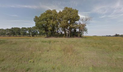
| Description | : | About two miles east of Rutherford, make a left onto Gravett Crossing. Soon the roads become unpaved and unmarked. Then make a right on Old Dyer Rutherford Rd., and very shortly make a left on Dr. Potter Rd. The cemetery will be on your left, and is on private farm property inside of a grove of trees located in the middle of a field. |
frequently asked questions (FAQ):
-
Where is Hopper Cemetery?
Hopper Cemetery is located at 83 Dr Porter Rd Dyer, Gibson County ,Tennessee ,USA.
-
Hopper Cemetery cemetery's updated grave count on graveviews.com?
0 memorials
-
Where are the coordinates of the Hopper Cemetery?
Latitude: 36.0936200
Longitude: -88.9878680
Nearby Cemetories:
1. Bobbitt Cemetery
Dyer, Gibson County, USA
Coordinate: 36.0774994, -88.9850006
2. Keas Cemetery
Dyer, Gibson County, USA
Coordinate: 36.0769005, -88.9757996
3. Apostolic Faith Tabernacle Cemetery
Dyer, Gibson County, USA
Coordinate: 36.0732460, -88.9674180
4. Taylor Family Cemetery
Rutherford, Gibson County, USA
Coordinate: 36.1049700, -89.0226300
5. Wilkes Cemetery
Rutherford, Gibson County, USA
Coordinate: 36.1097380, -89.0214500
6. Oakwood Cemetery
Dyer, Gibson County, USA
Coordinate: 36.0619011, -88.9875031
7. Rutherford Cemetery
Rutherford, Gibson County, USA
Coordinate: 36.1258011, -88.9989014
8. Mount Olive Cemetery
Dyer, Gibson County, USA
Coordinate: 36.0807991, -89.0278015
9. Crockett Memorial Plot
Rutherford, Gibson County, USA
Coordinate: 36.1299620, -88.9871980
10. Flowers - Wright Cemetery
Dyer, Gibson County, USA
Coordinate: 36.0951100, -89.0348700
11. Flowers Chapel Cemetery
Rutherford, Gibson County, USA
Coordinate: 36.1198820, -89.0265080
12. New Bethlehem Baptist Church Cemetery
Dyer, Gibson County, USA
Coordinate: 36.0715180, -88.9448400
13. New Bethlehem Memorial Cemetery
Dyer, Gibson County, USA
Coordinate: 36.0689090, -88.9452540
14. Old Bluff Cemetery
Rutherford, Gibson County, USA
Coordinate: 36.1417870, -88.9751880
15. Poplar Grove Cemetery
Dyer, Gibson County, USA
Coordinate: 36.0574989, -88.9389038
16. Thompson Cemetery
Rutherford, Gibson County, USA
Coordinate: 36.1047220, -89.0553430
17. Carroll Cemetery
Rutherford, Gibson County, USA
Coordinate: 36.1453900, -89.0140800
18. Salem Cemetery
Rutherford, Gibson County, USA
Coordinate: 36.1217003, -88.9266968
19. Crenshaw-Wyatt Cemetery
Dyer, Gibson County, USA
Coordinate: 36.0778090, -89.0589010
20. Bucksnort Cemetery
Gibson County, USA
Coordinate: 36.0318985, -88.9888992
21. Clear Creek Cemetery
Currie, Gibson County, USA
Coordinate: 36.0400009, -89.0299988
22. Liberty Grove Cemetery
Rutherford, Gibson County, USA
Coordinate: 36.1439760, -89.0371100
23. Good Hope Cemetery
Dyer, Gibson County, USA
Coordinate: 36.0477982, -89.0438995
24. Griers Chapel Cemetery
Gibson County, USA
Coordinate: 36.0317001, -88.9617004