| Memorials | : | 1 |
| Location | : | Parsons, Tucker County, USA |
| Coordinate | : | 39.1591000, -79.7961000 |
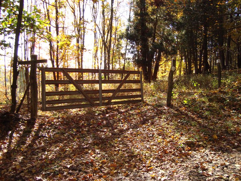
| Description | : | This cemetery is located in the Clover District, Colebank, on Road 17/6 Directions: West of St. George on WV Rt. 38 to Rt 15/3. Then west on 15/3 to 17/6 to the local property. Cemetery is on the left side of the road(17/6). It sits in the woods and is overgrown, it was fenced at one time and there are still some parts of the wire fence visible. There are some graves marked with creek rock and no writing on them and also some unmarked graves. |
frequently asked questions (FAQ):
-
Where is New Hope Cemetery?
New Hope Cemetery is located at Parsons, Tucker County ,West Virginia ,USA.
-
New Hope Cemetery cemetery's updated grave count on graveviews.com?
1 memorials
-
Where are the coordinates of the New Hope Cemetery?
Latitude: 39.1591000
Longitude: -79.7961000
Nearby Cemetories:
1. Sugargrove Church Cemetery
Tucker County, USA
Coordinate: 39.1759100, -79.7878300
2. Pifer Mountain Cemetery
Saint George, Tucker County, USA
Coordinate: 39.1853981, -79.7697983
3. Mount Pleasant Cemetery
Saint George, Tucker County, USA
Coordinate: 39.1197590, -79.7947820
4. Harsh Cemetery
Saint George, Tucker County, USA
Coordinate: 39.1197290, -79.7946770
5. Union Chapel Cemetery
Tucker County, USA
Coordinate: 39.1226040, -79.7756230
6. Mount Zion Church of The Brethren Cemetery
Meadowville, Barbour County, USA
Coordinate: 39.1720670, -79.8625520
7. Mount Zion Cemetery
Saint George, Tucker County, USA
Coordinate: 39.1300583, -79.7348175
8. Nestor Cemetery
Saint George, Tucker County, USA
Coordinate: 39.2066330, -79.7427500
9. Mount Castle Cemetery
Valley Furnace, Barbour County, USA
Coordinate: 39.2019870, -79.8629650
10. Shiloh Cemetery
Kasson, Barbour County, USA
Coordinate: 39.2172012, -79.8510971
11. New Hope Cemetery
Valley Furnace, Barbour County, USA
Coordinate: 39.1966040, -79.8787540
12. Mount Zion Mill Run Cemetery
Barbour County, USA
Coordinate: 39.1297120, -79.8924010
13. Macedonia Cemetery
Saint George, Tucker County, USA
Coordinate: 39.2226330, -79.7254910
14. Campbell Cemetery
Nestorville, Barbour County, USA
Coordinate: 39.2059960, -79.8860070
15. Old Dutch Cemetery
Nestorville, Barbour County, USA
Coordinate: 39.2069540, -79.8893020
16. Old White Oak Cemetery
Barbour County, USA
Coordinate: 39.1494010, -79.9108110
17. Bethel Cemetery
Holly Meadows, Tucker County, USA
Coordinate: 39.1363983, -79.6841965
18. Nestorville Cemetery
Barbour County, USA
Coordinate: 39.1865020, -79.9111950
19. White Oak Cemetery
Barbour County, USA
Coordinate: 39.1454760, -79.9152490
20. Armstrong Cemetery
Barbour County, USA
Coordinate: 39.2378807, -79.8649673
21. Primitive Baptist Church Cemetery
Montrose, Randolph County, USA
Coordinate: 39.0646330, -79.8187350
22. Central Chapel United Methodist Church Cemetery
Belington, Barbour County, USA
Coordinate: 39.1321300, -79.9160800
23. Tucker County Poor Farm Cemetery
Holly Meadows, Tucker County, USA
Coordinate: 39.1485980, -79.6655360
24. Little Bethel Church Cemetery
Meadowville, Barbour County, USA
Coordinate: 39.1146230, -79.9179040

