
| Memorials | : | 0 |
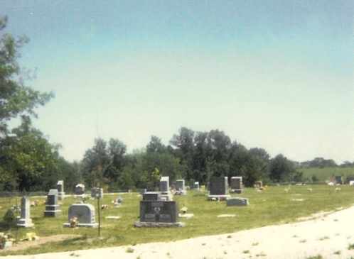
| Location | : | The Landing, Ralls County, USA |
| Coordinate | : | 39.5660200, -91.6651200 |
| Description | : | Directions from Monroe City, Missouri-- From Monroe City, go (east) about 3.2 mi. on US-24 E/US-36E. Turn right (south) onto State Hwy J and go about 7.8 mi. Turn right (west) onto Landing Lane and go about 1 mi. Turn right (north) onto Oakland Road and go about .25 mi. Cemetery is on the right. Saline Township, 55N-7W. Some graves from the Old Oakland Cemetery were moved to this cemetery by the US Army Corps of Engineers when the Clarence Canyon Dam was built. |
frequently asked questions (FAQ):
-
Where is New Oakland Cemetery?
New Oakland Cemetery is located at The Landing, Ralls County ,Missouri ,USA.
-
New Oakland Cemetery cemetery's updated grave count on graveviews.com?
0 memorials
-
Where are the coordinates of the New Oakland Cemetery?
Latitude: 39.5660200
Longitude: -91.6651200
Nearby Cemetories:
1. Yager Cemetery
The Landing, Ralls County, USA
Coordinate: 39.5600640, -91.6719080
2. Bethlehem Cemetery
Ralls County, USA
Coordinate: 39.6069400, -91.6733300
3. DeMoss Chapel Cemetery
Hassard, Ralls County, USA
Coordinate: 39.6044846, -91.6873856
4. Ariel Cemetery
Ralls County, USA
Coordinate: 39.5783200, -91.6091100
5. Utterback Cemetery
Ralls County, USA
Coordinate: 39.5080986, -91.6917038
6. Pleasant Grove Cemetery
Ralls County, USA
Coordinate: 39.5057500, -91.6298300
7. Greathouse Cemetery
Ralls County, USA
Coordinate: 39.6142006, -91.5991974
8. Brush Creek Cemetery
Ralls County, USA
Coordinate: 39.6197650, -91.6040461
9. Saint Paul Cemetery
Center, Ralls County, USA
Coordinate: 39.5026300, -91.6056200
10. Norton Cemetery
Ralls County, USA
Coordinate: 39.5772018, -91.5639038
11. Crigler Cemetery
Florida, Monroe County, USA
Coordinate: 39.5121994, -91.7497025
12. Saint Stephens Catholic Cemetery
Indian Creek, Monroe County, USA
Coordinate: 39.5925800, -91.7762400
13. Green Lawn Cemetery
Ralls County, USA
Coordinate: 39.4778100, -91.6861000
14. Scobee Cemetery
Ralls County, USA
Coordinate: 39.4688988, -91.7136002
15. Holy Rosary Cemetery
Monroe City, Monroe County, USA
Coordinate: 39.6528000, -91.7450000
16. Saint Jude Cemetery
Monroe City, Monroe County, USA
Coordinate: 39.6528015, -91.7450027
17. Mount Prairie Baptist Church Cemetery
Monroe County, USA
Coordinate: 39.4667700, -91.7355100
18. Olivet Cemetery
Center, Ralls County, USA
Coordinate: 39.5250015, -91.5280991
19. Mount Prairie Presbyterian Church Cemetery
Monroe County, USA
Coordinate: 39.4558590, -91.7242400
20. Old Mount Prairie Cemetery
Monroe County, USA
Coordinate: 39.4557991, -91.7241974
21. Florida Cemetery
Florida, Monroe County, USA
Coordinate: 39.4947850, -91.7933250
22. Finley Cemetery
Ralls County, USA
Coordinate: 39.6706009, -91.5781021
23. Vardeman Cemetery
New London, Ralls County, USA
Coordinate: 39.5663830, -91.5022330
24. Foreman Cemetery
Ralls County, USA
Coordinate: 39.6422005, -91.5338974