
| Memorials | : | 7 |
| Location | : | Ralls County, USA |
| Coordinate | : | 39.6197650, -91.6040461 |
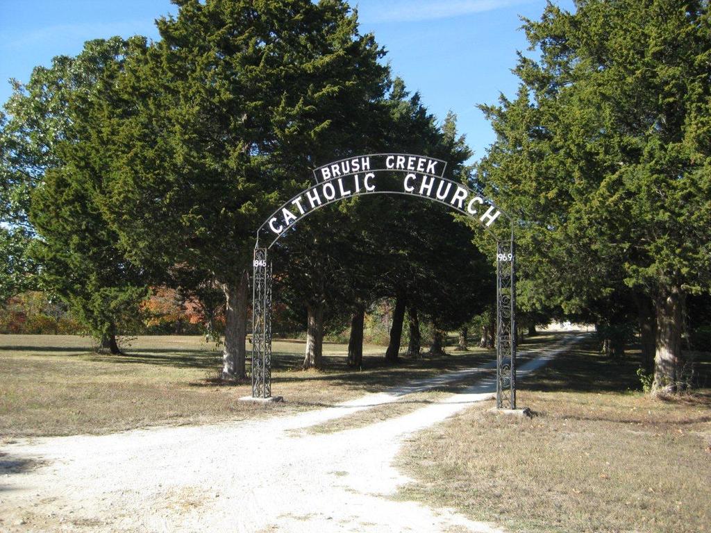
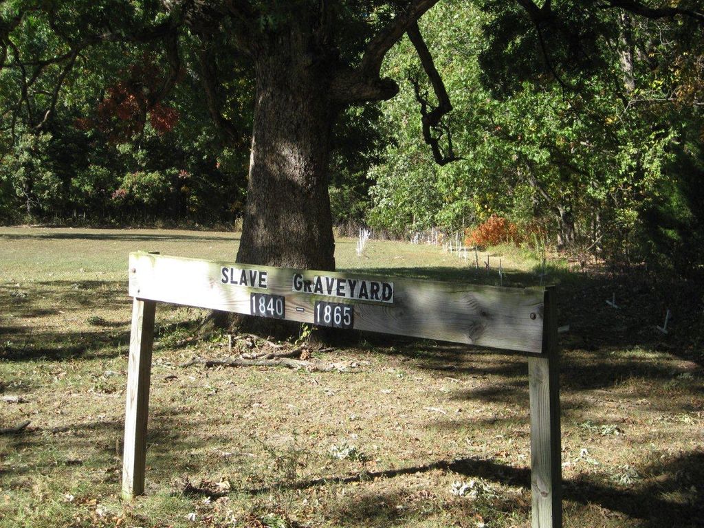
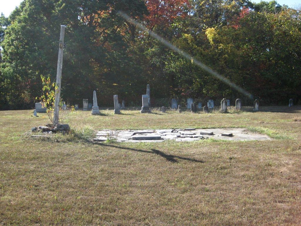
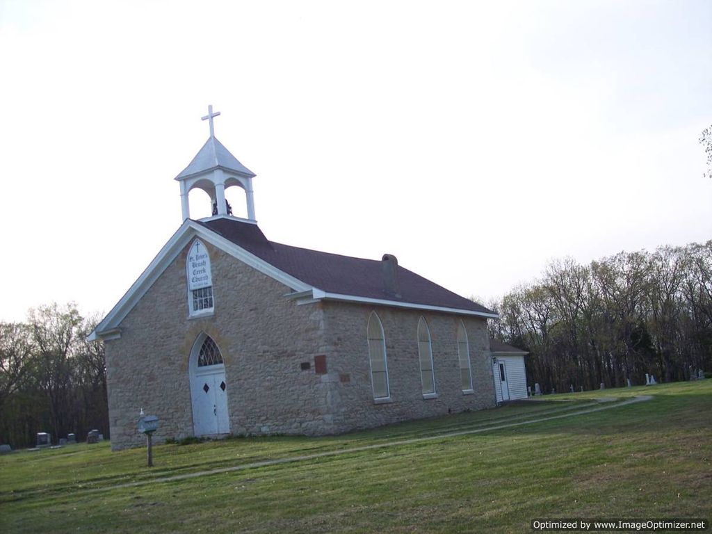
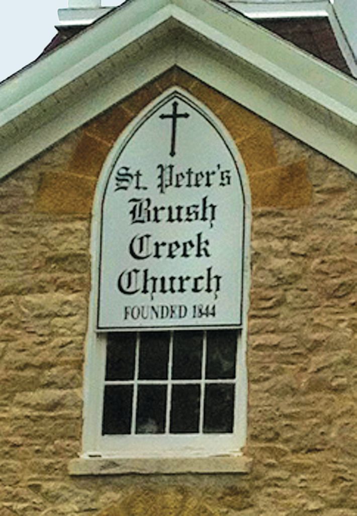
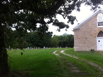
| Description | : | Brush Creek Cemetery, also known as Saint Peters Cemetery, is located halfway north to south on the eastern edge of Township 56N, Range 6W, Section 30. It is far out in the Missouri countryside on the grounds of St. Peters Catholic Church. It is well-maintained, even though St. Peters Church is no longer used for regular services. The church was founded in the 1860's by Fr. Peter Paul Lefevere, designed by Fr. Francis M. Kielty. It is a twin to St. Pauls Catholic Church near Center, MO, founded & designed by the same individuals. It was added to the National... Read More |
frequently asked questions (FAQ):
-
Where is Brush Creek Cemetery?
Brush Creek Cemetery is located at Ralls County ,Missouri ,USA.
-
Brush Creek Cemetery cemetery's updated grave count on graveviews.com?
7 memorials
-
Where are the coordinates of the Brush Creek Cemetery?
Latitude: 39.6197650
Longitude: -91.6040461

Nearby Cemetories:
1. Greathouse Cemetery
Ralls County, USA
Coordinate: 39.6142006, -91.5991974
2. Ariel Cemetery
Ralls County, USA
Coordinate: 39.5783200, -91.6091100
3. Norton Cemetery
Ralls County, USA
Coordinate: 39.5772018, -91.5639038
4. Finley Cemetery
Ralls County, USA
Coordinate: 39.6706009, -91.5781021
5. Bethlehem Cemetery
Ralls County, USA
Coordinate: 39.6069400, -91.6733300
6. Foreman Cemetery
Ralls County, USA
Coordinate: 39.6422005, -91.5338974
7. Salt Lick Cemetery
Spalding, Ralls County, USA
Coordinate: 39.6263500, -91.5192700
8. DeMoss Chapel Cemetery
Hassard, Ralls County, USA
Coordinate: 39.6044846, -91.6873856
9. Big Creek Cemetery
Rensselaer, Ralls County, USA
Coordinate: 39.6669006, -91.5382996
10. New Oakland Cemetery
The Landing, Ralls County, USA
Coordinate: 39.5660200, -91.6651200
11. Yager Cemetery
The Landing, Ralls County, USA
Coordinate: 39.5600640, -91.6719080
12. West Ely Presbyterian Cemetery
West Ely, Marion County, USA
Coordinate: 39.7068860, -91.5618500
13. Flowerree Cemetery
Ralls County, USA
Coordinate: 39.5732994, -91.4981003
14. Vardeman Cemetery
New London, Ralls County, USA
Coordinate: 39.5663830, -91.5022330
15. West Ely Cemetery
West Ely, Marion County, USA
Coordinate: 39.7106018, -91.5655975
16. Bethel Baptist Church Cemetery
New London, Ralls County, USA
Coordinate: 39.5680000, -91.4830000
17. Bethel Cemetery
Ralls County, USA
Coordinate: 39.5682983, -91.4824982
18. Olivet Cemetery
Center, Ralls County, USA
Coordinate: 39.5250015, -91.5280991
19. Holy Rosary Cemetery
Monroe City, Monroe County, USA
Coordinate: 39.6528000, -91.7450000
20. Saint Jude Cemetery
Monroe City, Monroe County, USA
Coordinate: 39.6528015, -91.7450027
21. Pleasant Grove Cemetery
Ralls County, USA
Coordinate: 39.5057500, -91.6298300
22. Hydesburg Methodist Episcopal Church Cemetery
Spalding, Ralls County, USA
Coordinate: 39.6710014, -91.4680023
23. Saint Paul Cemetery
Center, Ralls County, USA
Coordinate: 39.5026300, -91.6056200
24. Shannon Cemetery
Woodland, Marion County, USA
Coordinate: 39.7375500, -91.6301000