
| Memorials | : | 0 |
| Location | : | The Landing, Ralls County, USA |
| Coordinate | : | 39.5600640, -91.6719080 |
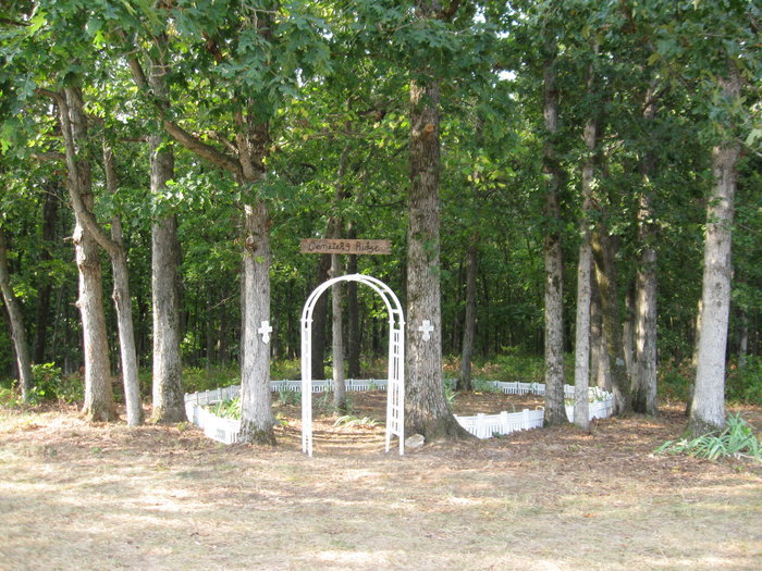
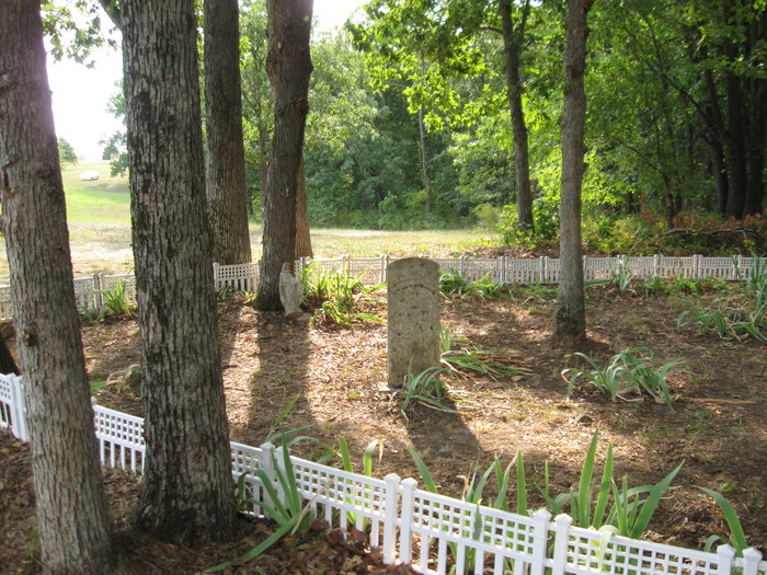
| Description | : | Yager Cemetery was a family burial place. It is located about 1/4 mile west of Oakland Road on private property. As shown by the photos it is very well maintained by the current owners. It contains one monument with names (Hurt & Lucinda Yager) and 4 or 5 field stones. It cannot be confirmed but it is believed that two of the field stones mark the graves of Lucinda Yager's parents, namely Joel Finks I (03/28/1781 - 03/05/1870) & his wife Frances "Wilhite" Finks (dates unknown but believed to have been born around 1783). They... Read More |
frequently asked questions (FAQ):
-
Where is Yager Cemetery?
Yager Cemetery is located at Oakland Road The Landing, Ralls County ,Missouri , 63456USA.
-
Yager Cemetery cemetery's updated grave count on graveviews.com?
0 memorials
-
Where are the coordinates of the Yager Cemetery?
Latitude: 39.5600640
Longitude: -91.6719080
Nearby Cemetories:
1. New Oakland Cemetery
The Landing, Ralls County, USA
Coordinate: 39.5660200, -91.6651200
2. DeMoss Chapel Cemetery
Hassard, Ralls County, USA
Coordinate: 39.6044846, -91.6873856
3. Bethlehem Cemetery
Ralls County, USA
Coordinate: 39.6069400, -91.6733300
4. Ariel Cemetery
Ralls County, USA
Coordinate: 39.5783200, -91.6091100
5. Utterback Cemetery
Ralls County, USA
Coordinate: 39.5080986, -91.6917038
6. Pleasant Grove Cemetery
Ralls County, USA
Coordinate: 39.5057500, -91.6298300
7. Crigler Cemetery
Florida, Monroe County, USA
Coordinate: 39.5121994, -91.7497025
8. Saint Paul Cemetery
Center, Ralls County, USA
Coordinate: 39.5026300, -91.6056200
9. Greathouse Cemetery
Ralls County, USA
Coordinate: 39.6142006, -91.5991974
10. Brush Creek Cemetery
Ralls County, USA
Coordinate: 39.6197650, -91.6040461
11. Green Lawn Cemetery
Ralls County, USA
Coordinate: 39.4778100, -91.6861000
12. Norton Cemetery
Ralls County, USA
Coordinate: 39.5772018, -91.5639038
13. Saint Stephens Catholic Cemetery
Indian Creek, Monroe County, USA
Coordinate: 39.5925800, -91.7762400
14. Scobee Cemetery
Ralls County, USA
Coordinate: 39.4688988, -91.7136002
15. Mount Prairie Baptist Church Cemetery
Monroe County, USA
Coordinate: 39.4667700, -91.7355100
16. Holy Rosary Cemetery
Monroe City, Monroe County, USA
Coordinate: 39.6528000, -91.7450000
17. Saint Jude Cemetery
Monroe City, Monroe County, USA
Coordinate: 39.6528015, -91.7450027
18. Mount Prairie Presbyterian Church Cemetery
Monroe County, USA
Coordinate: 39.4558590, -91.7242400
19. Old Mount Prairie Cemetery
Monroe County, USA
Coordinate: 39.4557991, -91.7241974
20. Florida Cemetery
Florida, Monroe County, USA
Coordinate: 39.4947850, -91.7933250
21. Olivet Cemetery
Center, Ralls County, USA
Coordinate: 39.5250015, -91.5280991
22. Wolfe Cemetery
Perry, Ralls County, USA
Coordinate: 39.4392014, -91.6714020
23. Vardeman Cemetery
New London, Ralls County, USA
Coordinate: 39.5663830, -91.5022330
24. Finley Cemetery
Ralls County, USA
Coordinate: 39.6706009, -91.5781021