
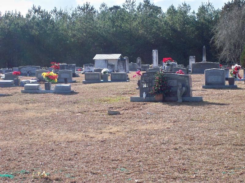
| Memorials | : | 1 |
| Location | : | Smith County, USA |
| Coordinate | : | 31.8099500, -89.6168700 |
| Description | : | From Mize, MS proceed South on Mississippi Highway 35 (MS 35 aka Oak Street) 4.3 miles to the intersection of Smith County Road 57 (SCR 57.) Turn Right (West) onto SCR 57 and continue 1.4 miles to the intersection of Smith County Road 51 (SCR 51.) Turn Left (Southwest) onto SCR 51 and continue seven tenths of a mile. Cemetery will be on the Right (West) side of road, specifically NW1/4 NW1/4, S28, T10N-R16W, Smith, Mize Quadrangle map USNG 16R BA 52275 22353. |
frequently asked questions (FAQ):
-
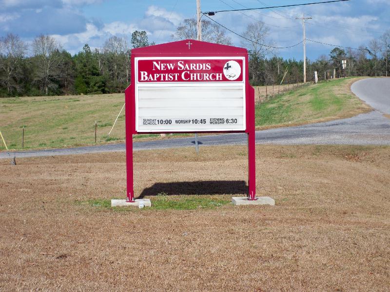
Where is New Sardis Baptist Church Cemetery?
New Sardis Baptist Church Cemetery is located at 682 Smith County Road 51 Smith County ,Mississippi , 39119USA.
-
New Sardis Baptist Church Cemetery cemetery's updated grave count on graveviews.com?
1 memorials
-
Where are the coordinates of the New Sardis Baptist Church Cemetery?
Latitude: 31.8099500
Longitude: -89.6168700
Nearby Cemetories:
1. Eubanks Cemetery
Mize, Smith County, USA
Coordinate: 31.8002663, -89.6283493
2. Tom Sullivan Cemetery
Mize, Smith County, USA
Coordinate: 31.7999992, -89.6294022
3. Maranatha Baptist Cemetery
Mize, Smith County, USA
Coordinate: 31.8102880, -89.5921820
4. Pleasant Hill Landmark Missionary Baptist Church C
Mount Olive, Covington County, USA
Coordinate: 31.7834200, -89.6106100
5. Calvary Baptist Church Cemetery
Saratoga, Simpson County, USA
Coordinate: 31.8050300, -89.6584300
6. Old McNair Cemetery
Simpson County, USA
Coordinate: 31.7918990, -89.6626240
7. Oak Grove Baptist Church Cemetery
Mize, Smith County, USA
Coordinate: 31.7933100, -89.5686700
8. Calvary Cemetery
Mize, Smith County, USA
Coordinate: 31.8526400, -89.6007700
9. Thomas F Sullivans Cemetery
Mize, Smith County, USA
Coordinate: 31.8335200, -89.5696100
10. Concord Baptist Church Cemetery
Mize, Smith County, USA
Coordinate: 31.8529190, -89.6421933
11. Zion Hill Missionary Baptist Church Cemetery
Mize, Smith County, USA
Coordinate: 31.8359394, -89.5683136
12. Byrd Cemetery
Mize, Smith County, USA
Coordinate: 31.8500920, -89.5831400
13. Alex Sullivan Cemetery
Mize, Smith County, USA
Coordinate: 31.8249400, -89.5608000
14. Ware Cemetery
Mize, Smith County, USA
Coordinate: 31.8583700, -89.6370300
15. Rutland Cemetery
Covington County, USA
Coordinate: 31.7611008, -89.5916977
16. Maranatha Baptist Church Cemetery
Mount Olive, Covington County, USA
Coordinate: 31.7611103, -89.6549988
17. Pleasant Hills Mennonite Cemetery
Mize, Smith County, USA
Coordinate: 31.8613850, -89.5787720
18. Old Zion Hill Cemetery
Mize, Smith County, USA
Coordinate: 31.7999900, -89.5438700
19. Shiloh Cemetery
Smith, Covington County, USA
Coordinate: 31.7556000, -89.5792007
20. Mount Olive City Cemetery
Mount Olive, Covington County, USA
Coordinate: 31.7644005, -89.6686020
21. Grace Fellowship Baptist Church Cemetery
Mount Olive, Covington County, USA
Coordinate: 31.7678000, -89.6783580
22. Ed Sullivan Cemetery
Mize, Smith County, USA
Coordinate: 31.8439500, -89.5484300
23. Mount Moriah Church Cemetery
Magee, Simpson County, USA
Coordinate: 31.8204100, -89.6952000
24. Galilee Missionary Baptist Church Cemetery
Mount Olive, Covington County, USA
Coordinate: 31.7598360, -89.6705230