
| Memorials | : | 0 |
| Location | : | Mize, Smith County, USA |
| Coordinate | : | 31.7999900, -89.5438700 |
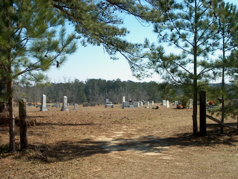
| Description | : | From Mize, MS proceed South on Mississippi Highway 35 (MS 35 aka Oak Street) 4 miles to the intersection of Smith County Road 45 (SCR 45) and turn Left (South.) Continue on SCR 45 two tenths of a mile to the intersection of Smith County Road 20 (SCR 20.) Turn Left (East) onto SCR 20 and continue 3 miles, cemetery will be on Right (East) side of road, specifically SW1/4 SE1/4, S30, T10N-R15W, Smith, Mize Quadrangle map, USNG 16R BA 59140 21092. |
frequently asked questions (FAQ):
-
Where is Old Zion Hill Cemetery?
Old Zion Hill Cemetery is located at Smith County Road 20 Mize, Smith County ,Mississippi , 39116USA.
-
Old Zion Hill Cemetery cemetery's updated grave count on graveviews.com?
0 memorials
-
Where are the coordinates of the Old Zion Hill Cemetery?
Latitude: 31.7999900
Longitude: -89.5438700
Nearby Cemetories:
1. Oak Grove Baptist Church Cemetery
Mize, Smith County, USA
Coordinate: 31.7933100, -89.5686700
2. Alex Sullivan Cemetery
Mize, Smith County, USA
Coordinate: 31.8249400, -89.5608000
3. New Liberty Landmark Baptist Church Cemetery
Smith County, USA
Coordinate: 31.7903500, -89.5116800
4. Old Miller Cemetery
Taylorsville, Smith County, USA
Coordinate: 31.8005409, -89.5008545
5. Thomas F Sullivans Cemetery
Mize, Smith County, USA
Coordinate: 31.8335200, -89.5696100
6. Zion Hill Missionary Baptist Church Cemetery
Mize, Smith County, USA
Coordinate: 31.8359394, -89.5683136
7. Maranatha Baptist Cemetery
Mize, Smith County, USA
Coordinate: 31.8102880, -89.5921820
8. Lilly Valley Missionary Baptist Church Cemetery
Mount Olive, Covington County, USA
Coordinate: 31.7687740, -89.5074290
9. Ed Sullivan Cemetery
Mize, Smith County, USA
Coordinate: 31.8439500, -89.5484300
10. Jesus Name Holy Hill
Mount Olive, Covington County, USA
Coordinate: 31.7541850, -89.5531740
11. Berkhalter Cemetery
Covington County, USA
Coordinate: 31.7558002, -89.5263977
12. Apostolic Church of Jesus Christ Cemetery
Mount Olive, Covington County, USA
Coordinate: 31.7518860, -89.5450100
13. Shiloh Cemetery
Smith, Covington County, USA
Coordinate: 31.7556000, -89.5792007
14. Rutland Cemetery
Covington County, USA
Coordinate: 31.7611008, -89.5916977
15. Mize Cemetery
Mize, Smith County, USA
Coordinate: 31.8576794, -89.5548096
16. Pleasant Hill Landmark Missionary Baptist Church C
Mount Olive, Covington County, USA
Coordinate: 31.7834200, -89.6106100
17. Providence Baptist Church Cemetery
Mize, Smith County, USA
Coordinate: 31.8536400, -89.5126400
18. Byrd Cemetery
Mize, Smith County, USA
Coordinate: 31.8500920, -89.5831400
19. Okahay Cemetery
Collins, Covington County, USA
Coordinate: 31.7682300, -89.4818100
20. New Sardis Baptist Church Cemetery
Smith County, USA
Coordinate: 31.8099500, -89.6168700
21. Blakely Creek Baptist Church Cemetery
Covington County, USA
Coordinate: 31.7355995, -89.5671997
22. Pleasant Hills Mennonite Cemetery
Mize, Smith County, USA
Coordinate: 31.8613850, -89.5787720
23. Corleys Cemetery
Gilmore, Covington County, USA
Coordinate: 31.7659760, -89.4706802
24. Calvary Cemetery
Mize, Smith County, USA
Coordinate: 31.8526400, -89.6007700