
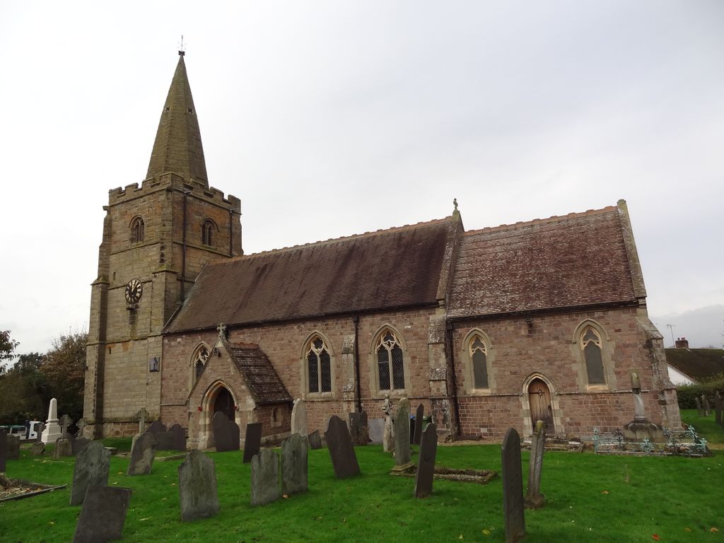
| Memorials | : | 29 |
| Location | : | Leire, Harborough District, England |
| Coordinate | : | 52.5053690, -1.2266430 |
frequently asked questions (FAQ):
-
Where is St Peters Churchyard?
St Peters Churchyard is located at Leire, Harborough District ,Leicestershire ,England.
-
St Peters Churchyard cemetery's updated grave count on graveviews.com?
1 memorials
-
Where are the coordinates of the St Peters Churchyard?
Latitude: 52.5053690
Longitude: -1.2266430
Nearby Cemetories:
1. St Peter Churchyard
Ashby Parva, Harborough District, England
Coordinate: 52.4930340, -1.2272720
2. Church of All Saints
Dunton Bassett, Harborough District, England
Coordinate: 52.5091000, -1.1946000
3. Broughton Astley Cemetery
Broughton Astley, Harborough District, England
Coordinate: 52.5259830, -1.2325190
4. Saint Nicholas Churchyard
Frolesworth, Harborough District, England
Coordinate: 52.5112740, -1.2599970
5. St Marys Parish Churchyard
Broughton Astley, Harborough District, England
Coordinate: 52.5287810, -1.2253600
6. St. Peter's Churchyard
Claybrooke Parva, Harborough District, England
Coordinate: 52.4868640, -1.2708550
7. Sutton Elms Baptist Chapelyard
Broughton Astley, Harborough District, England
Coordinate: 52.5389370, -1.2328020
8. Claybrooke Cemetery
Claybrooke Parva, Harborough District, England
Coordinate: 52.4862230, -1.2724990
9. St Mary Churchyard
Bitteswell, Harborough District, England
Coordinate: 52.4679220, -1.2105000
10. St Helen
Sharnford, Blaby District, England
Coordinate: 52.5228440, -1.2886350
11. All Saints
Sapcote, Blaby District, England
Coordinate: 52.5344520, -1.2810440
12. All Saints Churchyard
Gilmorton, Harborough District, England
Coordinate: 52.4855900, -1.1604900
13. Sapcote Cemetery
Sapcote, Blaby District, England
Coordinate: 52.5336420, -1.2842020
14. St Michael and All Angels Churchyard
Cosby, Blaby District, England
Coordinate: 52.5488260, -1.1933700
15. St Mary's Churchyard
Willoughby Waterleys, Harborough District, England
Coordinate: 52.5270920, -1.1532770
16. Saint Mary's Churchyard
Lutterworth, Harborough District, England
Coordinate: 52.4554750, -1.2023830
17. St Leonard's churchyard
Willey, Rugby Borough, England
Coordinate: 52.4589200, -1.2705800
18. Cosby Cemetery
Cosby, Blaby District, England
Coordinate: 52.5560490, -1.1962970
19. St Michael's Churchyard
Stoney Stanton, Blaby District, England
Coordinate: 52.5487420, -1.2794980
20. Nock Verges Cemetery
Stoney Stanton, Blaby District, England
Coordinate: 52.5492300, -1.2807020
21. St Michael & All Angels
Croft, Blaby District, England
Coordinate: 52.5593821, -1.2484472
22. St Leonard Churchyard
Misterton, Harborough District, England
Coordinate: 52.4510630, -1.1818140
23. St Peter's Church
Aston Flamville, Blaby District, England
Coordinate: 52.5307260, -1.3187510
24. All Saints Churchyard
Kimcote, Harborough District, England
Coordinate: 52.4736330, -1.1390390