
| Memorials | : | 123 |
| Location | : | Chesterville, Morrow County, USA |
| Coordinate | : | 40.5443800, -82.6475200 |
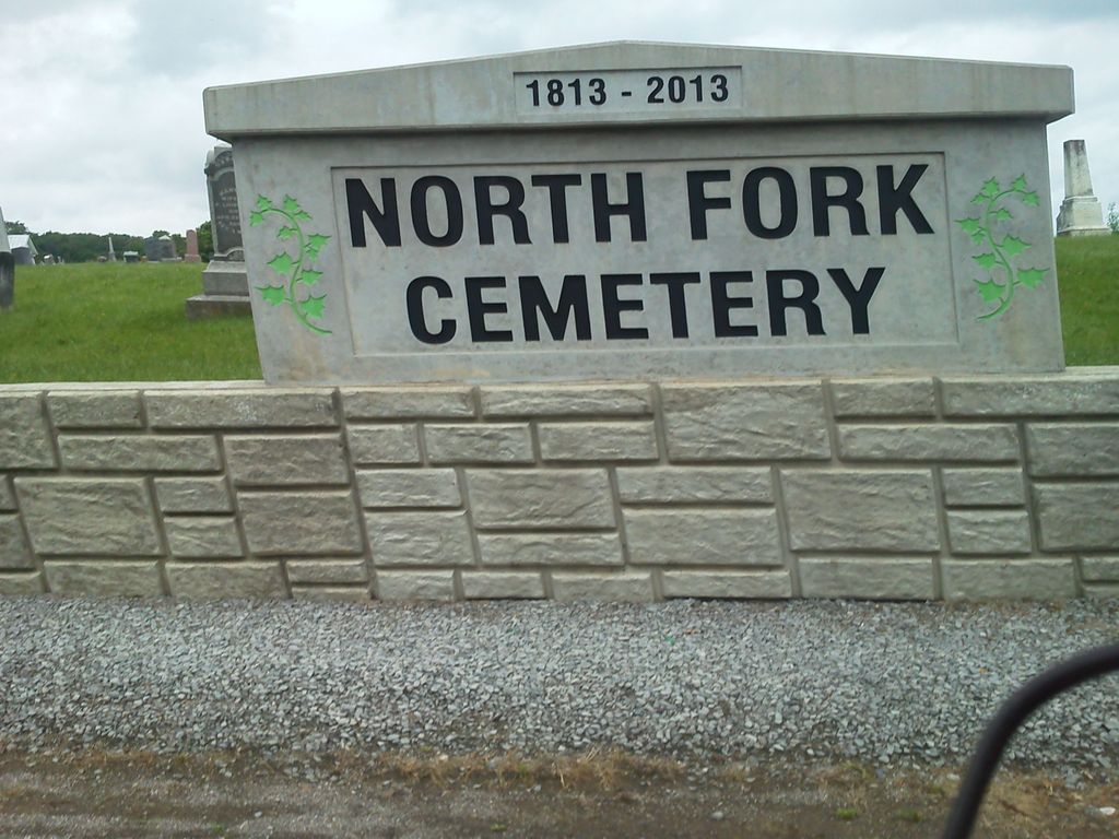
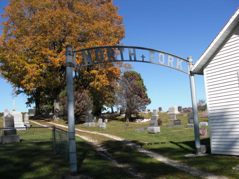
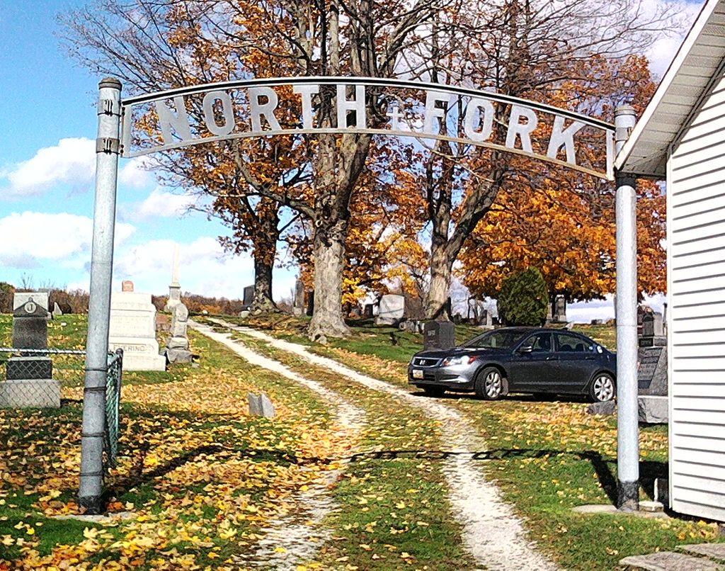
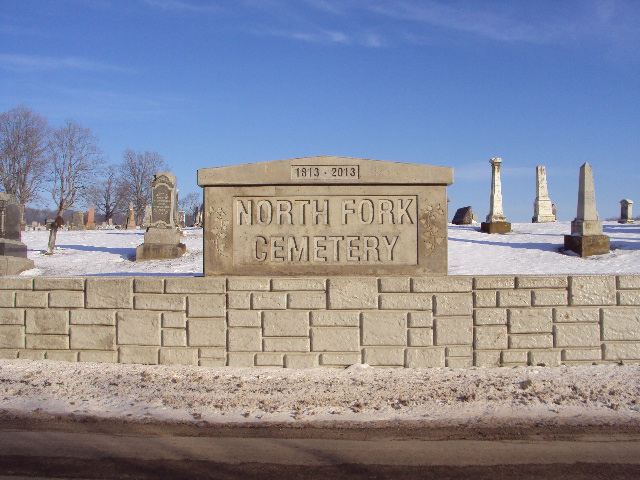
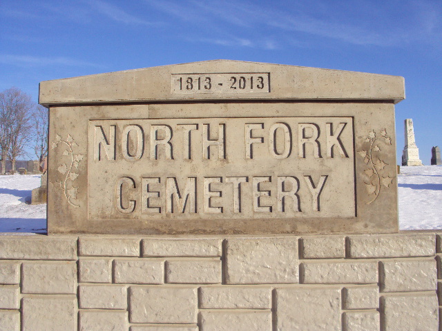
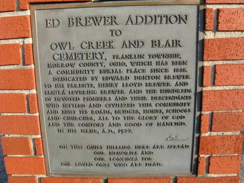
| Description | : | The cemetery is located on the north side of Mt Vernon-Tiffin Road (County Road 22) about 1300 feet west of its intersection with Morrow Road (County Road 80) and 2500 feet east of I-71. The cemetery is 5.09 acres in size and extends over the county line into Knox County. The cemetery is located in Franklin Township, Morrow County, Ohio, and is # 8642 (Owl Creek Cemetery) in “Ohio Cemeteries 1803-2003”, compiled by the Ohio Genealogical Society. The U.S. Geological Survey (USGS) Geographic Names Information System (GNIS) feature ID for the cemetery is 1963219 (Owl Creek Cemetery). |
frequently asked questions (FAQ):
-
Where is North Fork Cemetery?
North Fork Cemetery is located at 7416 Mount Vernon-Tiffin Road (County Road 22) Chesterville, Morrow County ,Ohio , 43019USA.
-
North Fork Cemetery cemetery's updated grave count on graveviews.com?
122 memorials
-
Where are the coordinates of the North Fork Cemetery?
Latitude: 40.5443800
Longitude: -82.6475200
Nearby Cemetories:
1. Levering Cemetery
Waterford, Knox County, USA
Coordinate: 40.5479460, -82.6196770
2. Yankee Street Presbyterian Cemetery
Chesterville, Morrow County, USA
Coordinate: 40.5192270, -82.6690611
3. Singrey Cemetery
Morrow County, USA
Coordinate: 40.5730200, -82.6287500
4. Franks Cemetery
Mount Gilead, Morrow County, USA
Coordinate: 40.5794710, -82.6631770
5. Strong Cemetery
Knox County, USA
Coordinate: 40.5155983, -82.6113968
6. Center Corners Cemetery
Chesterville, Morrow County, USA
Coordinate: 40.5030000, -82.6725600
7. Ruhl Cemetery
Fredericktown, Knox County, USA
Coordinate: 40.5167270, -82.5968350
8. Pulaskiville Cemetery
Pulaskiville, Morrow County, USA
Coordinate: 40.5356200, -82.7112900
9. Culp Cemetery
Perry Township, Richland County, USA
Coordinate: 40.5656013, -82.5836029
10. Perry Cemetery
Bellville, Richland County, USA
Coordinate: 40.5862060, -82.5953830
11. Bufmer Cemetery
North Woodbury, Morrow County, USA
Coordinate: 40.6010970, -82.6633520
12. Woodbury Cemetery
North Woodbury, Morrow County, USA
Coordinate: 40.6011800, -82.6629440
13. Old Center Cemetery
Darlington, Richland County, USA
Coordinate: 40.6011700, -82.6240600
14. Salem Methodist Episcopal Cemetery
Fredericktown, Knox County, USA
Coordinate: 40.4842300, -82.6257300
15. Lucas Family Cemetery
Perry Township, Morrow County, USA
Coordinate: 40.6071760, -82.6427490
16. Baldwin Cemetery
Middlebury Township, Knox County, USA
Coordinate: 40.5499600, -82.5582700
17. Chesterville Methodist Episcopal Cemetery
Chesterville, Morrow County, USA
Coordinate: 40.4798000, -82.6799780
18. Chesterville Presbyterian Cemetery
Chesterville, Morrow County, USA
Coordinate: 40.4798000, -82.6799780
19. Maple Grove Cemetery
Chesterville, Morrow County, USA
Coordinate: 40.4761009, -82.6782990
20. McDaniel Cemetery
Middlebury Township, Knox County, USA
Coordinate: 40.5211517, -82.5493273
21. Pleasant Grove Cemetery
Bangorville, Richland County, USA
Coordinate: 40.6083305, -82.5866719
22. George Family Cemetery
Franklin Township, Morrow County, USA
Coordinate: 40.5164420, -82.7447810
23. Quaker Cemetery
Fredericktown, Knox County, USA
Coordinate: 40.5113000, -82.5495000
24. Wayne Baptist Cemetery
Knox County, USA
Coordinate: 40.4667358, -82.6142654