
| Memorials | : | 6 |
| Location | : | Coffee County, USA |
| Coordinate | : | 31.7616997, -82.9338989 |
frequently asked questions (FAQ):
-
Where is Oak Grove Methodist Church Cemetery?
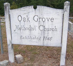
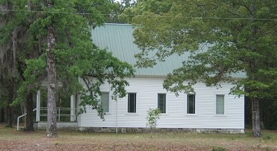
Oak Grove Methodist Church Cemetery is located at Coffee County ,Georgia ,USA.
-
Oak Grove Methodist Church Cemetery cemetery's updated grave count on graveviews.com?
6 memorials
-
Where are the coordinates of the Oak Grove Methodist Church Cemetery?
Latitude: 31.7616997
Longitude: -82.9338989
Nearby Cemetories:
1. Frier Cemetery
Jeff Davis County, USA
Coordinate: 31.7646999, -82.9163971
2. Frier Cemetery
Pridgen, Coffee County, USA
Coordinate: 31.7649000, -82.9150400
3. Rocky Creek Cemetery
Coffee County, USA
Coordinate: 31.7572002, -82.8786011
4. Benjamin Chapel Cemetery
Coffee County, USA
Coordinate: 31.7355995, -82.9819031
5. Fussell Cemetery
Coffee County, USA
Coordinate: 31.7546997, -82.9961014
6. Candacy Cato Cemetery
Coffee County, USA
Coordinate: 31.7082996, -82.9060974
7. Smith Family Cemetery
Pridgen, Coffee County, USA
Coordinate: 31.7667410, -82.8651950
8. Fusselle Cemetery
Red Bluff, Ben Hill County, USA
Coordinate: 31.7487200, -83.0021800
9. Pridgen Family Cemetery
Pridgen, Coffee County, USA
Coordinate: 31.7045100, -82.9566700
10. Pridgen Family Cemetery #1
Pridgen, Coffee County, USA
Coordinate: 31.7022200, -82.9649200
11. Pridgen Baptist Church Cemetery
Coffee County, USA
Coordinate: 31.6972008, -82.9227982
12. Mobley Cemetery
Ben Hill County, USA
Coordinate: 31.7660999, -83.0113983
13. Ashley-Manning-Pace Cemetery
Kirkland, Jeff Davis County, USA
Coordinate: 31.7907800, -82.8516800
14. Saint Andrews Cemetery
Coffee County, USA
Coordinate: 31.7514000, -82.8442001
15. Saint Pauls Cemetery
Ben Hill County, USA
Coordinate: 31.7252998, -83.0192032
16. Old Union Cemetery
Red Bluff, Ben Hill County, USA
Coordinate: 31.7131004, -83.0108032
17. Alexander S. Mobley Cemetery
Ben Hill County, USA
Coordinate: 31.7134000, -83.0129000
18. New Bethel Church Cemetery
Fitzgerald, Ben Hill County, USA
Coordinate: 31.7289530, -83.0423720
19. Deberry Cemetery
Broxton, Coffee County, USA
Coordinate: 31.6602993, -82.9839020
20. Mount Pleasant Baptist Church Cemetery
Snipesville, Jeff Davis County, USA
Coordinate: 31.7219980, -82.8118520
21. Piney Grove Baptist Church Cemetery
Hazlehurst, Jeff Davis County, USA
Coordinate: 31.7818800, -82.8050700
22. Graham Cemetery
Fitzgerald, Ben Hill County, USA
Coordinate: 31.6833310, -83.0275540
23. Macedonia Missionary Baptist Church Cemetery
Fitzgerald, Ben Hill County, USA
Coordinate: 31.6828300, -83.0275500
24. Reedy Branch Cemetery
Broxton, Coffee County, USA
Coordinate: 31.6518993, -82.9030991