
| Memorials | : | 0 |
| Location | : | Pridgen, Coffee County, USA |
| Coordinate | : | 31.7667410, -82.8651950 |
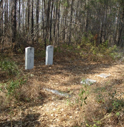
| Description | : | The Smith/Merritt Family Cemetery is located just off of hwy 107 between Pridgen and Snipesville, Georgia in Coffee County. The map is accurate. Click on the hybrid view to see the roads better, the graves are hidden under the trees. This Family burial ground, that was restored in 2001 by Smith family and friends, is recorded in Deed Book A-1, pages 454 and 455 at the Coffee County Court House. Lots 20 and 39 were purchased by A. A. Smith from the Frederick Merritt estate on May 7, 1861. We understand that a Merritt family member or two... Read More |
frequently asked questions (FAQ):
-
Where is Smith Family Cemetery?
Smith Family Cemetery is located at Pridgen, Coffee County ,Georgia ,USA.
-
Smith Family Cemetery cemetery's updated grave count on graveviews.com?
0 memorials
-
Where are the coordinates of the Smith Family Cemetery?
Latitude: 31.7667410
Longitude: -82.8651950
Nearby Cemetories:
1. Rocky Creek Cemetery
Coffee County, USA
Coordinate: 31.7572002, -82.8786011
2. Saint Andrews Cemetery
Coffee County, USA
Coordinate: 31.7514000, -82.8442001
3. Ashley-Manning-Pace Cemetery
Kirkland, Jeff Davis County, USA
Coordinate: 31.7907800, -82.8516800
4. Frier Cemetery
Pridgen, Coffee County, USA
Coordinate: 31.7649000, -82.9150400
5. Frier Cemetery
Jeff Davis County, USA
Coordinate: 31.7646999, -82.9163971
6. Piney Grove Baptist Church Cemetery
Hazlehurst, Jeff Davis County, USA
Coordinate: 31.7818800, -82.8050700
7. Oak Grove Methodist Church Cemetery
Coffee County, USA
Coordinate: 31.7616997, -82.9338989
8. Mount Pleasant Baptist Church Cemetery
Snipesville, Jeff Davis County, USA
Coordinate: 31.7219980, -82.8118520
9. Candacy Cato Cemetery
Coffee County, USA
Coordinate: 31.7082996, -82.9060974
10. Pridgen Baptist Church Cemetery
Coffee County, USA
Coordinate: 31.6972008, -82.9227982
11. Carver Chapel Cemetery
Denton, Jeff Davis County, USA
Coordinate: 31.6945160, -82.8036650
12. Union Springs Baptist Church Cemetery
Snipesville, Jeff Davis County, USA
Coordinate: 31.7936470, -82.7640810
13. Mary's Chapel Methodist Cemetery
Broxton, Coffee County, USA
Coordinate: 31.6706800, -82.8388350
14. Pridgen Family Cemetery
Pridgen, Coffee County, USA
Coordinate: 31.7045100, -82.9566700
15. Creech Cemetery
Snipesville, Jeff Davis County, USA
Coordinate: 31.7752060, -82.7480360
16. Benjamin Chapel Cemetery
Coffee County, USA
Coordinate: 31.7355995, -82.9819031
17. Williams Chapel Cemetery
Snipesville, Jeff Davis County, USA
Coordinate: 31.7154700, -82.7562800
18. Pridgen Family Cemetery #1
Pridgen, Coffee County, USA
Coordinate: 31.7022200, -82.9649200
19. Girtman Cemetery
Jeff Davis County, USA
Coordinate: 31.8370400, -82.7664300
20. Fussell Cemetery
Coffee County, USA
Coordinate: 31.7546997, -82.9961014
21. Fusselle Cemetery
Red Bluff, Ben Hill County, USA
Coordinate: 31.7487200, -83.0021800
22. Reedy Branch Cemetery
Broxton, Coffee County, USA
Coordinate: 31.6518993, -82.9030991
23. Mobley Cemetery
Ben Hill County, USA
Coordinate: 31.7660999, -83.0113983
24. Broxton Church of God Cemetery
Broxton, Coffee County, USA
Coordinate: 31.6459290, -82.9033470