
| Memorials | : | 8 |
| Location | : | Snipesville, Jeff Davis County, USA |
| Coordinate | : | 31.7219980, -82.8118520 |
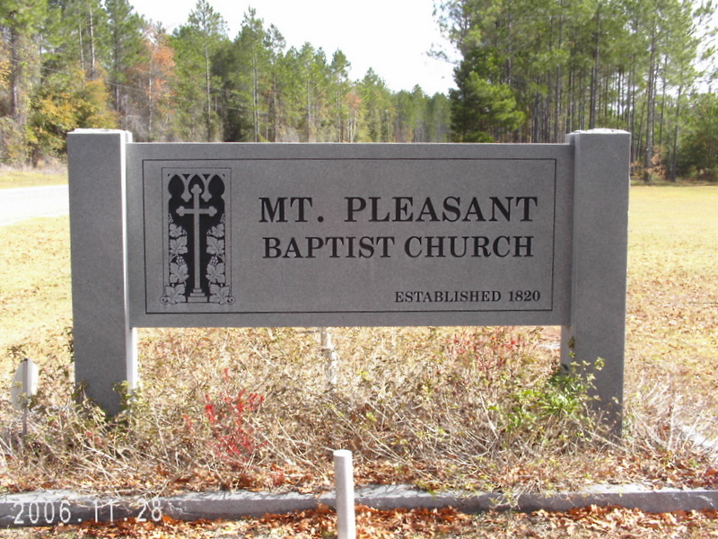
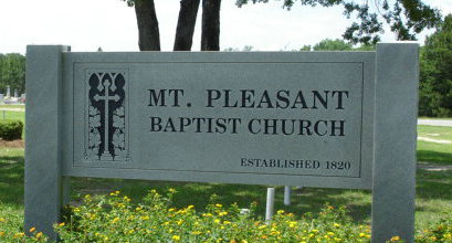
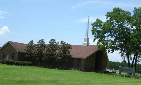
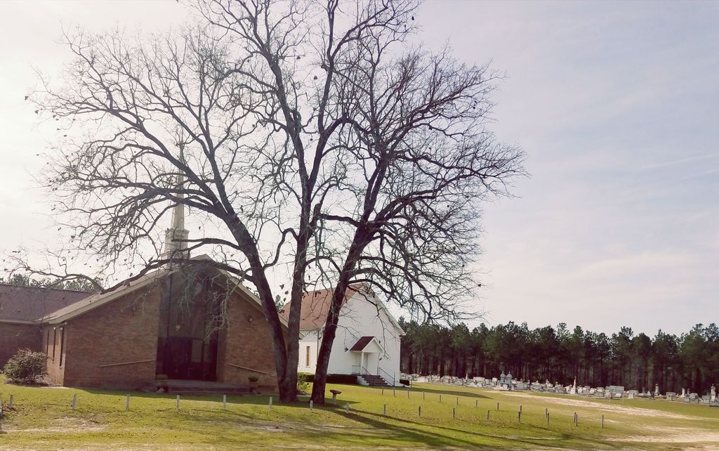
| Description | : | Mt. Pleasant Baptist Church was organized in 1820. The land where the church stands today was given by the Byrd family, and is also known as Byrd Church. Many members of the Byrd family are interred in the cemetery. Mt. Pleasant is the oldest church in the Smyrna Baptist Association, holding its first meeting there in 1878. A beautiful new church was erected in 1989. The original church was remodeled and is used for social events. Mt Pleasant Baptist Church is located on Mt. Pleasant Church Road, off the highway between Broxton and Hazlehurst in Jeff Davis County Georgia. ... Read More |
frequently asked questions (FAQ):
-
Where is Mount Pleasant Baptist Church Cemetery?
Mount Pleasant Baptist Church Cemetery is located at Mt. Pleasant Church Road Snipesville, Jeff Davis County ,Georgia ,USA.
-
Mount Pleasant Baptist Church Cemetery cemetery's updated grave count on graveviews.com?
5 memorials
-
Where are the coordinates of the Mount Pleasant Baptist Church Cemetery?
Latitude: 31.7219980
Longitude: -82.8118520
Nearby Cemetories:
1. Carver Chapel Cemetery
Denton, Jeff Davis County, USA
Coordinate: 31.6945160, -82.8036650
2. Saint Andrews Cemetery
Coffee County, USA
Coordinate: 31.7514000, -82.8442001
3. Williams Chapel Cemetery
Snipesville, Jeff Davis County, USA
Coordinate: 31.7154700, -82.7562800
4. Mary's Chapel Methodist Cemetery
Broxton, Coffee County, USA
Coordinate: 31.6706800, -82.8388350
5. Piney Grove Baptist Church Cemetery
Hazlehurst, Jeff Davis County, USA
Coordinate: 31.7818800, -82.8050700
6. Smith Family Cemetery
Pridgen, Coffee County, USA
Coordinate: 31.7667410, -82.8651950
7. Rocky Creek Cemetery
Coffee County, USA
Coordinate: 31.7572002, -82.8786011
8. Creech Cemetery
Snipesville, Jeff Davis County, USA
Coordinate: 31.7752060, -82.7480360
9. Providence Baptist Church Cemetery
Douglas, Coffee County, USA
Coordinate: 31.6455970, -82.8121950
10. Ashley-Manning-Pace Cemetery
Kirkland, Jeff Davis County, USA
Coordinate: 31.7907800, -82.8516800
11. Candacy Cato Cemetery
Coffee County, USA
Coordinate: 31.7082996, -82.9060974
12. Union Springs Baptist Church Cemetery
Snipesville, Jeff Davis County, USA
Coordinate: 31.7936470, -82.7640810
13. Cato Cemetery
Broxton, Coffee County, USA
Coordinate: 31.6368999, -82.8514023
14. Pridgen Baptist Church Cemetery
Coffee County, USA
Coordinate: 31.6972008, -82.9227982
15. Frier Cemetery
Pridgen, Coffee County, USA
Coordinate: 31.7649000, -82.9150400
16. Frier Cemetery
Jeff Davis County, USA
Coordinate: 31.7646999, -82.9163971
17. Annie Reed Cemetery
Jeff Davis County, USA
Coordinate: 31.7225417, -82.6895083
18. Reedy Branch Cemetery
Broxton, Coffee County, USA
Coordinate: 31.6518993, -82.9030991
19. Denton Cemetery
Denton, Jeff Davis County, USA
Coordinate: 31.7260200, -82.6887500
20. Broxton City Cemetery
Broxton, Coffee County, USA
Coordinate: 31.6327991, -82.8767014
21. Broxton Church of God Cemetery
Broxton, Coffee County, USA
Coordinate: 31.6459290, -82.9033470
22. Oak Grove Methodist Church Cemetery
Coffee County, USA
Coordinate: 31.7616997, -82.9338989
23. Old Broxton Cemetery
Broxton, Coffee County, USA
Coordinate: 31.6285450, -82.8882610
24. Oak Grove AME Church Cemetery #2
West Green, Coffee County, USA
Coordinate: 31.6093900, -82.7838820