
| Memorials | : | 0 |
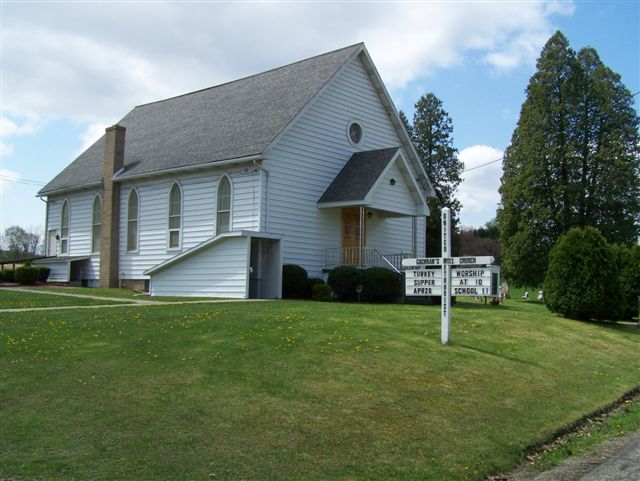
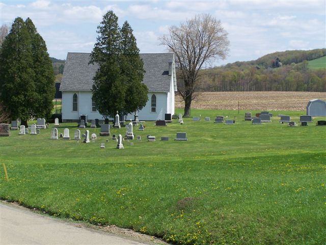
| Location | : | Cochrans Mills, Armstrong County, USA |
| Coordinate | : | 40.6706000, -79.4700000 |
frequently asked questions (FAQ):
-
Where is Cochrans Mill United Methodist Church Cemetery?
Cochrans Mill United Methodist Church Cemetery is located at Cochrans Mills, Armstrong County ,Pennsylvania ,USA.
-
Cochrans Mill United Methodist Church Cemetery cemetery's updated grave count on graveviews.com?
0 memorials
-
Where are the coordinates of the Cochrans Mill United Methodist Church Cemetery?
Latitude: 40.6706000
Longitude: -79.4700000
Nearby Cemetories:
1. Dunkard Baptist Christian Bretheren Cemetery
Cochrans Mills, Armstrong County, USA
Coordinate: 40.6697655, -79.4726105
2. Shoemaker Family Cemetery
Cochrans Mills, Armstrong County, USA
Coordinate: 40.6639400, -79.4665790
3. Ramaley Family Cemetery
Cochrans Mills, Armstrong County, USA
Coordinate: 40.6574780, -79.4585220
4. Saint Michael's Lutheran Church Cemetery
Brick Church, Armstrong County, USA
Coordinate: 40.6831360, -79.4557114
5. McDonald Cemetery
Burrell Township, Armstrong County, USA
Coordinate: 40.6603012, -79.4464035
6. Shaeffer Cemetery
Brick Church, Armstrong County, USA
Coordinate: 40.6927986, -79.4441986
7. Shellhammer Cemetery
Mateer, Armstrong County, USA
Coordinate: 40.6420000, -79.4887000
8. Shellhammer-Beck Cemetery
Mateer, Armstrong County, USA
Coordinate: 40.6394230, -79.4799040
9. Porter Cemetery
Armstrong County, USA
Coordinate: 40.6618996, -79.5147018
10. Shellhammer Cemetery
Mateer, Armstrong County, USA
Coordinate: 40.6404860, -79.4944850
11. Mount Zion United Methodist Church Cemetery
Girty, Armstrong County, USA
Coordinate: 40.6555710, -79.4134674
12. Shotts Cemetery
Armstrong County, USA
Coordinate: 40.7186012, -79.4753036
13. Saint John's Lutheran Church Cemetery
Ford City, Armstrong County, USA
Coordinate: 40.7197037, -79.4614410
14. Highfield Lutheran Church Cemetery
North Vandergrift, Armstrong County, USA
Coordinate: 40.6392441, -79.5245590
15. Rupert Cemetery
Girty, Armstrong County, USA
Coordinate: 40.6596550, -79.4020500
16. Rowley Cemetery
Elderton, Armstrong County, USA
Coordinate: 40.6889750, -79.4027500
17. Crooked Creek Presbyterian Cemetery
Ford City, Armstrong County, USA
Coordinate: 40.7104000, -79.5197000
18. Bethel Lutheran Church Cemetery
Ford City, Armstrong County, USA
Coordinate: 40.6969290, -79.5336720
19. Smail Family Cemetery
North Vandergrift, Armstrong County, USA
Coordinate: 40.6781730, -79.5466050
20. United Rockville Lutheran Cemetery
Ford City, Armstrong County, USA
Coordinate: 40.7305260, -79.4382095
21. Fairview Cemetery
Spring Church, Armstrong County, USA
Coordinate: 40.6075000, -79.4899000
22. Spring Church Joint Cemetery
Spring Church, Armstrong County, USA
Coordinate: 40.6069000, -79.4902000
23. Spring Church Lutheran Church Cemetery
Spring Church, Armstrong County, USA
Coordinate: 40.6067009, -79.4916992
24. Oakland Methodist Cemetery
Ford City, Armstrong County, USA
Coordinate: 40.7217865, -79.5342789