| Memorials | : | 5 |
| Location | : | Rochester, Olmsted County, USA |
| Coordinate | : | 44.0504990, -92.4079971 |
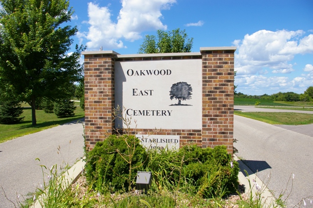
| Description | : | Established in 1999, Oakwood East Cemetery is an extension of Oakwood Cemetery and is located ¾ mile east of Century High School on County Road #2. 36th Avenue & Viola Road NE Rochester, MN 55906 507-282-1608 |
frequently asked questions (FAQ):
-
Where is Oakwood East Cemetery?
Oakwood East Cemetery is located at Rochester, Olmsted County ,Minnesota ,USA.
-
Oakwood East Cemetery cemetery's updated grave count on graveviews.com?
5 memorials
-
Where are the coordinates of the Oakwood East Cemetery?
Latitude: 44.0504990
Longitude: -92.4079971
Nearby Cemetories:
1. Our Saviors Lutheran Church Columbarium
Rochester, Olmsted County, USA
Coordinate: 44.0448920, -92.4330100
2. Haverhill Cemetery
Olmsted County, USA
Coordinate: 44.0572014, -92.3692017
3. Rochester State Hospital Cemetery
Rochester, Olmsted County, USA
Coordinate: 44.0292700, -92.4377000
4. Rosemont Cemetery
Rochester, Olmsted County, USA
Coordinate: 44.0269880, -92.4369450
5. Calvary Cemetery
Rochester, Olmsted County, USA
Coordinate: 44.0285988, -92.4468994
6. Oakwood Cemetery
Rochester, Olmsted County, USA
Coordinate: 44.0271988, -92.4558029
7. Boynton Cemetery
Ringe, Olmsted County, USA
Coordinate: 44.0916710, -92.4416733
8. Grandview Memorial Gardens
Rochester, Olmsted County, USA
Coordinate: 44.0050011, -92.4368973
9. Bethel Lutheran Church Columbarium
Rochester, Olmsted County, USA
Coordinate: 44.0147580, -92.4583110
10. Calvary Episcopal Church Columbarium
Rochester, Olmsted County, USA
Coordinate: 44.0220450, -92.4676640
11. Zumbro Lutheran Church Columbarium
Rochester, Olmsted County, USA
Coordinate: 44.0165200, -92.4664500
12. First Presbyterian Church Columbarium
Rochester, Olmsted County, USA
Coordinate: 44.0201416, -92.4704132
13. Mount Olive Lutheran Church Columbarium
Rochester, Olmsted County, USA
Coordinate: 44.0540848, -92.4881973
14. Fitch Cemetery
Ringe, Olmsted County, USA
Coordinate: 44.1074982, -92.3886032
15. Saint Lukes Episcopal Church Columbarium
Rochester, Olmsted County, USA
Coordinate: 44.0453240, -92.4928450
16. Chester Cemetery
Chester, Olmsted County, USA
Coordinate: 44.0002785, -92.3458328
17. Congregational Church Columbarium
Rochester, Olmsted County, USA
Coordinate: 44.0122900, -92.4857200
18. First Unitarian Universalist Memorial Garden
Rochester, Olmsted County, USA
Coordinate: 44.0140700, -92.4876100
19. Saint Johns Evangelical Lutheran Church Cemetery
Haverhill, Olmsted County, USA
Coordinate: 44.0930595, -92.3194427
20. Pleasant Prairie Cemetery
Rochester, Olmsted County, USA
Coordinate: 44.1006012, -92.5139008
21. Zion German Evangelical Church Cemetery
Farmington Township, Olmsted County, USA
Coordinate: 44.1364840, -92.3486280
22. Randall Fork Cemetery
Eyota, Olmsted County, USA
Coordinate: 44.0194397, -92.2750015
23. Mayowood Cemetery
Rochester, Olmsted County, USA
Coordinate: 43.9909500, -92.5218800
24. Marion Cemetery
Marion, Olmsted County, USA
Coordinate: 43.9480591, -92.3494415

