
| Memorials | : | 6 |
| Location | : | Rochester, Olmsted County, USA |
| Coordinate | : | 44.0292700, -92.4377000 |
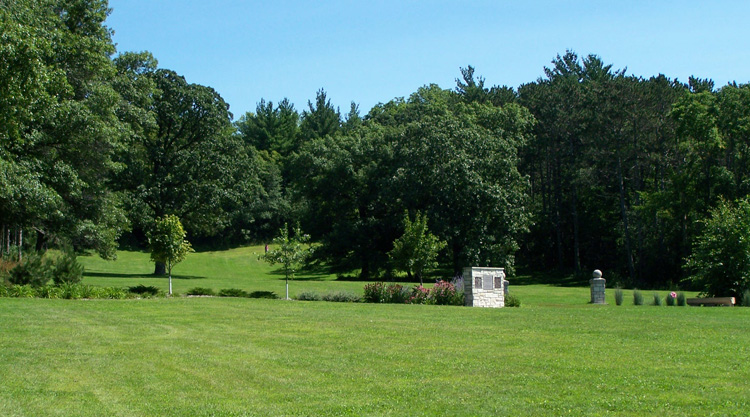
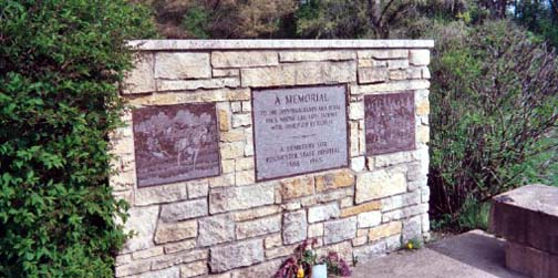
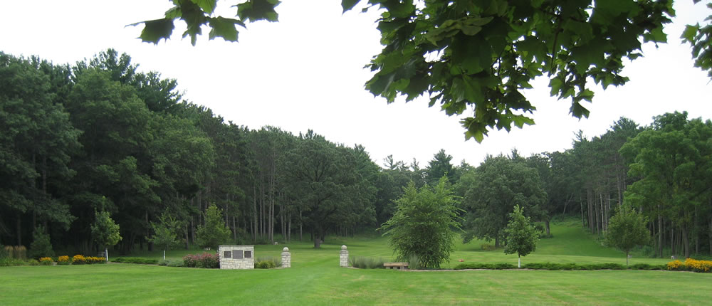
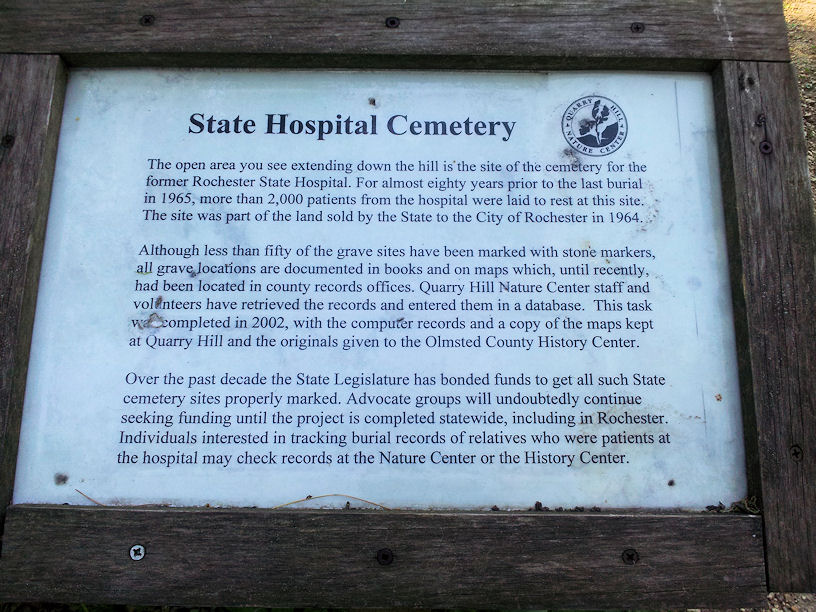
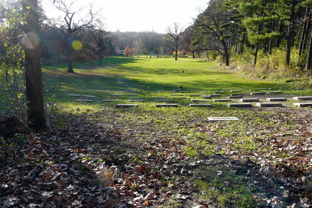
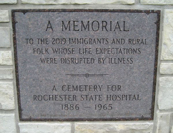
| Description | : | "Rochester State Hospital opened January 1, 1879. The first cemetery, named Rosemont Cemetery, was used from 1879 to 1897. The location is unknown today as there are no tombstones, but it is thought to be close to the railroad tracks immediately north of the hospital. The cemetery plot map has survived but not the sexton's record, if it ever existed. A second cemetery was begun after 1897 in what is now Quarry Hill Park. Eleven tombstones remain although there were hundreds of burials. The Olmsted County Court House, Recorder's Office, has the cemetery records for this cemetery. The records (3 books)... Read More |
frequently asked questions (FAQ):
-
Where is Rochester State Hospital Cemetery?
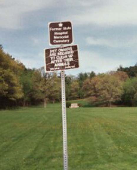
Rochester State Hospital Cemetery is located at Quarry Hill Park-701 Silver Creek Rd. NE Rochester, Olmsted County ,Minnesota , 55906USA.
-
Rochester State Hospital Cemetery cemetery's updated grave count on graveviews.com?
2 memorials
-
Where are the coordinates of the Rochester State Hospital Cemetery?
Latitude: 44.0292700
Longitude: -92.4377000
Nearby Cemetories:
1. Rosemont Cemetery
Rochester, Olmsted County, USA
Coordinate: 44.0269880, -92.4369450
2. Calvary Cemetery
Rochester, Olmsted County, USA
Coordinate: 44.0285988, -92.4468994
3. Oakwood Cemetery
Rochester, Olmsted County, USA
Coordinate: 44.0271988, -92.4558029
4. Our Saviors Lutheran Church Columbarium
Rochester, Olmsted County, USA
Coordinate: 44.0448920, -92.4330100
5. Bethel Lutheran Church Columbarium
Rochester, Olmsted County, USA
Coordinate: 44.0147580, -92.4583110
6. Calvary Episcopal Church Columbarium
Rochester, Olmsted County, USA
Coordinate: 44.0220450, -92.4676640
7. Grandview Memorial Gardens
Rochester, Olmsted County, USA
Coordinate: 44.0050011, -92.4368973
8. Zumbro Lutheran Church Columbarium
Rochester, Olmsted County, USA
Coordinate: 44.0165200, -92.4664500
9. First Presbyterian Church Columbarium
Rochester, Olmsted County, USA
Coordinate: 44.0201416, -92.4704132
10. Oakwood East Cemetery
Rochester, Olmsted County, USA
Coordinate: 44.0504990, -92.4079971
11. Congregational Church Columbarium
Rochester, Olmsted County, USA
Coordinate: 44.0122900, -92.4857200
12. First Unitarian Universalist Memorial Garden
Rochester, Olmsted County, USA
Coordinate: 44.0140700, -92.4876100
13. Saint Lukes Episcopal Church Columbarium
Rochester, Olmsted County, USA
Coordinate: 44.0453240, -92.4928450
14. Mount Olive Lutheran Church Columbarium
Rochester, Olmsted County, USA
Coordinate: 44.0540848, -92.4881973
15. Haverhill Cemetery
Olmsted County, USA
Coordinate: 44.0572014, -92.3692017
16. Boynton Cemetery
Ringe, Olmsted County, USA
Coordinate: 44.0916710, -92.4416733
17. Mayowood Cemetery
Rochester, Olmsted County, USA
Coordinate: 43.9909500, -92.5218800
18. Chester Cemetery
Chester, Olmsted County, USA
Coordinate: 44.0002785, -92.3458328
19. Fitch Cemetery
Ringe, Olmsted County, USA
Coordinate: 44.1074982, -92.3886032
20. Pleasant Prairie Cemetery
Rochester, Olmsted County, USA
Coordinate: 44.1006012, -92.5139008
21. Marion Cemetery
Marion, Olmsted County, USA
Coordinate: 43.9480591, -92.3494415
22. Saint Bridgets Catholic Church Cemetery
Simpson, Olmsted County, USA
Coordinate: 43.9230423, -92.4351883
23. Saint Johns Evangelical Lutheran Church Cemetery
Haverhill, Olmsted County, USA
Coordinate: 44.0930595, -92.3194427
24. Mount Hope Cemetery
Rochester, Olmsted County, USA
Coordinate: 44.0703011, -92.5783005