
| Memorials | : | 0 |
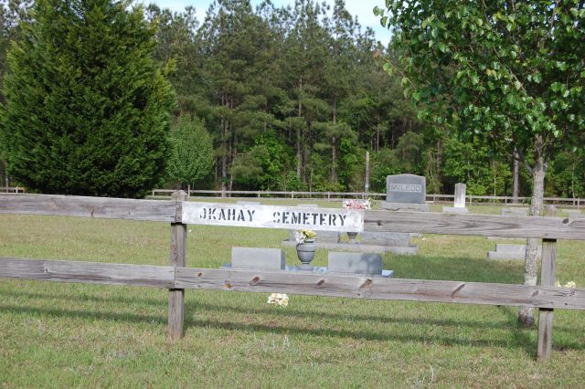
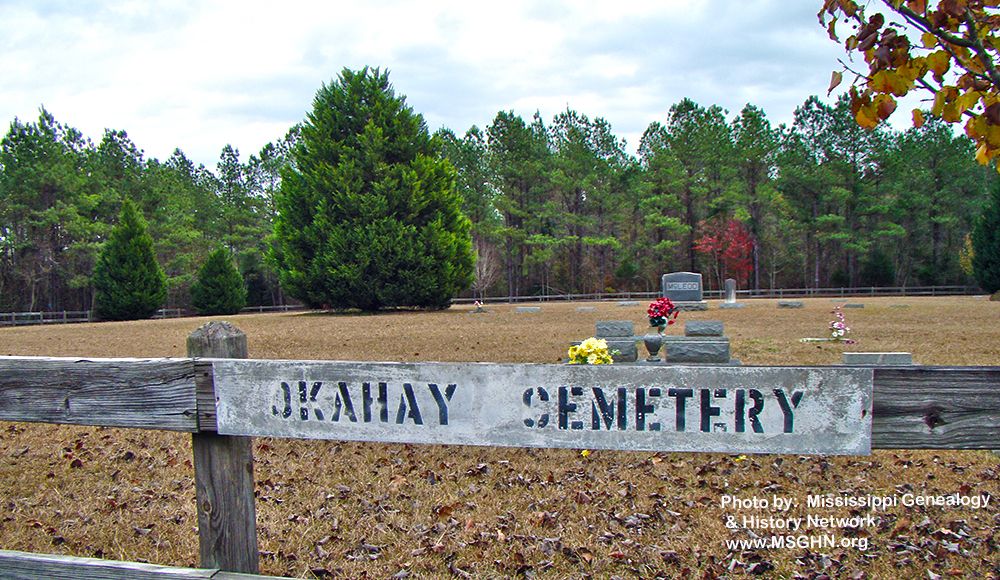
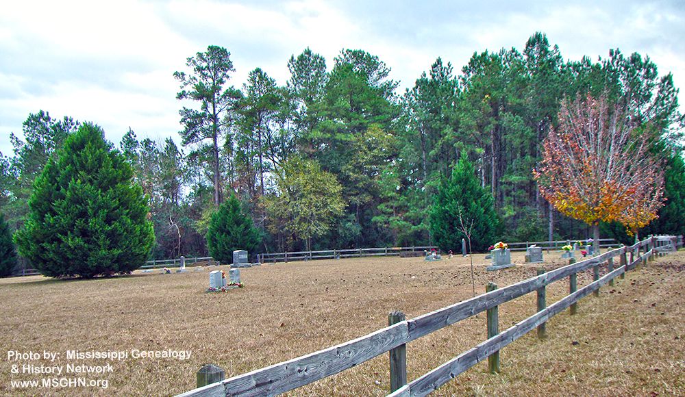
| Location | : | Collins, Covington County, USA |
| Coordinate | : | 31.7682300, -89.4818100 |
| Description | : | From Mount Olive, MS proceed Northeast on Mississippi Highway 35 (MS 35) 1.2 miles to the intersection of Mississippi Highway 532 E (MS 532 E.) Turn Right (East) onto MS 532 E and continue 8 miles to the intersection of Lilly Valley Church Road. Turn Left (North) onto Lilly Valley Church Road and proceed 2.4 miles to the intersection of Gilmer Road (aka Hot Coffee Road.) Turn Right (East) onto Gilmer Road and continue 1.2 miles, cemetery will be on Left (East) side of road specifically NW1/4 NW1/4, S11, T9N-R15W, Covington, Taylorsville Quadrangle map USNG 16R BA 64959 17427. |
frequently asked questions (FAQ):
-
Where is Okahay Cemetery?
Okahay Cemetery is located at Gilmer Road Collins, Covington County ,Mississippi , 39428USA.
-
Okahay Cemetery cemetery's updated grave count on graveviews.com?
0 memorials
-
Where are the coordinates of the Okahay Cemetery?
Latitude: 31.7682300
Longitude: -89.4818100
Nearby Cemetories:
1. Corleys Cemetery
Gilmore, Covington County, USA
Coordinate: 31.7659760, -89.4706802
2. Lilly Valley Missionary Baptist Church Cemetery
Mount Olive, Covington County, USA
Coordinate: 31.7687740, -89.5074290
3. Union Baptist Church Cemetery
Union (Hot Coffee), Covington County, USA
Coordinate: 31.7386799, -89.4879532
4. New Hopewell Church Cemetery
Covington County, USA
Coordinate: 31.7681007, -89.4441986
5. New Liberty Landmark Baptist Church Cemetery
Smith County, USA
Coordinate: 31.7903500, -89.5116800
6. Old Miller Cemetery
Taylorsville, Smith County, USA
Coordinate: 31.8005409, -89.5008545
7. Berkhalter Cemetery
Covington County, USA
Coordinate: 31.7558002, -89.5263977
8. Calhoun Baptist Church Cemetery
Collins, Covington County, USA
Coordinate: 31.7406006, -89.4431000
9. Jones Chapel Cemetery
Collins, Covington County, USA
Coordinate: 31.7301220, -89.5062560
10. Maranatha Mennonite Church Cemetery
Covington County, USA
Coordinate: 31.7896160, -89.4369000
11. Barnes Cemetery
Gilmore, Covington County, USA
Coordinate: 31.7607994, -89.4246979
12. Old Hopewell Cemetery
Hopewell, Covington County, USA
Coordinate: 31.7199993, -89.4708023
13. James E. Terrell Cemetery
Covington County, USA
Coordinate: 31.7188225, -89.4703369
14. Hopewell Baptist Church Cemetery
Hopewell, Covington County, USA
Coordinate: 31.7161340, -89.4690800
15. Apostolic Church of Jesus Christ Cemetery
Mount Olive, Covington County, USA
Coordinate: 31.7518860, -89.5450100
16. Old Zion Hill Cemetery
Mize, Smith County, USA
Coordinate: 31.7999900, -89.5438700
17. Jesus Name Holy Hill
Mount Olive, Covington County, USA
Coordinate: 31.7541850, -89.5531740
18. Fellowship Cemetery
Taylorsville, Smith County, USA
Coordinate: 31.8302500, -89.4507000
19. Oak Grove Baptist Church Cemetery
Mize, Smith County, USA
Coordinate: 31.7933100, -89.5686700
20. Blakely Creek Baptist Church Cemetery
Covington County, USA
Coordinate: 31.7355995, -89.5671997
21. John Jackie Knight Cemetery
Jones County, USA
Coordinate: 31.7267000, -89.3979000
22. Shady Oak Missionary Baptist Cemetery
Covington County, USA
Coordinate: 31.6940600, -89.4378000
23. Shiloh Cemetery
Smith, Covington County, USA
Coordinate: 31.7556000, -89.5792007
24. Oak Grove Missionary Baptist Church Cemetery
Jones County, USA
Coordinate: 31.7290980, -89.3939390