
| Memorials | : | 0 |
| Location | : | Murray County, USA |
| Coordinate | : | 34.5005560, -97.3077780 |
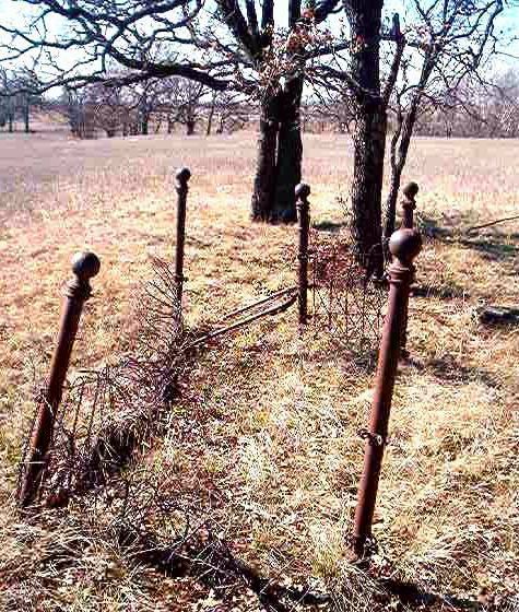
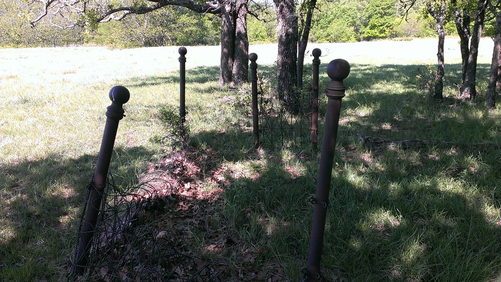
| Description | : | Turner Twp, T1S R1W SW 1/4, NW 1/4, Sec 4 From Davis, go west on SH 7 about 9.5 miles to Mountain View Road. Turn south and go to first section line, turn right & travel west on county road 9/10ths of a mile. There is a sign on the right that reads "Arbuckle Ranch" with an underground house. The pasture gate will be there on the left. Take the pasture road 3/10ths of a mile over the hill until you come to a fork in the path, take the right fork. Continue down the hill until you come... Read More |
frequently asked questions (FAQ):
-
Where is Old Five Mile Cemetery?
Old Five Mile Cemetery is located at N3192 Road Murray County ,Oklahoma , 73444USA.
-
Old Five Mile Cemetery cemetery's updated grave count on graveviews.com?
0 memorials
-
Where are the coordinates of the Old Five Mile Cemetery?
Latitude: 34.5005560
Longitude: -97.3077780
Nearby Cemetories:
1. Five Mile Cemetery
Hennepin, Garvin County, USA
Coordinate: 34.5213585, -97.3167267
2. Hennepin Cemetery
Hennepin, Garvin County, USA
Coordinate: 34.4914017, -97.3443985
3. Fort Arbuckle Cemetery
Washita, Murray County, USA
Coordinate: 34.5208330, -97.2472220
4. Oil Spring Cemetery
Tatums, Carter County, USA
Coordinate: 34.4897003, -97.4124985
5. Sweet Home Cemetery
Katie, Garvin County, USA
Coordinate: 34.5848600, -97.3338900
6. Katie City Cemetery
Katie, Garvin County, USA
Coordinate: 34.5801400, -97.3538000
7. Oak Ridge Cemetery
Garvin County, USA
Coordinate: 34.5127983, -97.1921997
8. Pooleville Cemetery
Pooleville, Carter County, USA
Coordinate: 34.4258003, -97.3996964
9. Howell Cemetery
Garvin County, USA
Coordinate: 34.5080986, -97.1735992
10. Wynnewood View Cemetery
Garvin County, USA
Coordinate: 34.5787930, -97.1955940
11. Little Flock Cemetery
Elmore City, Garvin County, USA
Coordinate: 34.5667400, -97.4564000
12. Tatums Cemetery
Tatums, Carter County, USA
Coordinate: 34.4674988, -97.4738998
13. Oak Ridge Cemetery
Davis, Murray County, USA
Coordinate: 34.5050011, -97.1296997
14. Green Hill Cemetery
Davis, Murray County, USA
Coordinate: 34.4981003, -97.1294022
15. Wheeler Flats Cemetery
Murray County, USA
Coordinate: 34.5614014, -97.1399994
16. Elmore City Cemetery
Elmore City, Garvin County, USA
Coordinate: 34.6197014, -97.4210968
17. Wyatt Chapel Cemetery
Foster, Garvin County, USA
Coordinate: 34.5699043, -97.4765396
18. Monk Cemetery
Ratliff City, Carter County, USA
Coordinate: 34.4580994, -97.4925003
19. James Cemetery
Murray County, USA
Coordinate: 34.4601800, -97.1174670
20. Woodford Cemetery
Woodford, Carter County, USA
Coordinate: 34.3381690, -97.2896410
21. Milo Cemetery
Milo, Carter County, USA
Coordinate: 34.3330994, -97.3257980
22. Dripping Springs Cemetery
Pernell, Garvin County, USA
Coordinate: 34.5161018, -97.5177994
23. Klondike Cemetery
Pauls Valley, Garvin County, USA
Coordinate: 34.6711006, -97.2589035
24. Ratliff City Cemetery
Ratliff City, Carter County, USA
Coordinate: 34.4544870, -97.5130550