
| Memorials | : | 0 |
| Location | : | Fairway, Johnson County, USA |
| Coordinate | : | 39.0293200, -94.6246500 |
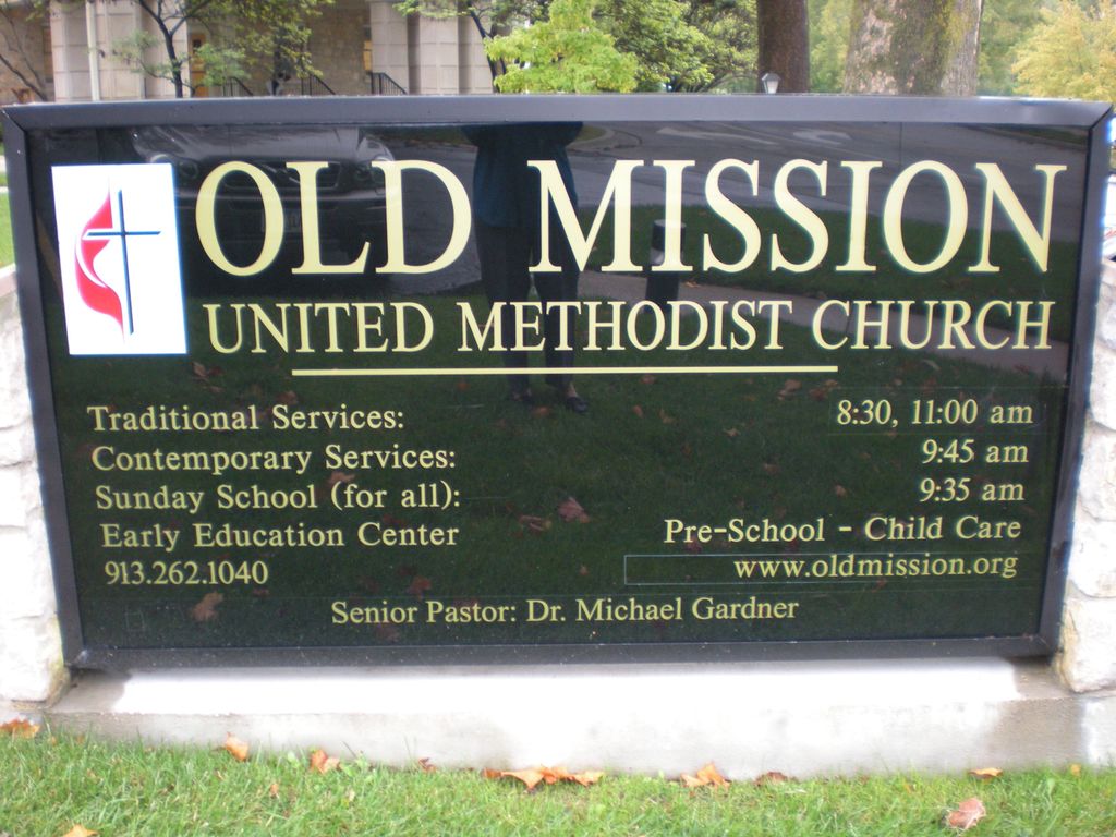
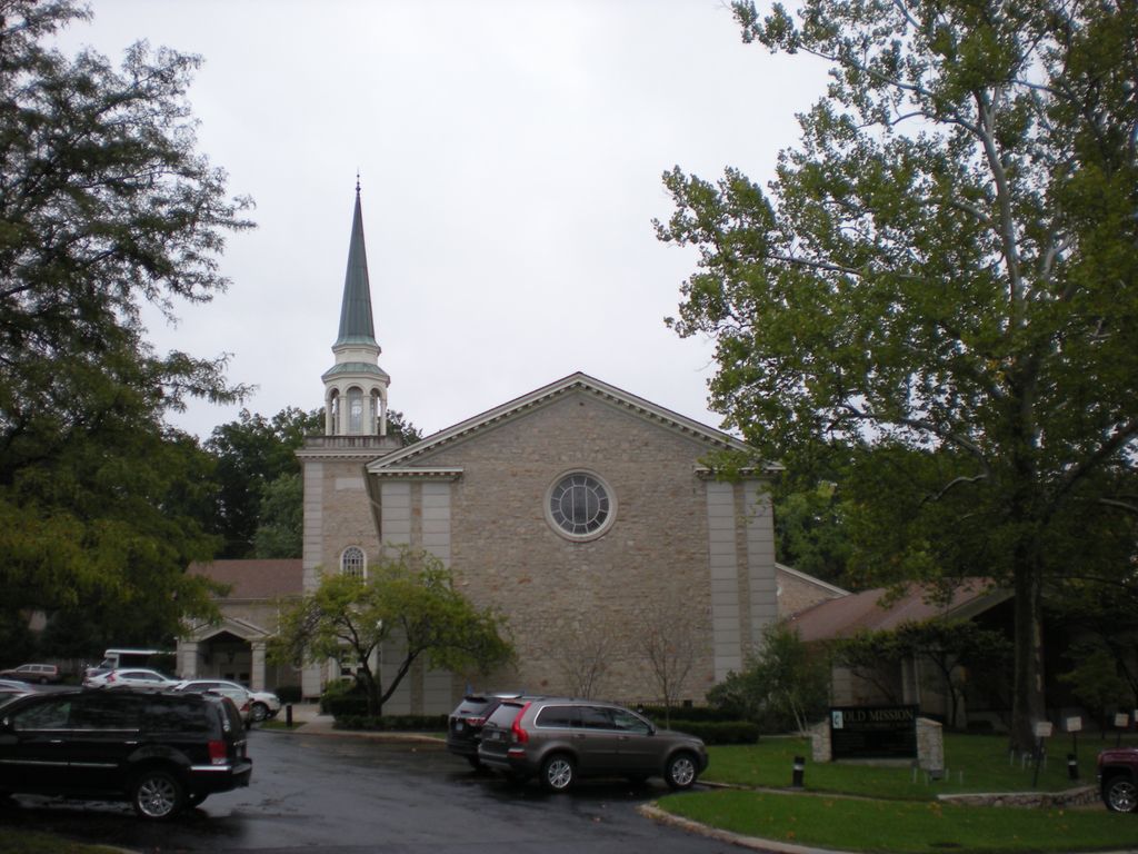
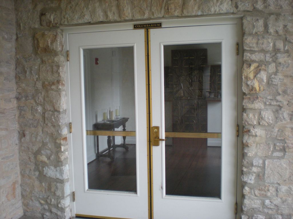
| Description | : | The Columbarium at Old Mission United Methodist Church is located outside the west entrance to Bingham Chapel. The Columbarium was constructed in 2015 and can be added to in the future. The church is located on Shawnee Mission Parkway in Fairway, Kansas, just east of Mission Road. The church address is 5519 State Park Road, Fairway, Kansas 66205. |
frequently asked questions (FAQ):
-
Where is Old Mission United Methodist Church Columbarium?
Old Mission United Methodist Church Columbarium is located at 5519 State Park Road Fairway, Johnson County ,Kansas ,USA.
-
Old Mission United Methodist Church Columbarium cemetery's updated grave count on graveviews.com?
0 memorials
-
Where are the coordinates of the Old Mission United Methodist Church Columbarium?
Latitude: 39.0293200
Longitude: -94.6246500
Nearby Cemetories:
1. Shawnee Methodist Mission Cemetery
Fairway, Johnson County, USA
Coordinate: 39.0307846, -94.6217880
2. Southminster Presbyterian Church Columbarium
Prairie Village, Johnson County, USA
Coordinate: 39.0145600, -94.6407400
3. Village Presbyterian Church Columbarium
Prairie Village, Johnson County, USA
Coordinate: 39.0083300, -94.6299900
4. George Hamilton Combs Chapel Columbarium & Garden
Kansas City, Jackson County, USA
Coordinate: 39.0176000, -94.6013500
5. Highland Cemetery
Prairie Village, Johnson County, USA
Coordinate: 39.0111008, -94.6444016
6. Country Club United Methodist Church Memor
Kansas City, Jackson County, USA
Coordinate: 39.0247260, -94.5933250
7. Cross Cemetery (Defunct)
Mission, Johnson County, USA
Coordinate: 39.0223083, -94.6582565
8. Shawnee Friends Mission Cemetery
Mission, Johnson County, USA
Coordinate: 39.0185800, -94.6568200
9. Colonial Church Garden of Life
Prairie Village, Johnson County, USA
Coordinate: 39.0009900, -94.6300200
10. Saint Michaels Memorial Garden and Columbarium
Mission, Johnson County, USA
Coordinate: 39.0081100, -94.6495800
11. Saint Andrews Episcopal Church Columbarium
Kansas City, Jackson County, USA
Coordinate: 39.0115600, -94.5938100
12. Westport Cemetery
Kansas City, Jackson County, USA
Coordinate: 39.0508200, -94.5932400
13. All Souls Unitarian Universalist Church Gardens
Kansas City, Jackson County, USA
Coordinate: 39.0452060, -94.5847200
14. Kauffman Memorial Garden
Kansas City, Jackson County, USA
Coordinate: 39.0398100, -94.5789700
15. Nelson-Atkins Museum of Art
Kansas City, Jackson County, USA
Coordinate: 39.0449890, -94.5809780
16. Saint Paul's Episcopal Church Cemetery
Kansas City, Jackson County, USA
Coordinate: 39.0540700, -94.5856600
17. Asbury Memorial Garden
Prairie Village, Johnson County, USA
Coordinate: 38.9932800, -94.6470000
18. Calvary Cemetery
Kansas City, Jackson County, USA
Coordinate: 39.0050964, -94.5748215
19. Rose Hill Cemetery
Kansas City, Jackson County, USA
Coordinate: 39.0017014, -94.5757980
20. Woolford Farm Grounds
Prairie Village, Johnson County, USA
Coordinate: 38.9822388, -94.6332169
21. Forest Hill Cemetery
Kansas City, Jackson County, USA
Coordinate: 39.0018997, -94.5699997
22. Boone-Hays Cemetery
Kansas City, Jackson County, USA
Coordinate: 39.0129395, -94.5630493
23. Corinth Cemetery
Prairie Village, Johnson County, USA
Coordinate: 38.9783000, -94.6266700
24. Union Cemetery
Kansas City, Jackson County, USA
Coordinate: 39.0752983, -94.5811005