
| Memorials | : | 0 |
| Location | : | Fairway, Johnson County, USA |
| Coordinate | : | 39.0307846, -94.6217880 |
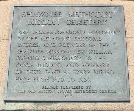
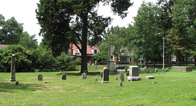
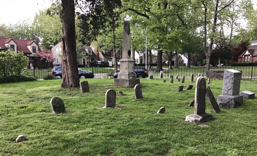
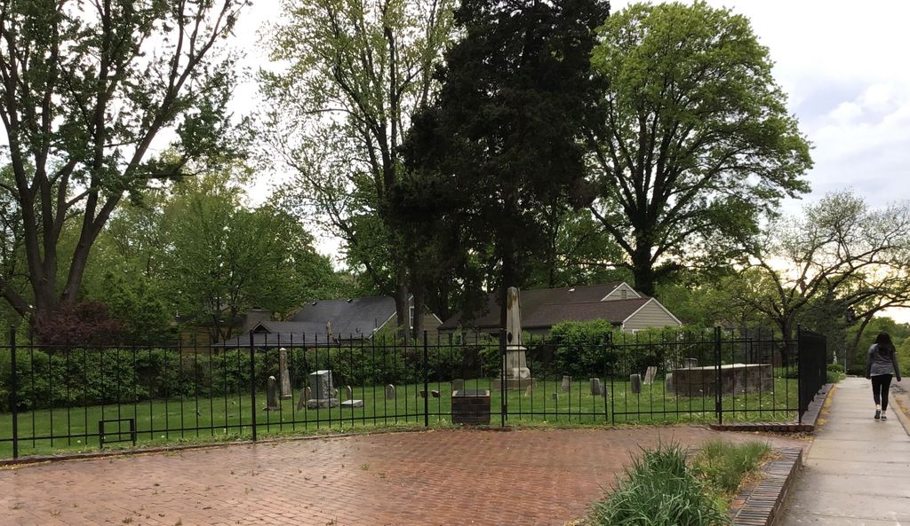
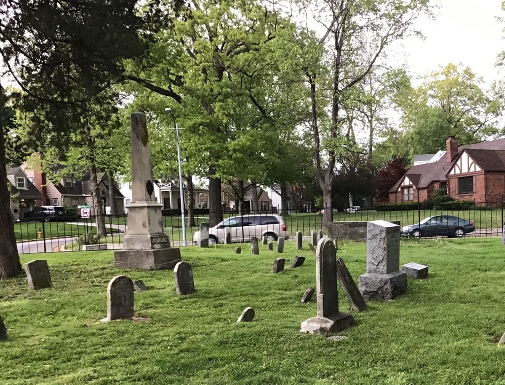
| Description | : | The plaque at the cemetery entrance reads: "Rev. Thomas Johnson, a missionary of the Methodist Episcopal Church and Founder of the Shawnee Mission; Rev. William Johnson, Missionary to the Kansa Indians, and members of their families were buried here from 1839 to 1930. Plaque furnished by the Old Mission United Methodist Church 1988." Originally the Shawnee Mission Cemetery was larger. In 1928 a stone wall was built around the remaining Johnson family grave sites. In the 1950s Shawnee Mission Parkway was widened and graves located ouside the wall were disturbed. It was during that time Sarah Barrymen's grave was... Read More |
frequently asked questions (FAQ):
-
Where is Shawnee Methodist Mission Cemetery?
Shawnee Methodist Mission Cemetery is located at Fairway, Johnson County ,Kansas ,USA.
-
Shawnee Methodist Mission Cemetery cemetery's updated grave count on graveviews.com?
0 memorials
-
Where are the coordinates of the Shawnee Methodist Mission Cemetery?
Latitude: 39.0307846
Longitude: -94.6217880
Nearby Cemetories:
1. Old Mission United Methodist Church Columbarium
Fairway, Johnson County, USA
Coordinate: 39.0293200, -94.6246500
2. George Hamilton Combs Chapel Columbarium & Garden
Kansas City, Jackson County, USA
Coordinate: 39.0176000, -94.6013500
3. Southminster Presbyterian Church Columbarium
Prairie Village, Johnson County, USA
Coordinate: 39.0145600, -94.6407400
4. Country Club United Methodist Church Memor
Kansas City, Jackson County, USA
Coordinate: 39.0247260, -94.5933250
5. Village Presbyterian Church Columbarium
Prairie Village, Johnson County, USA
Coordinate: 39.0083300, -94.6299900
6. Highland Cemetery
Prairie Village, Johnson County, USA
Coordinate: 39.0111008, -94.6444016
7. Saint Andrews Episcopal Church Columbarium
Kansas City, Jackson County, USA
Coordinate: 39.0115600, -94.5938100
8. Cross Cemetery (Defunct)
Mission, Johnson County, USA
Coordinate: 39.0223083, -94.6582565
9. Shawnee Friends Mission Cemetery
Mission, Johnson County, USA
Coordinate: 39.0185800, -94.6568200
10. Westport Cemetery
Kansas City, Jackson County, USA
Coordinate: 39.0508200, -94.5932400
11. Colonial Church Garden of Life
Prairie Village, Johnson County, USA
Coordinate: 39.0009900, -94.6300200
12. Saint Michaels Memorial Garden and Columbarium
Mission, Johnson County, USA
Coordinate: 39.0081100, -94.6495800
13. All Souls Unitarian Universalist Church Gardens
Kansas City, Jackson County, USA
Coordinate: 39.0452060, -94.5847200
14. Kauffman Memorial Garden
Kansas City, Jackson County, USA
Coordinate: 39.0398100, -94.5789700
15. Nelson-Atkins Museum of Art
Kansas City, Jackson County, USA
Coordinate: 39.0449890, -94.5809780
16. Saint Paul's Episcopal Church Cemetery
Kansas City, Jackson County, USA
Coordinate: 39.0540700, -94.5856600
17. Asbury Memorial Garden
Prairie Village, Johnson County, USA
Coordinate: 38.9932800, -94.6470000
18. Calvary Cemetery
Kansas City, Jackson County, USA
Coordinate: 39.0050964, -94.5748215
19. Rose Hill Cemetery
Kansas City, Jackson County, USA
Coordinate: 39.0017014, -94.5757980
20. Boone-Hays Cemetery
Kansas City, Jackson County, USA
Coordinate: 39.0129395, -94.5630493
21. Woolford Farm Grounds
Prairie Village, Johnson County, USA
Coordinate: 38.9822388, -94.6332169
22. Forest Hill Cemetery
Kansas City, Jackson County, USA
Coordinate: 39.0018997, -94.5699997
23. Corinth Cemetery
Prairie Village, Johnson County, USA
Coordinate: 38.9783000, -94.6266700
24. Union Cemetery
Kansas City, Jackson County, USA
Coordinate: 39.0752983, -94.5811005