
| Memorials | : | 0 |
| Location | : | Cologne, King and Queen County, USA |
| Coordinate | : | 37.5228752, -76.6955547 |
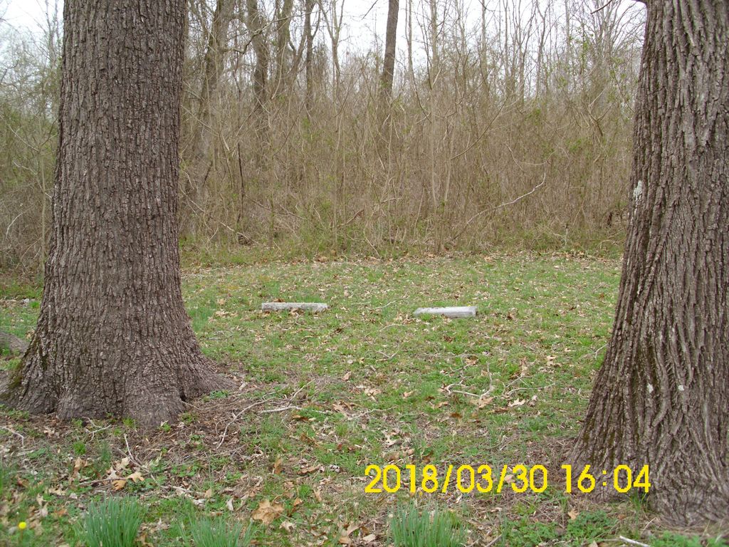
| Description | : | The Old Poroporone Cemetery is located about one tenth mile SW of the intersections of Stratton Major Road (Route 601) and Taylorsville Road (Route 606) near Cologne, VA, in Buena Vista District, King & Queen County, Virginia. Originally this was the location of the first church of the Lower Stratton Major Parish (Church of England / Episcopal) in New Kent County (it later became King and Queen County). It was built about 1656 and a graveyard soon ensued. The Lower Church "Poroporone" of Stratton Major Parish was used by the Episcopalian's until their new Corbin's Church was... Read More |
frequently asked questions (FAQ):
-
Where is Old Poroporone Cemetery?
Old Poroporone Cemetery is located at No postal address, but located at about 785 Stratton Major Road, .6 mile SW of Cologne, VA 23156 Cologne, King and Queen County ,Virginia , 23156USA.
-
Old Poroporone Cemetery cemetery's updated grave count on graveviews.com?
0 memorials
-
Where are the coordinates of the Old Poroporone Cemetery?
Latitude: 37.5228752
Longitude: -76.6955547
Nearby Cemetories:
1. Union Prospect Baptist Church Cemetery
Cologne, King and Queen County, USA
Coordinate: 37.5139950, -76.6929080
2. Beulah Wesleyan Church Cemetery
Cologne, King and Queen County, USA
Coordinate: 37.5471970, -76.6840390
3. Shackelfords Chapel Cemetery
Plain View, King and Queen County, USA
Coordinate: 37.4984000, -76.6741000
4. First Baptist Church Cemetery
Shacklefords, King and Queen County, USA
Coordinate: 37.5072460, -76.7377920
5. Poroporone Baptist Church Cemetery
Shacklefords, King and Queen County, USA
Coordinate: 37.5514890, -76.7337300
6. New Hope United Methodist Church Cemetery
Gloucester County, USA
Coordinate: 37.5592800, -76.6606130
7. Unnamed Colonial Era Farm Cemetery
Owl Trap, Gloucester County, USA
Coordinate: 37.5239449, -76.6276016
8. New Hope Memorial Baptist Church Cemetery
Shacklefords, King and Queen County, USA
Coordinate: 37.5790900, -76.6766100
9. Church of God Cemetery
Gloucester, Gloucester County, USA
Coordinate: 37.4736830, -76.6359110
10. Saint Andrew Cemetery
Gloucester County, USA
Coordinate: 37.5556960, -76.6166210
11. Escobrook Baptist Church Cemetery
Mattaponi, King and Queen County, USA
Coordinate: 37.5947980, -76.7298300
12. Morning Glory Baptist Church Cemetery
Gloucester, Gloucester County, USA
Coordinate: 37.4600580, -76.6358830
13. Pamunkey Neck Chapel Cemetery
West Point, King William County, USA
Coordinate: 37.5300962, -76.7955810
14. Salem United Methodist Church Cemetery
Gloucester, Gloucester County, USA
Coordinate: 37.5283210, -76.5938500
15. Dixon Cemetery
Mattaponi, King and Queen County, USA
Coordinate: 37.5801570, -76.7693140
16. New Mount Zion Baptist Church Cemetery
Gloucester County, USA
Coordinate: 37.5112070, -76.5924850
17. Mount Olive Baptist Church Cemetery
Barhamsville, New Kent County, USA
Coordinate: 37.4770830, -76.7909470
18. Saint Theresas Cemetery
West Point, King William County, USA
Coordinate: 37.5466995, -76.8032990
19. Sunny Slope Cemetery
West Point, King William County, USA
Coordinate: 37.5477982, -76.8031006
20. Burton Cemetery
Mascot, King and Queen County, USA
Coordinate: 37.6084490, -76.7299050
21. Oliver Russell Cemetery
Eltham, New Kent County, USA
Coordinate: 37.4993100, -76.8087500
22. Petsworth Parish Episcopal Church Cemetery
Gloucester County, USA
Coordinate: 37.4637186, -76.6046384
23. Marlfield Plantation Cemetery
Marlfield, Gloucester County, USA
Coordinate: 37.4492760, -76.6223860
24. Saint Luke's Baptist Church Cemetery
New Kent County, USA
Coordinate: 37.5200700, -76.8193130