
| Memorials | : | 25 |
| Location | : | Marlfield, Gloucester County, USA |
| Coordinate | : | 37.4492760, -76.6223860 |
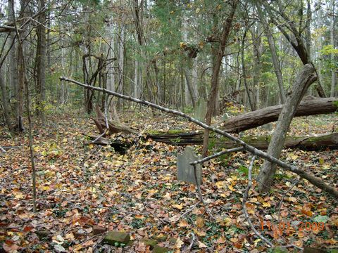
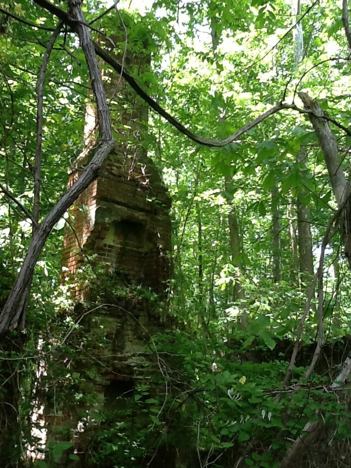
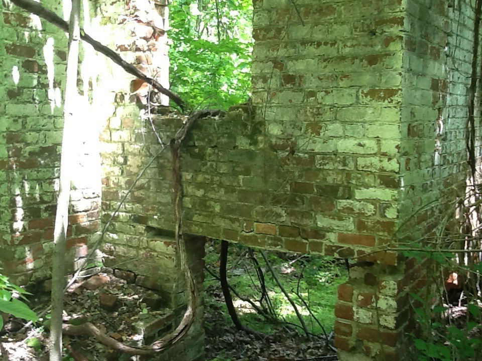
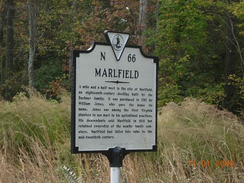
| Description | : | AKA Buckner Plantation. John and Deborah (Ferrers) Buckner family were the 1st to settle this farm land in 1667. John brought the 1st printing press to the Virginia Colony. The brick home was built in 1732 and in ruins today. William and Lucy (Taliaferro) Jones family bought the farm from the Buckner's in 1782 and added a wing onto the home. There is an old burying ground there in ruins and very hard to find, in it are tombstones of the Buckners, Joneses, and Fields and many with out markers. Directions: Take Hwy 17/George Washington Memorial Hwy to Enos... Read More |
frequently asked questions (FAQ):
-
Where is Marlfield Plantation Cemetery?
Marlfield Plantation Cemetery is located at 3780 Pebble Lane Marlfield, Gloucester County ,Virginia ,USA.
-
Marlfield Plantation Cemetery cemetery's updated grave count on graveviews.com?
0 memorials
-
Where are the coordinates of the Marlfield Plantation Cemetery?
Latitude: 37.4492760
Longitude: -76.6223860
Nearby Cemetories:
1. Morning Glory Baptist Church Cemetery
Gloucester, Gloucester County, USA
Coordinate: 37.4600580, -76.6358830
2. Petsworth Parish Episcopal Church Cemetery
Gloucester County, USA
Coordinate: 37.4637186, -76.6046384
3. Church of God Cemetery
Gloucester, Gloucester County, USA
Coordinate: 37.4736830, -76.6359110
4. Petsworth Baptist Church Cemetery
Pinetta, Gloucester County, USA
Coordinate: 37.4182300, -76.6205210
5. Grace Bible Church Cemetery
Ark, Gloucester County, USA
Coordinate: 37.4411260, -76.5790070
6. Bethel Baptist Church Cemetery
Sassafras, Gloucester County, USA
Coordinate: 37.4109200, -76.6086960
7. Shepherdsville Baptist Church Cemetery
Gloucester County, USA
Coordinate: 37.4509200, -76.5684680
8. Bellamy Memorial Cemetery
Bellamy, Gloucester County, USA
Coordinate: 37.4014940, -76.5888260
9. Shackelfords Chapel Cemetery
Plain View, King and Queen County, USA
Coordinate: 37.4984000, -76.6741000
10. New Mount Zion Baptist Church Cemetery
Gloucester County, USA
Coordinate: 37.5112070, -76.5924850
11. Newington Baptist Church Cemetery
Gloucester, Gloucester County, USA
Coordinate: 37.4174900, -76.5422420
12. Unnamed Colonial Era Farm Cemetery
Owl Trap, Gloucester County, USA
Coordinate: 37.5239449, -76.6276016
13. First Presbyterian Church Columbarium
Gloucester, Gloucester County, USA
Coordinate: 37.4150300, -76.5310400
14. Salem United Methodist Church Cemetery
Gloucester, Gloucester County, USA
Coordinate: 37.5283210, -76.5938500
15. Zion Hill Baptist Church Cemetery
Gloucester, Gloucester County, USA
Coordinate: 37.4840290, -76.5263470
16. Union Prospect Baptist Church Cemetery
Cologne, King and Queen County, USA
Coordinate: 37.5139950, -76.6929080
17. Smithfield Baptist Church Cemetery
Gloucester, Gloucester County, USA
Coordinate: 37.3703300, -76.5748250
18. Ebenezer Baptist Church Cemetery
Gloucester, Gloucester County, USA
Coordinate: 37.4989000, -76.5308960
19. Old Poroporone Cemetery
Cologne, King and Queen County, USA
Coordinate: 37.5228752, -76.6955547
20. Ware Episcopal Church Cemetery
Gloucester, Gloucester County, USA
Coordinate: 37.4227470, -76.5078880
21. Olive Branch United Methodist Church Cemetery
Harcum, Gloucester County, USA
Coordinate: 37.5070790, -76.5191580
22. Shiloh Cemetery
Gloucester, Gloucester County, USA
Coordinate: 37.3996010, -76.5123030
23. Zion Poplars Baptist Church Cemetery
Gloucester, Gloucester County, USA
Coordinate: 37.3994320, -76.5085530
24. First United Baptist Church Cemetery
Gloucester, Gloucester County, USA
Coordinate: 37.3713340, -76.5344850