| Memorials | : | 0 |
| Location | : | Blount County, USA |
| Coordinate | : | 33.9858340, -86.5832680 |
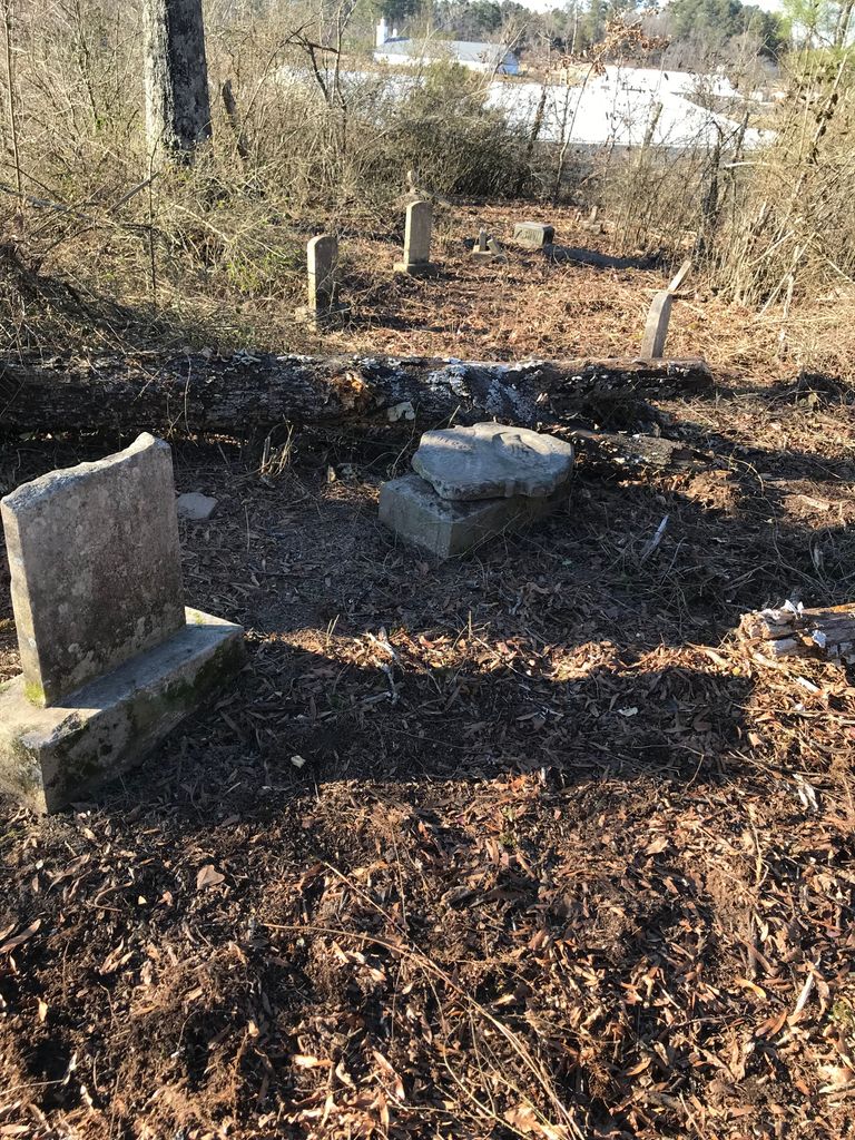
| Description | : | Location: From the intersection of Highways 160 and 79 at Cleveland; go East about one quarter mile and look across the highway from the Cleveland Funeral Home and the Shur Value; the cemetery is a few yeards east of a tin farm building under some trees and thick hedge bushes. There are only eleven gravestones which areengraved; four metal markers [no names], and fifteen rock stones graves. |
frequently asked questions (FAQ):
-
Where is Old Presbyterian Church Site Cemetery?
Old Presbyterian Church Site Cemetery is located at Blount County ,Alabama ,USA.
-
Old Presbyterian Church Site Cemetery cemetery's updated grave count on graveviews.com?
0 memorials
-
Where are the coordinates of the Old Presbyterian Church Site Cemetery?
Latitude: 33.9858340
Longitude: -86.5832680
Nearby Cemetories:
1. First Baptist Church of Cleveland Cemetery
Cleveland, Blount County, USA
Coordinate: 33.9898500, -86.5859700
2. Cleveland Methodist Cemetery
Cleveland, Blount County, USA
Coordinate: 33.9892006, -86.5764008
3. Cleveland Westside Baptist Church Cemetery
Cleveland, Blount County, USA
Coordinate: 33.9979710, -86.5839400
4. Greens Chapel Cemetery
Blount County, USA
Coordinate: 33.9606018, -86.5883026
5. Austin Creek Baptist Church Cemetery
Hayden, Blount County, USA
Coordinate: 34.0148550, -86.6146450
6. Mount Joy Cemetery
Cleveland, Blount County, USA
Coordinate: 34.0175018, -86.5528030
7. Chitwood Cemetery
Blount County, USA
Coordinate: 33.9536018, -86.5513992
8. Easley Church of the Brethren Cemetery
Blount County, USA
Coordinate: 33.9602800, -86.5421800
9. Blackwood-Stephens Cemetery
Cleveland, Blount County, USA
Coordinate: 34.0092010, -86.5382996
10. Fowler Springs Cemetery
Blount County, USA
Coordinate: 34.0307900, -86.5813900
11. Nectar Cemetery
Nectar, Blount County, USA
Coordinate: 33.9620260, -86.6333680
12. Fowler-Pullen-Sims Cemetery
Blountsville, Blount County, USA
Coordinate: 34.0338000, -86.5878000
13. Daileys Chapel Cemetery
Rosa, Blount County, USA
Coordinate: 33.9941673, -86.5213852
14. Blackwood-Cornelius Cemetery
Five Points, Blount County, USA
Coordinate: 34.0326210, -86.5479110
15. Copeland Cemetery
Sky Ball, Blount County, USA
Coordinate: 34.0193670, -86.6379170
16. Tidwell Cemetery
Deavers Town, Blount County, USA
Coordinate: 33.9272003, -86.5868988
17. Brown-Hudson Cemetery
Locust Fork, Blount County, USA
Coordinate: 33.9152985, -86.6055984
18. Graves Cemetery
Joy, Blount County, USA
Coordinate: 34.0620260, -86.5998880
19. Mount Tabor Cemetery
Blountsville, Blount County, USA
Coordinate: 34.0393982, -86.6556015
20. Shoal Creek Missionary Baptist Church Cemetery
Hayden, Blount County, USA
Coordinate: 33.9442659, -86.6672153
21. Edgewood Baptist Church Cemetery
Locust Fork, Blount County, USA
Coordinate: 33.9221992, -86.6483002
22. Curl Cemetery
Blount County, USA
Coordinate: 34.0113983, -86.6791992
23. William Cornelius Cemetery
Blount County, USA
Coordinate: 33.9302559, -86.5061798
24. Mount Ebell Cemetery
Rosa, Blount County, USA
Coordinate: 33.9956017, -86.4807968

