
| Memorials | : | 0 |
| Location | : | Olney, Milton Keynes Borough, England |
| Phone | : | 01234 241808 |
| Website | : | www.olneygreenburial.co.uk/ |
| Coordinate | : | 52.1724350, -0.7142690 |
frequently asked questions (FAQ):
-
Where is Olney Green Burial Ground?
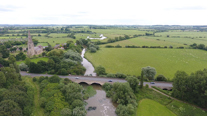
Olney Green Burial Ground is located at Yardley Road Olney, Milton Keynes Borough ,Buckinghamshire , MK46 5EHEngland.
-
Olney Green Burial Ground cemetery's updated grave count on graveviews.com?
0 memorials
-
Where are the coordinates of the Olney Green Burial Ground?
Latitude: 52.1724350
Longitude: -0.7142690
Nearby Cemetories:
1. Olney Baptist Church Cemetery
Olney, Milton Keynes Borough, England
Coordinate: 52.1532830, -0.7021010
2. Olney Cemetery
Olney, Milton Keynes Borough, England
Coordinate: 52.1505480, -0.6996760
3. St Peter and St Paul Churchyard
Olney, Milton Keynes Borough, England
Coordinate: 52.1498710, -0.7009460
4. St Mary's Churchyard
Clifton Reynes, Milton Keynes Borough, England
Coordinate: 52.1520000, -0.6820000
5. Weston Underwood Parish Churchyard
Olney, Milton Keynes Borough, England
Coordinate: 52.1448260, -0.7393570
6. St. Michael's Churchyard
Lavendon, Milton Keynes Borough, England
Coordinate: 52.1734100, -0.6615200
7. St Andrew Churchyard
Yardley Hastings, South Northamptonshire Borough, England
Coordinate: 52.2048450, -0.7336810
8. Lavendon Abbey
Addington, Aylesbury Vale District, England
Coordinate: 52.1799170, -0.6588330
9. All Saints Churchyard
Ravenstone, Milton Keynes Borough, England
Coordinate: 52.1498400, -0.7585290
10. All Saints Churchyard
Emberton, Milton Keynes Borough, England
Coordinate: 52.1365770, -0.7082700
11. St. Nicholas Churchyard
Newton Blossomville, Milton Keynes Borough, England
Coordinate: 52.1546343, -0.6482556
12. St. Mary's Churchyard
Cold Brayfield, Milton Keynes Borough, England
Coordinate: 52.1609580, -0.6414440
13. St Peter and St Paul Churchyard
Easton Maudit, Wellingborough Borough, England
Coordinate: 52.2204300, -0.7006700
14. St. Mary Magdalene Churchyard
Castle Ashby, South Northamptonshire Borough, England
Coordinate: 52.2237000, -0.7371000
15. All Saints Churchyard
Turvey, Bedford Borough, England
Coordinate: 52.1632000, -0.6267000
16. St Mary Magdalene Churchyard
Horton, South Northamptonshire Borough, England
Coordinate: 52.1799830, -0.8036230
17. Turvey Cemetery
Turvey, Bedford Borough, England
Coordinate: 52.1665007, -0.6243628
18. St Margaret
Denton, South Northamptonshire Borough, England
Coordinate: 52.2136350, -0.7749650
19. St. Mary the Virgin Churchyard
Bozeat, Wellingborough Borough, England
Coordinate: 52.2235060, -0.6747470
20. St. Peter's Churchyard
Stoke Goldington, Milton Keynes Borough, England
Coordinate: 52.1348000, -0.7865000
21. St Lauds Churchyard
Sherington, Milton Keynes Borough, England
Coordinate: 52.1122500, -0.7018140
22. St Mary Churchyard
Grendon, Wellingborough Borough, England
Coordinate: 52.2351630, -0.7145540
23. St. Peter's Churchyard
Tyringham, Milton Keynes Borough, England
Coordinate: 52.1119430, -0.7465510
24. St. Mary's Churchyard
Carlton, Bedford Borough, England
Coordinate: 52.1837270, -0.6093090