
| Memorials | : | 0 |
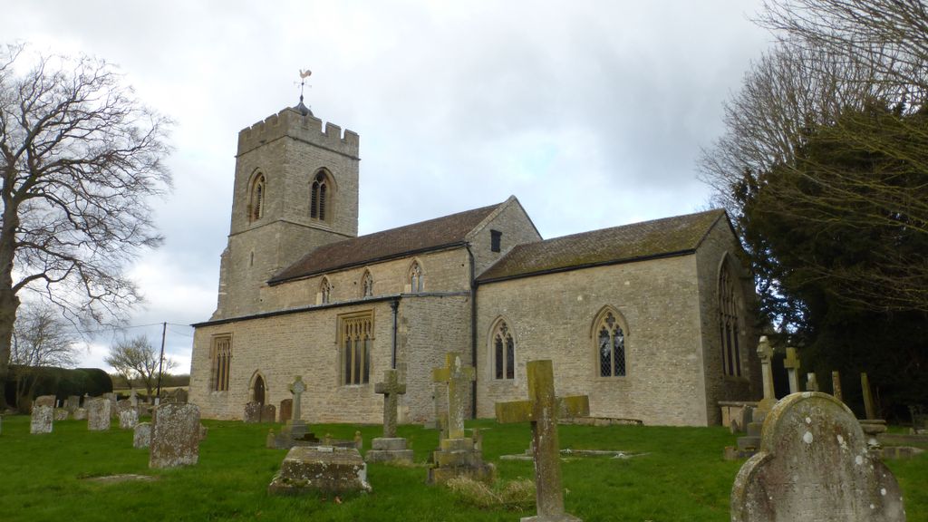
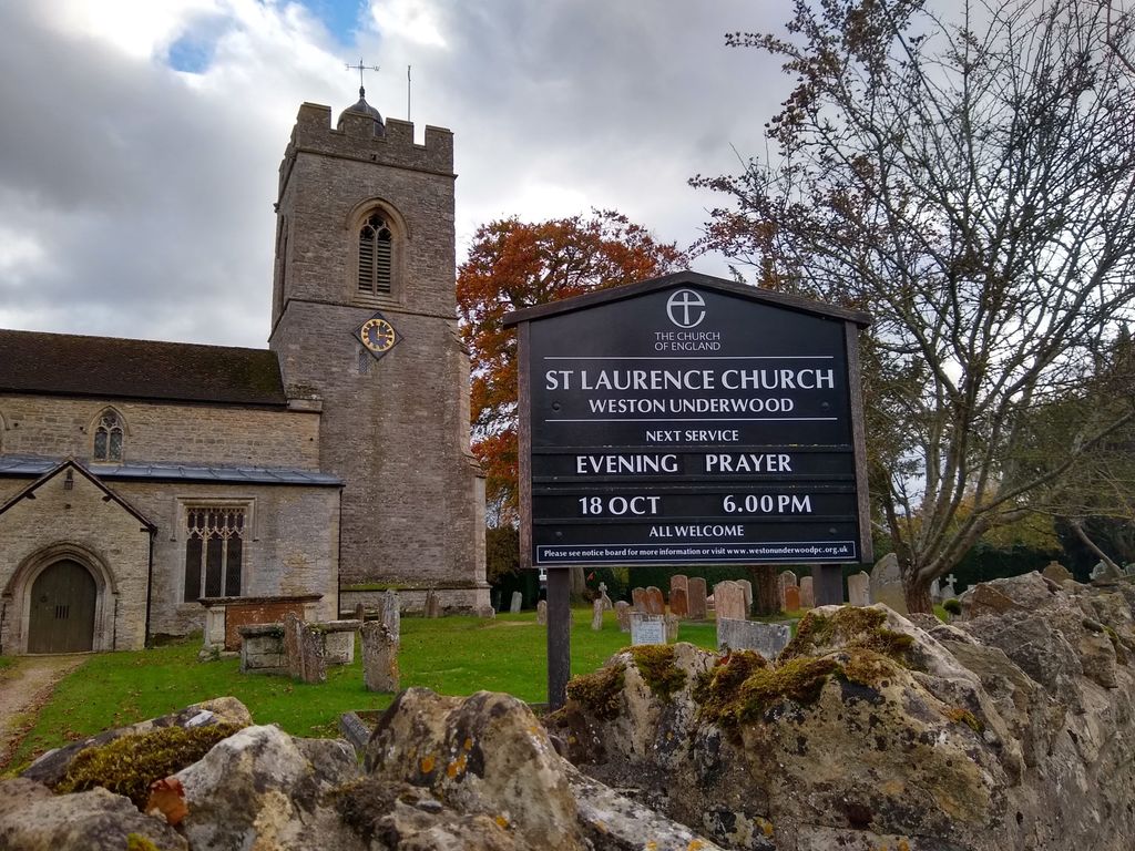
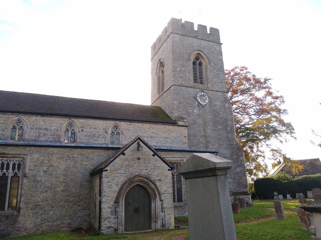
| Location | : | Olney, Milton Keynes Borough, England |
| Coordinate | : | 52.1448260, -0.7393570 |
| Description | : | The nave probably incorporates part of the walling of a 12th century church to which aisles were added about the middle of the 13th century. The chancel arch was rebuilt in the first half of the 14th century, but by the middle of the century the condition of the fabric must have become very unsatisfactory, as its restoration was undertaken by John Olney, lord of the manor, about 1368, in which year the church was refounded. The rebuilding of the chancel was probably the only work accomplished by this date, but the reconstruction of the rest of the building... Read More |
frequently asked questions (FAQ):
-
Where is Weston Underwood Parish Churchyard?
Weston Underwood Parish Churchyard is located at Olney, Milton Keynes Borough ,Buckinghamshire ,England.
-
Weston Underwood Parish Churchyard cemetery's updated grave count on graveviews.com?
0 memorials
-
Where are the coordinates of the Weston Underwood Parish Churchyard?
Latitude: 52.1448260
Longitude: -0.7393570
Nearby Cemetories:
1. All Saints Churchyard
Ravenstone, Milton Keynes Borough, England
Coordinate: 52.1498400, -0.7585290
2. All Saints Churchyard
Emberton, Milton Keynes Borough, England
Coordinate: 52.1365770, -0.7082700
3. St Peter and St Paul Churchyard
Olney, Milton Keynes Borough, England
Coordinate: 52.1498710, -0.7009460
4. Olney Baptist Church Cemetery
Olney, Milton Keynes Borough, England
Coordinate: 52.1532830, -0.7021010
5. Olney Cemetery
Olney, Milton Keynes Borough, England
Coordinate: 52.1505480, -0.6996760
6. St. Peter's Churchyard
Stoke Goldington, Milton Keynes Borough, England
Coordinate: 52.1348000, -0.7865000
7. Olney Green Burial Ground
Olney, Milton Keynes Borough, England
Coordinate: 52.1724350, -0.7142690
8. St. Peter's Churchyard
Tyringham, Milton Keynes Borough, England
Coordinate: 52.1119430, -0.7465510
9. St Mary's Churchyard
Clifton Reynes, Milton Keynes Borough, England
Coordinate: 52.1520000, -0.6820000
10. St Lauds Churchyard
Sherington, Milton Keynes Borough, England
Coordinate: 52.1122500, -0.7018140
11. St. Peter's Churchyard
Gayhurst, Milton Keynes Borough, England
Coordinate: 52.1081810, -0.7652570
12. Lathbury Churchyard
Lathbury, Milton Keynes Borough, England
Coordinate: 52.0963900, -0.7247400
13. St Mary Magdalene Churchyard
Horton, South Northamptonshire Borough, England
Coordinate: 52.1799830, -0.8036230
14. St Lawrence Churchyard
Chicheley, Milton Keynes Borough, England
Coordinate: 52.1037000, -0.6807000
15. St. Michael's Churchyard
Lavendon, Milton Keynes Borough, England
Coordinate: 52.1734100, -0.6615200
16. St. Nicholas Churchyard
Newton Blossomville, Milton Keynes Borough, England
Coordinate: 52.1546343, -0.6482556
17. Newport Pagnell Old Cemetery
Newport Pagnell, Milton Keynes Borough, England
Coordinate: 52.0873930, -0.7186730
18. St. Peter and St. Paul's Churchyard
Newport Pagnell, Milton Keynes Borough, England
Coordinate: 52.0869970, -0.7203080
19. St Andrew Churchyard
Yardley Hastings, South Northamptonshire Borough, England
Coordinate: 52.2048450, -0.7336810
20. Lavendon Abbey
Addington, Aylesbury Vale District, England
Coordinate: 52.1799170, -0.6588330
21. St. Mary's Churchyard
Cold Brayfield, Milton Keynes Borough, England
Coordinate: 52.1609580, -0.6414440
22. St James the Great Churchyard
Hanslope, Milton Keynes Borough, England
Coordinate: 52.1129940, -0.8274720
23. Tickford Street Cemetery
Newport Pagnell, Milton Keynes Borough, England
Coordinate: 52.0807670, -0.7121200
24. St John the Baptist
Piddington, South Northamptonshire Borough, England
Coordinate: 52.1840386, -0.8299477