
| Memorials | : | 0 |
| Location | : | Cold Brayfield, Milton Keynes Borough, England |
| Coordinate | : | 52.1609580, -0.6414440 |
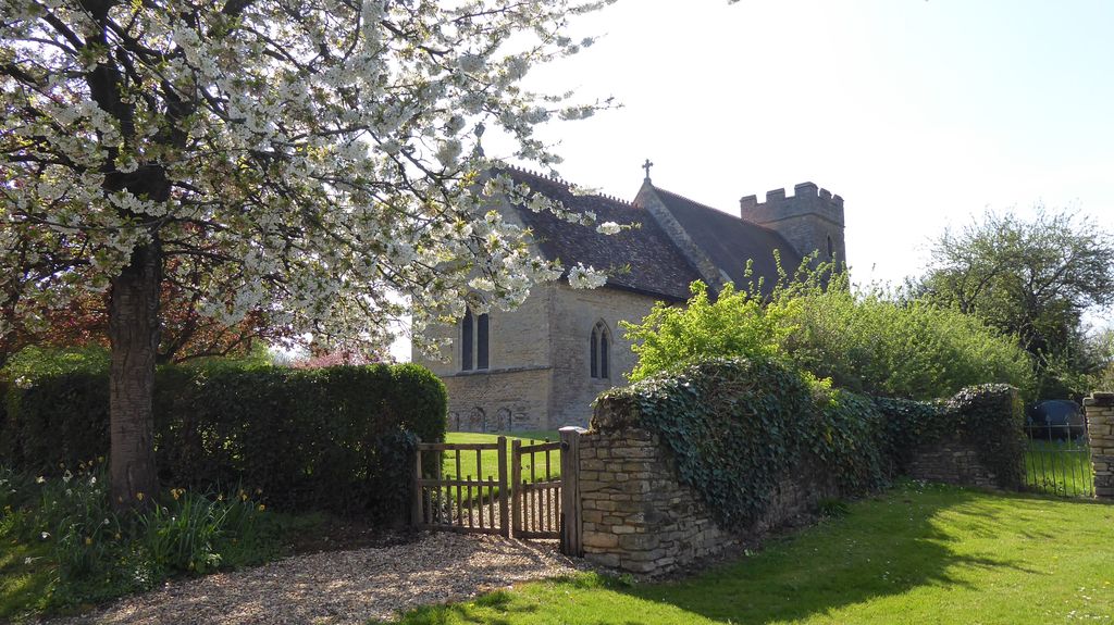
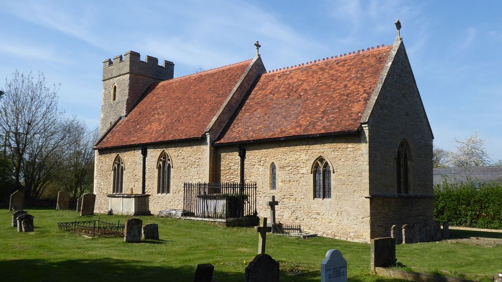
| Description | : | Cold Brayfield is not mentioned by name in the Domesday Survey, but it seems likely that it was among the three holdings of Countess Judith in nearby Lavendon. One of these, held from the Countess by Gilbert de Blosseville, must correspond to Newton Blossomville. The other two were held respectively by Roger and Ralph from the Countess. The church appears to have been built shortly before it was granted to Harrold Priory a little before the middle of the 12th century. |
frequently asked questions (FAQ):
-
Where is St. Mary's Churchyard?
St. Mary's Churchyard is located at Cold Brayfield, Milton Keynes Borough ,Buckinghamshire ,England.
-
St. Mary's Churchyard cemetery's updated grave count on graveviews.com?
0 memorials
-
Where are the coordinates of the St. Mary's Churchyard?
Latitude: 52.1609580
Longitude: -0.6414440
Nearby Cemetories:
1. St. Nicholas Churchyard
Newton Blossomville, Milton Keynes Borough, England
Coordinate: 52.1546343, -0.6482556
2. All Saints Churchyard
Turvey, Bedford Borough, England
Coordinate: 52.1632000, -0.6267000
3. Turvey Cemetery
Turvey, Bedford Borough, England
Coordinate: 52.1665007, -0.6243628
4. St. Michael's Churchyard
Lavendon, Milton Keynes Borough, England
Coordinate: 52.1734100, -0.6615200
5. Lavendon Abbey
Addington, Aylesbury Vale District, England
Coordinate: 52.1799170, -0.6588330
6. St Mary's Churchyard
Clifton Reynes, Milton Keynes Borough, England
Coordinate: 52.1520000, -0.6820000
7. St. Mary's Churchyard
Carlton, Bedford Borough, England
Coordinate: 52.1837270, -0.6093090
8. Carlton Baptist Chapel Chapelyard
Carlton, Bedford Borough, England
Coordinate: 52.1870676, -0.6055073
9. Olney Cemetery
Olney, Milton Keynes Borough, England
Coordinate: 52.1505480, -0.6996760
10. Olney Baptist Church Cemetery
Olney, Milton Keynes Borough, England
Coordinate: 52.1532830, -0.7021010
11. St Peter and St Paul Churchyard
Olney, Milton Keynes Borough, England
Coordinate: 52.1498710, -0.7009460
12. St. Mary's Churchyard
Hardmead, Milton Keynes Borough, England
Coordinate: 52.1196000, -0.6358000
13. Harrold United Reformed Church Cemetery
Harrold, Bedford Borough, England
Coordinate: 52.2021458, -0.6139397
14. St. Peter and All Saints Churchyard
Harrold, Bedford Borough, England
Coordinate: 52.2000130, -0.6056760
15. St. Nicholas' Churchyard
Chellington, Bedford Borough, England
Coordinate: 52.1967000, -0.5956000
16. Olney Green Burial Ground
Olney, Milton Keynes Borough, England
Coordinate: 52.1724350, -0.7142690
17. St. Peter's Churchyard
Astwood, Milton Keynes Borough, England
Coordinate: 52.1164390, -0.6135200
18. All Saints Churchyard
Emberton, Milton Keynes Borough, England
Coordinate: 52.1365770, -0.7082700
19. Stevington Baptist Chapel Chapelyard
Bedford Borough, England
Coordinate: 52.1730085, -0.5637366
20. St. Leonard's Churchyard
Stagsden, Bedford Borough, England
Coordinate: 52.1313467, -0.5662217
21. St. Mary the Virgin Churchyard
Stevington, Bedford Borough, England
Coordinate: 52.1722000, -0.5532000
22. All Saints Churchyard
Odell, Bedford Borough, England
Coordinate: 52.2114900, -0.5869800
23. St Lauds Churchyard
Sherington, Milton Keynes Borough, England
Coordinate: 52.1122500, -0.7018140
24. St Lawrence Churchyard
Chicheley, Milton Keynes Borough, England
Coordinate: 52.1037000, -0.6807000