
| Memorials | : | 4 |
| Location | : | Atchison, Atchison County, USA |
| Coordinate | : | 39.5934906, -95.1105728 |
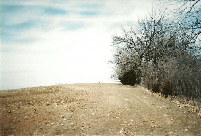
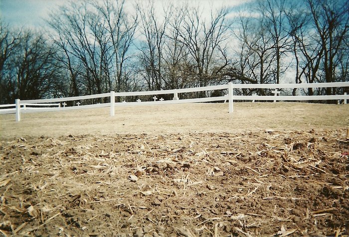
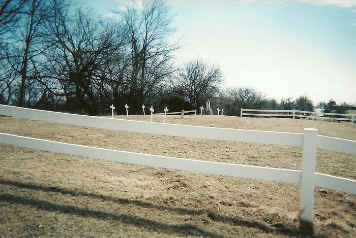
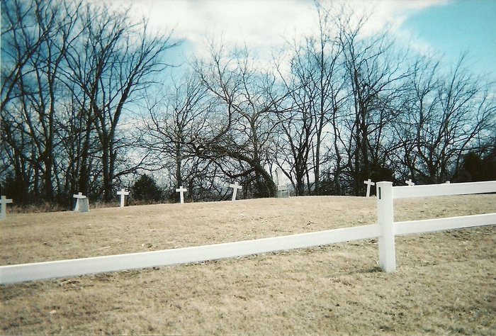
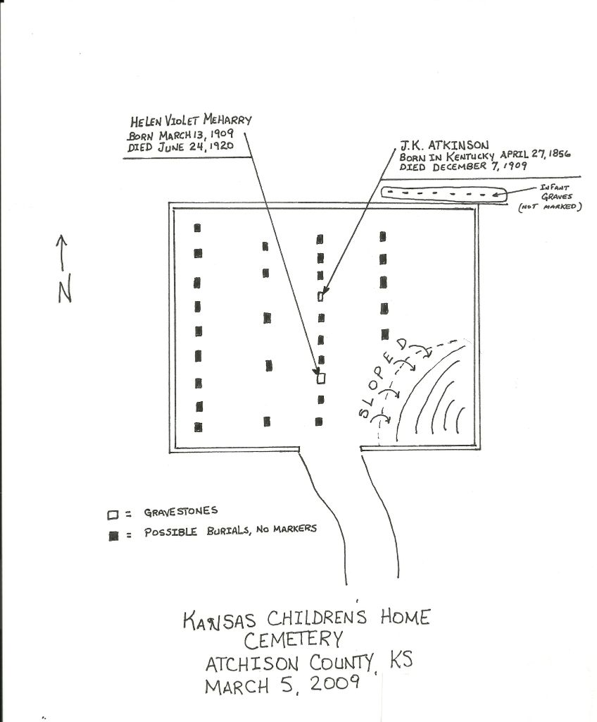
| Description | : | From a report @ 1986: The Orphans Home was a home for Civil War Veteran's children that had lost their parents. The cemetery is atop a hill north of the original brick building. There are 8 markers left. The last burial was in 1952. ------------------- Update Oct 2014: The property is now owned by an out-of-state company and will be turned into a new International Student school. It is unknown, at this time, whether the new owners will allow access freely to the cemetery or not. (Top info courtesy of Roxanne Tosterud: Atchison County Kansas Cemetery Listing, @1986) |
frequently asked questions (FAQ):
-
Where is Orphans Home Cemetery?
Orphans Home Cemetery is located at Atchison, Atchison County ,Kansas ,USA.
-
Orphans Home Cemetery cemetery's updated grave count on graveviews.com?
0 memorials
-
Where are the coordinates of the Orphans Home Cemetery?
Latitude: 39.5934906
Longitude: -95.1105728

Nearby Cemetories:
1. Taylor Cemetery
Atchison, Atchison County, USA
Coordinate: 39.5867200, -95.1055400
2. Mount Calvary Cemetery
Atchison, Atchison County, USA
Coordinate: 39.5971985, -95.1311035
3. Saint Benedicts Abbey Cemetery
Atchison, Atchison County, USA
Coordinate: 39.5770645, -95.1098862
4. Sunset Memory Gardens
Atchison, Atchison County, USA
Coordinate: 39.5978203, -95.1342621
5. Gore-Cummings-Nielson-Armstrong-Case Cemetery
Shannon, Atchison County, USA
Coordinate: 39.6241989, -95.1128006
6. Trinity Episcopal Church Memorial Garden
Atchison, Atchison County, USA
Coordinate: 39.5593910, -95.1187363
7. Oak Hill Cemetery
Atchison, Atchison County, USA
Coordinate: 39.5628014, -95.1444016
8. Mount Saint Scholastica Cemetery
Atchison, Atchison County, USA
Coordinate: 39.5524788, -95.1274185
9. Myers Cemetery
Atchison, Atchison County, USA
Coordinate: 39.6369019, -95.1149979
10. Spriggs Family Cemetery (Defunct)
Atchison, Atchison County, USA
Coordinate: 39.5564400, -95.1434100
11. Yoakum Cemetery
Atchison, Atchison County, USA
Coordinate: 39.5522600, -95.1611400
12. Hudspeth Cemetery
Rushville, Buchanan County, USA
Coordinate: 39.5682100, -95.0400000
13. Mount Vernon Cemetery
Atchison, Atchison County, USA
Coordinate: 39.5383200, -95.1437800
14. Schmidt Graves
Rushville, Buchanan County, USA
Coordinate: 39.5616330, -95.0416950
15. Doniphan Cemetery
Doniphan, Doniphan County, USA
Coordinate: 39.6478004, -95.0699997
16. Gordon Graveyard
Rushville, Buchanan County, USA
Coordinate: 39.5607400, -95.0352900
17. Dicksen Cemetery
Rushville, Buchanan County, USA
Coordinate: 39.5889100, -95.0220400
18. Cash Cemetery
Rushville, Buchanan County, USA
Coordinate: 39.5702400, -95.0220600
19. Allison Homestead Graveyard
Rushville, Buchanan County, USA
Coordinate: 39.5659100, -95.0211900
20. Mormon Grove Historical Marker Memorial
Parnell, Atchison County, USA
Coordinate: 39.5572319, -95.1985931
21. Sumner Cemetery
Atchison, Atchison County, USA
Coordinate: 39.5163994, -95.1081009
22. Armstrong Cemetery
Rushville, Buchanan County, USA
Coordinate: 39.5960999, -95.0083008
23. Eden Cemetery (Defunct)
Good Intent, Atchison County, USA
Coordinate: 39.5989300, -95.2163100
24. Fist Cemetery
Buchanan County, USA
Coordinate: 39.5763000, -95.0014000